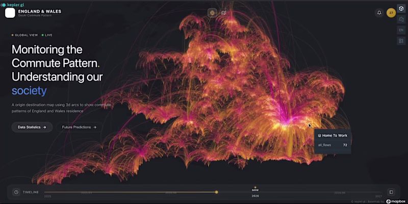
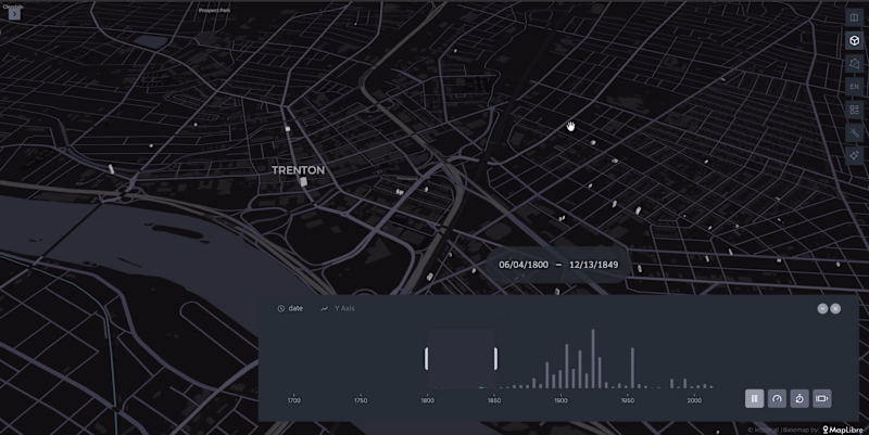
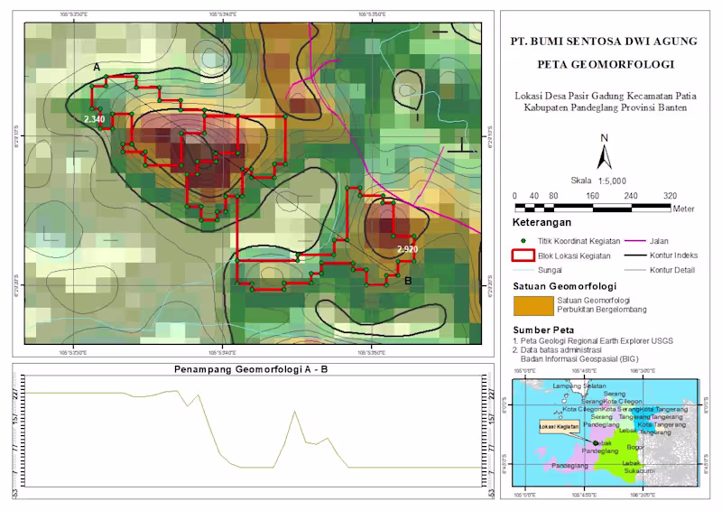
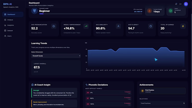
Spatial Data Visualization & AI Workflow Systems
Work Life Balance
Work Life Balance

Visual Artist in 3D, VFX, mirroring ideas into reality.
Visual Artist in 3D, VFX, mirroring ideas into reality.


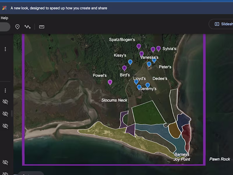
Where geography meets design excellence
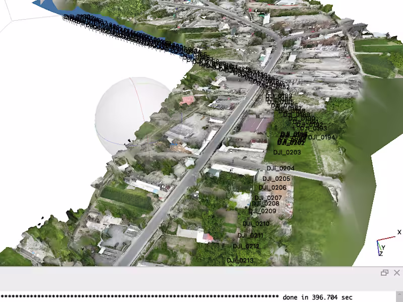

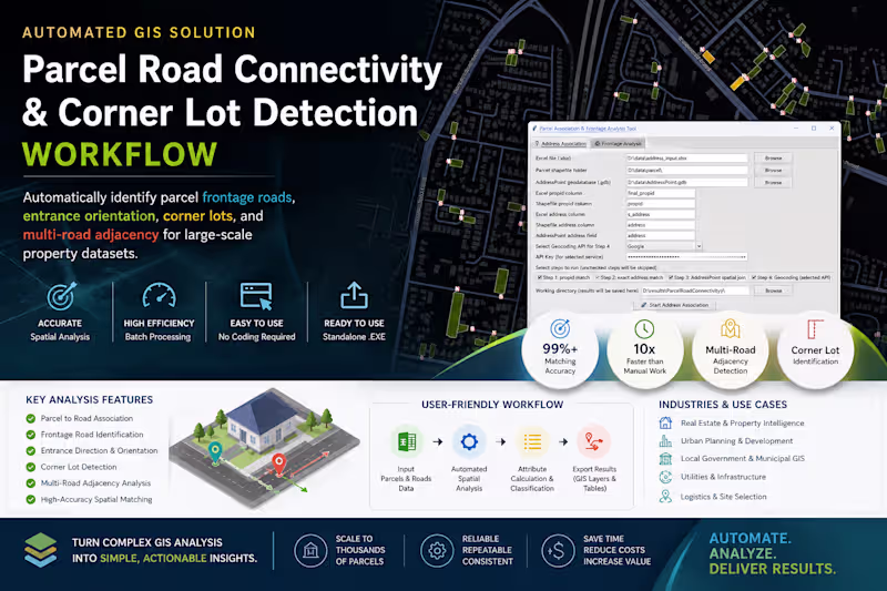
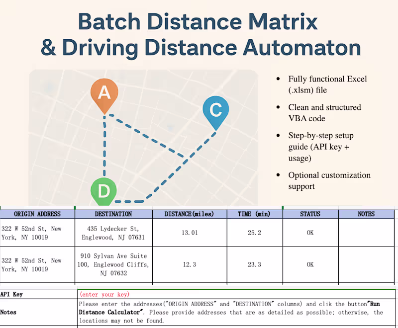
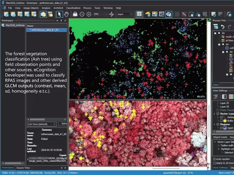
Geospatial wizardry: analyze, code, export, repeat!


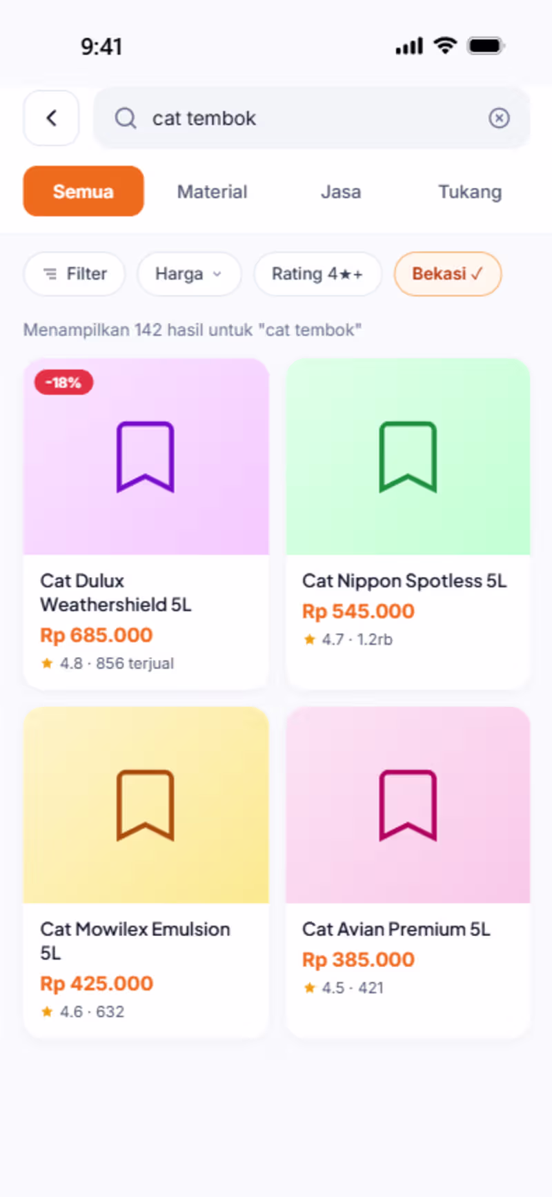
Full stack engineer implementing original ideas