The network for creativity
Join 1.25M professional creatives like you
Connect with clients, get discovered, and run your business 100% commission-free
Creatives on Contra have earned over $150M and we are just getting started
Back to feedPost
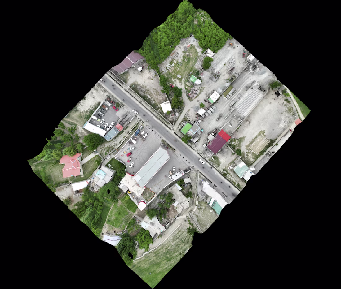
Developed a high-resolution 3D road corridor model using GIS and terrain data to visualize road alignment, elevation profiles, and surrounding landscapes. The project delivered realistic engineering-grade visualizations for planning, stakeholder presentations, and project documentation.
The network for creativity
Join 1.25M professional creatives like you
Connect with clients, get discovered, and run your business 100% commission-free
Creatives on Contra have earned over $150M and we are just getting started
Trending
Claude
Claude has entered the design space. How are you using it?
Contra University
Learn from expert creatives how to earn more using next-gen AI tools.
Brand Design
The best brand designers are on Contra. Scroll to see what's trending in brand design. What are you building?
creativeaiflow
Creative AI workflows are evolving. What tools do you use, and what are their strengths and weaknesses?
freelancerlife
Freelancer life is wins, pivots, and everything in between. What’s yours right now?
Related posts
I challenged myself to create an AI-generated automotive commercial that feels like something a real car brand would release, not just another AI video.
The goal was to combine cinematic storytelling, a realistic AI presenter, smooth motion graphics and premium editing to create a commercial that puts the product first.
Highlights:
🚀 Realistic AI presenter with natural lip sync
🚀Cinematic camera movements and smooth transitions
🚀Clean premium motion graphics
🚀Commercial quality colour grading
🚀Storytelling with a strong marketing focus
This is the kind of work I enjoy creating. Polished AI-powered commercials that help products stand out and capture attention. My goal is to create ads that people remember because of the story and the product, not because they were made with AI.
I'll love to hear what you think.
#AIVideo #AICommercial #Automotive #ExplainerVideo #CommercialProduction #MotionGraphics #VideoEditing #CreativeDirection #Storytelling #ProductMarketing #BrandAdvertising #GenerativeAI #ContentCreation #Cinematic video
I am also indulged in A.I. Video Production but there are few things doesn't make sense...
Using multiple angles and keeping no transition can helps to improve video alot because these transitions makes video looks cheap. Instead you can surely use multiple camera angles to...
3D Luxury Apartment Visualization

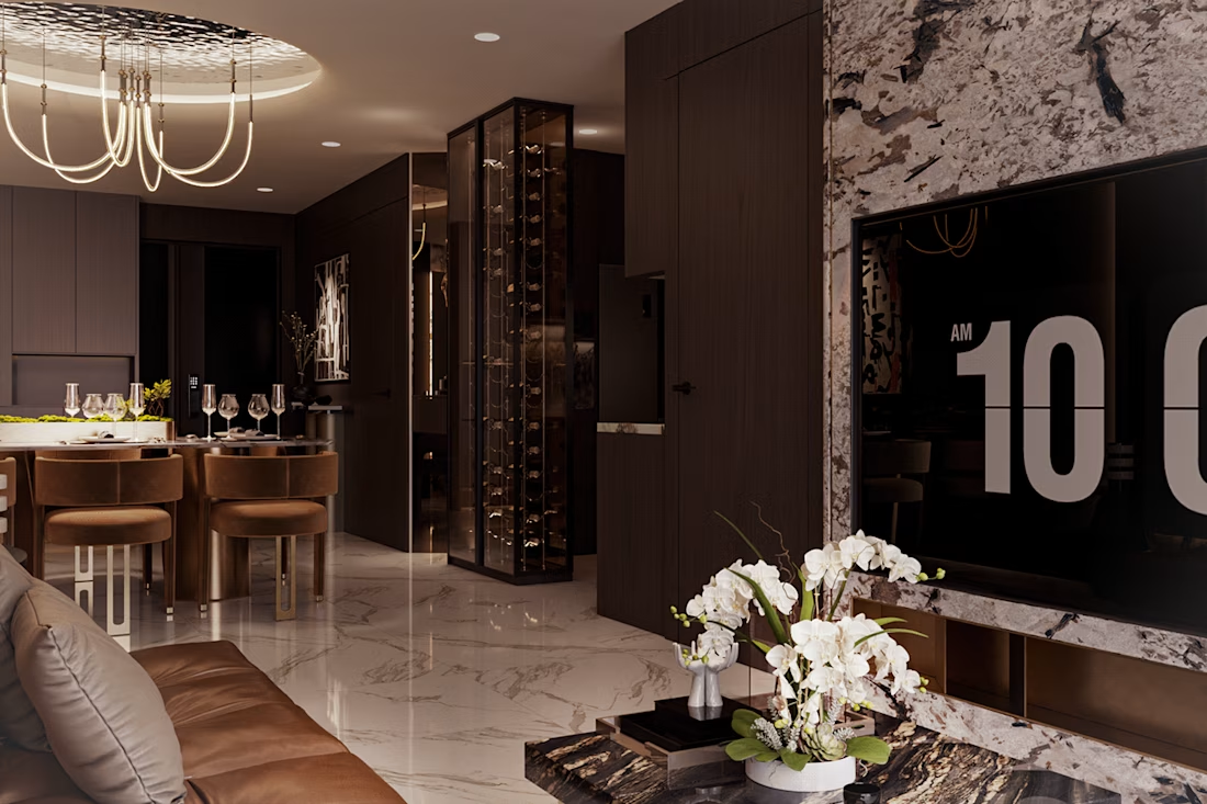
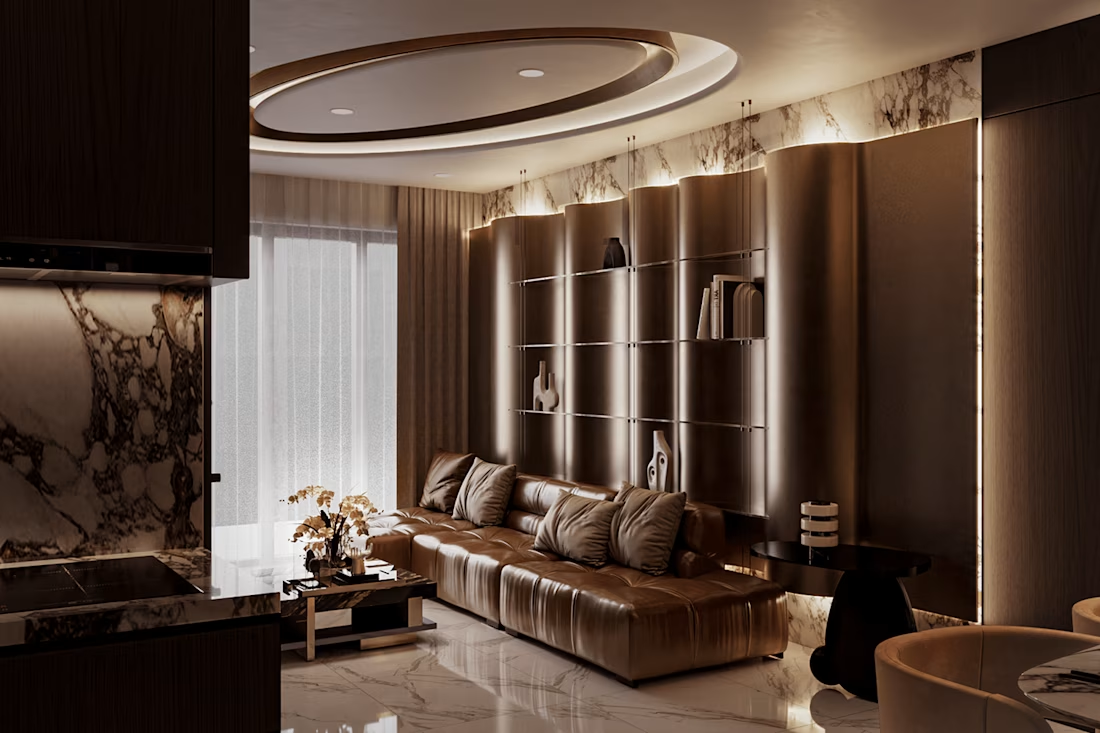
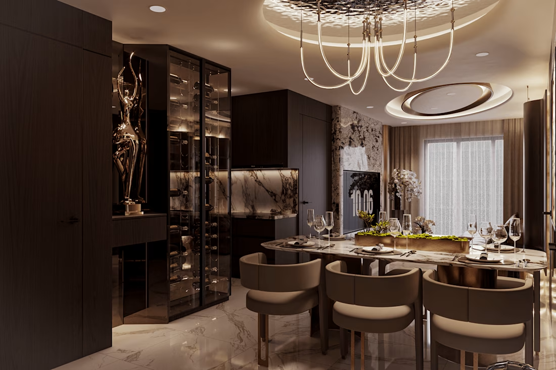
Absolutely stunning work. The attention to detail, lighting, and realism are exceptional. This is the kind of visualization that truly brings architecture to life. 👏🔥
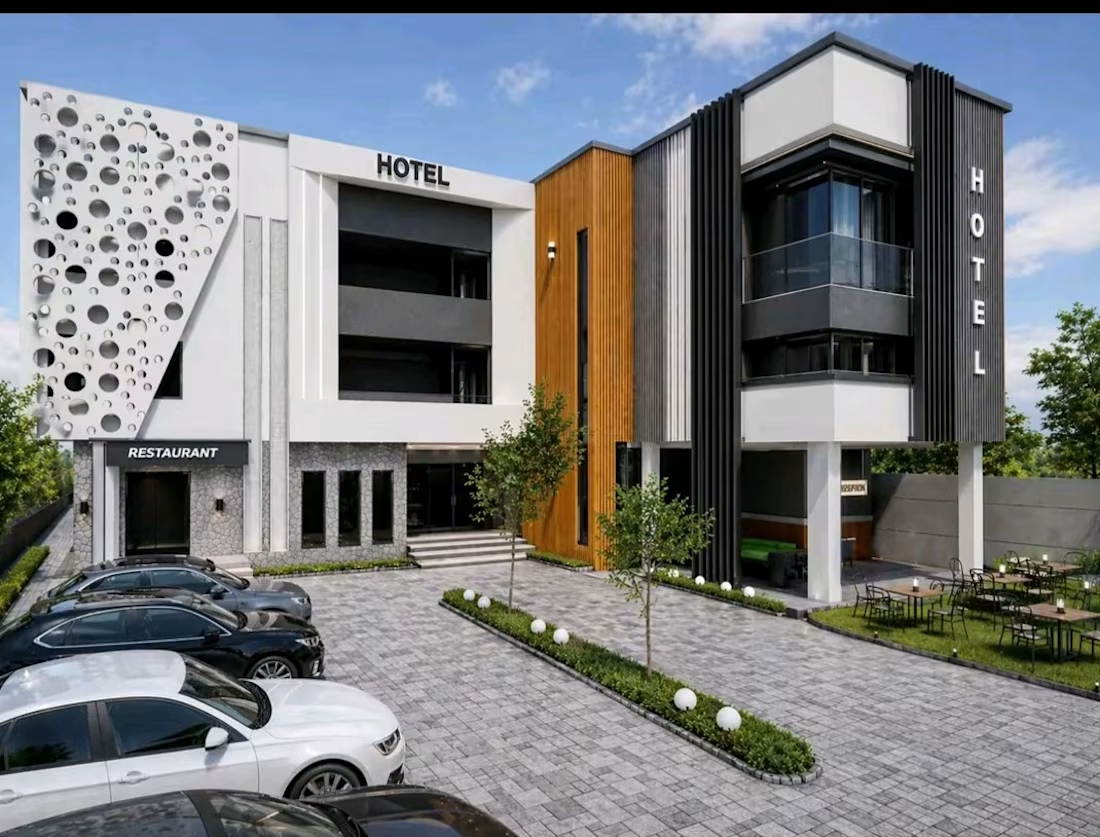
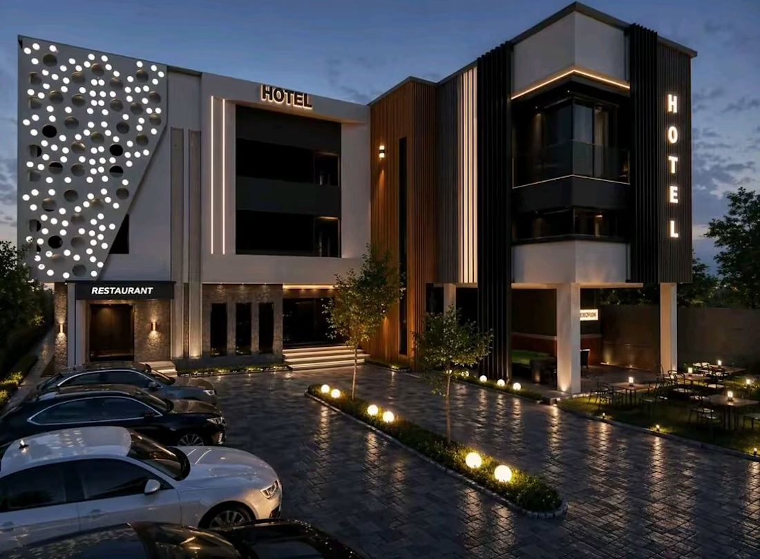
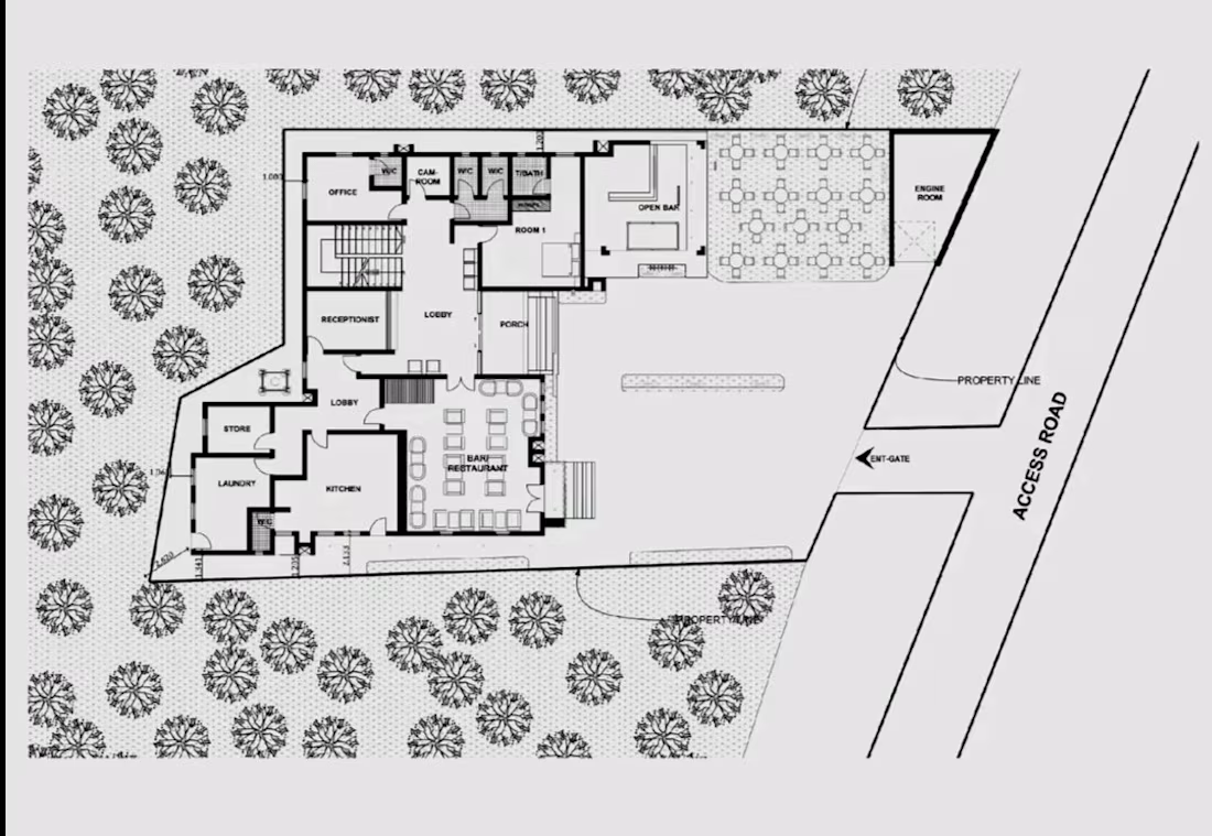
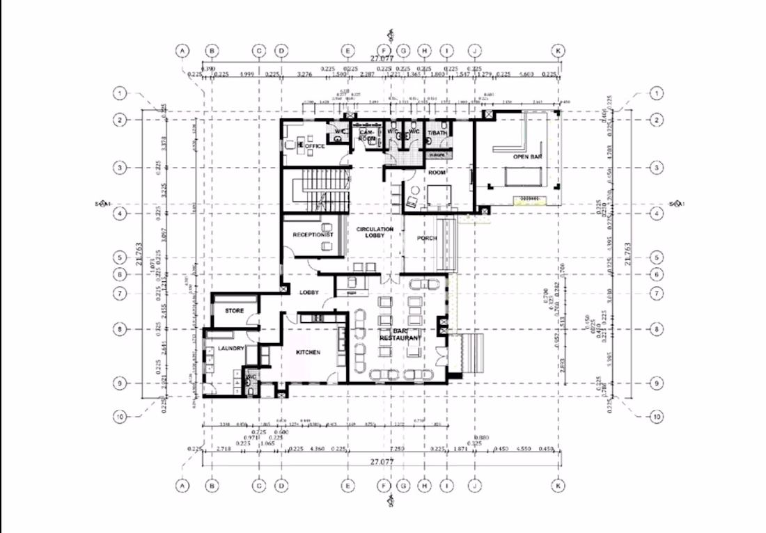
From concept to construction-ready design.
This modern hotel project showcases a complete architectural workflow—from site planning and detailed floor plans to photorealistic 3D visualizations with both daytime and nighttime perspectives. Every space is carefully designed to balance functionality, aesthetics, and the guest experience.
I help clients transform ideas into buildable, high-quality architectural solutions with accurate drawings and realistic visualizations.
📩 Need architectural design, hotel planning, floor plans, or premium 3D renders? Let's bring your project to life.
#Architecture #HotelDesign #ArchitecturalDesign #CommercialArchitecture #FloorPlans #SitePlanning #3DRendering #ArchitecturalVisualization #BuildingDesign #Construction #Texas #USA