NexCAD - Computer-Aided Dispatch Platform for Emergency Services

Ayan E.


NexCAD - Computer-Aided Dispatch Platform for Emergency Services
NexCAD is a mission-critical dispatch platform used by 911 call centers and field responders to manage live incidents, track units in real time, and pull investigative data in seconds. I designed the full system: the dispatcher's command console, live mapping and unit tracking, cross-database search tools, hazard alerting, and the incident communication layer connecting dispatch with officers
in the field.
The core design constraint was speed under pressure - every screen had to support split-second decisions during active emergencies, which meant prioritizing scannability, status clarity, and zero ambiguity over visual polish for its own sake.
One Screen, Every Active Event
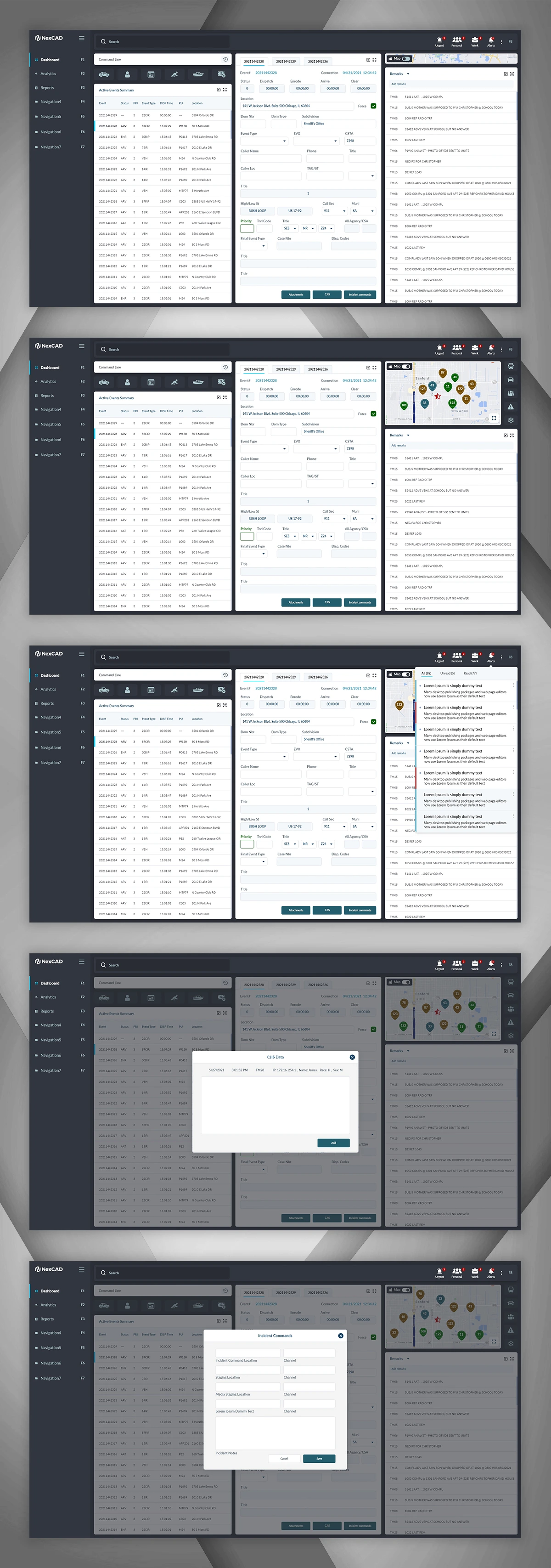
The dashboard a dispatcher lives in during a shift. A live table of active events sits alongside a real-time map showing every unit's position, with a running remarks feed on the right so nothing gets missed. I designed this as a three-panel layout specifically so a dispatcher never has to navigate away from active events to get map or communication context - everything they need during a live call stays on one screen.
Catching Bad Addresses Before They Cost Time
Wrong addresses during emergency dispatch can cost minutes that matter. I designed an address verification step that surfaces close matches the moment a dispatcher enters a location, letting them confirm the correct one in a single click rather than discovering the error after a unit is already en route. The event entry form beside it captures caller info, event type, priority, and disposition in a dense but structured layout built for fast, repeated data entry under time pressure.
Surfacing the Context Dispatchers Need, Automatically
When a call comes from a known business or location, dispatchers need contact and site details immediately - not buried in a separate lookup. I designed a responder information panel that surfaces this automatically, alongside a unit notice display confirming exactly which units have been notified and dispatched to a given event, reducing the chance of duplicate or missed dispatches.
Every Unit, Visible in Real Time
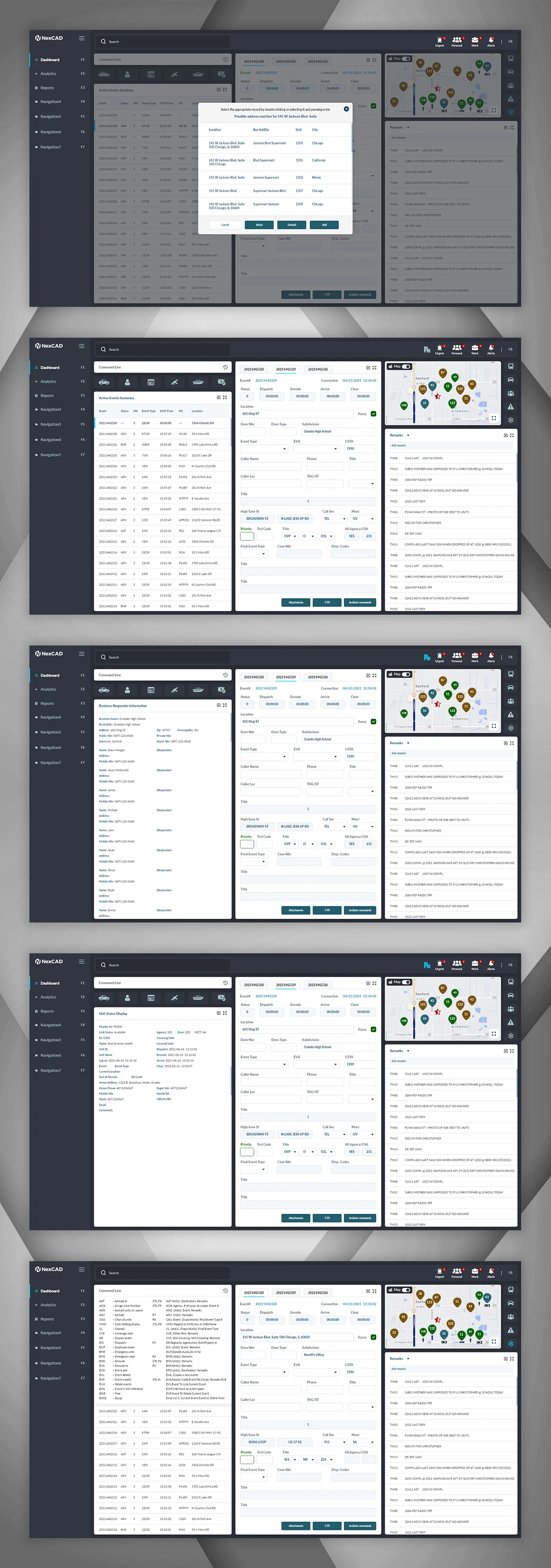
The live map uses colour and iconography to distinguish unit types and status at a glance - critical when a dispatcher is tracking dozens of units simultaneously across a jurisdiction. A companion Command Status panel lists every connected unit's current state in text form, giving dispatchers both a spatial and a list-based way to confirm unit availability depending on what a given moment calls for.
Keeping Dispatch and the Field on the Same Page
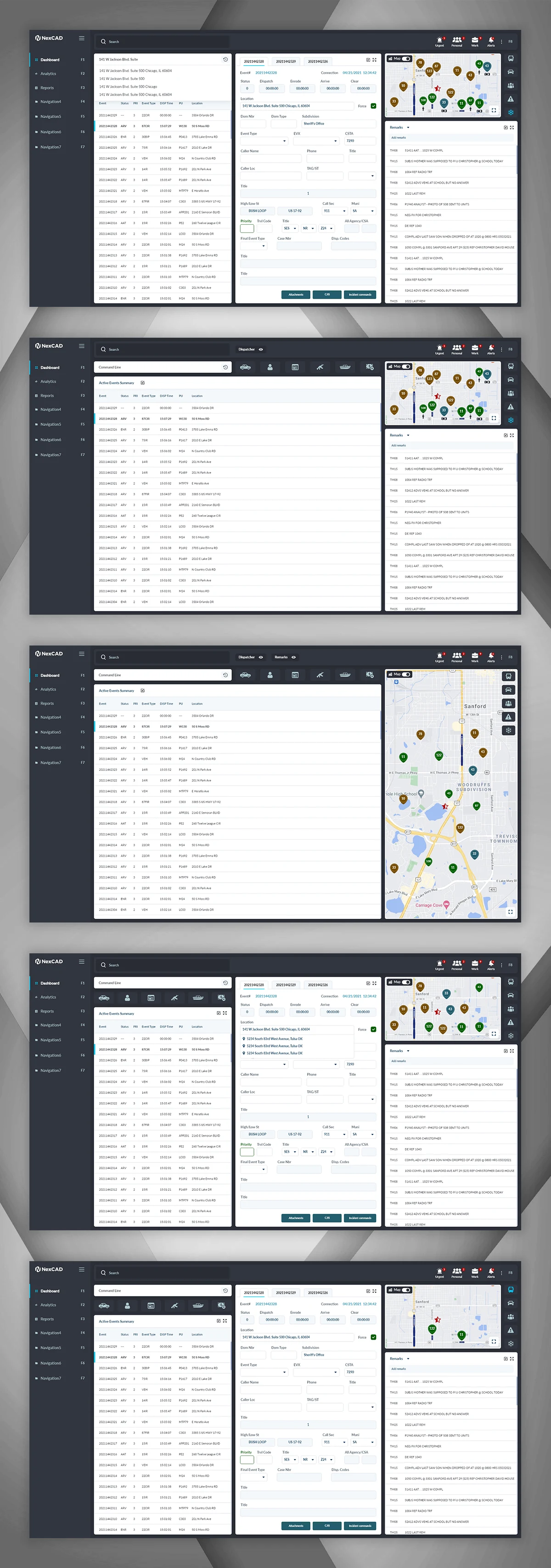
Not everything needs a radio call. I designed a lightweight messaging layer tied directly to each incident, so dispatchers and field units can exchange quick updates - location changes, additional details, confirmations - without cluttering voice channels. Each thread stays attached to its incident, so context is never lost when a shift changes hands.
Confirmations You Can Trust, Failures You Can Recover From
A small but important detail: when a unit marks arrival, dispatchers get an immediate, unmistakable toast confirmation with a location snapshot - no need to hunt for the update in a log. On the flip side, I designed a clear, low-friction error state for when something fails on the backend, giving users a direct retry action instead of a dead end, which matters enormously in a tool where every second of downtime has real consequences.
One Search Bar Into Five Different Databases
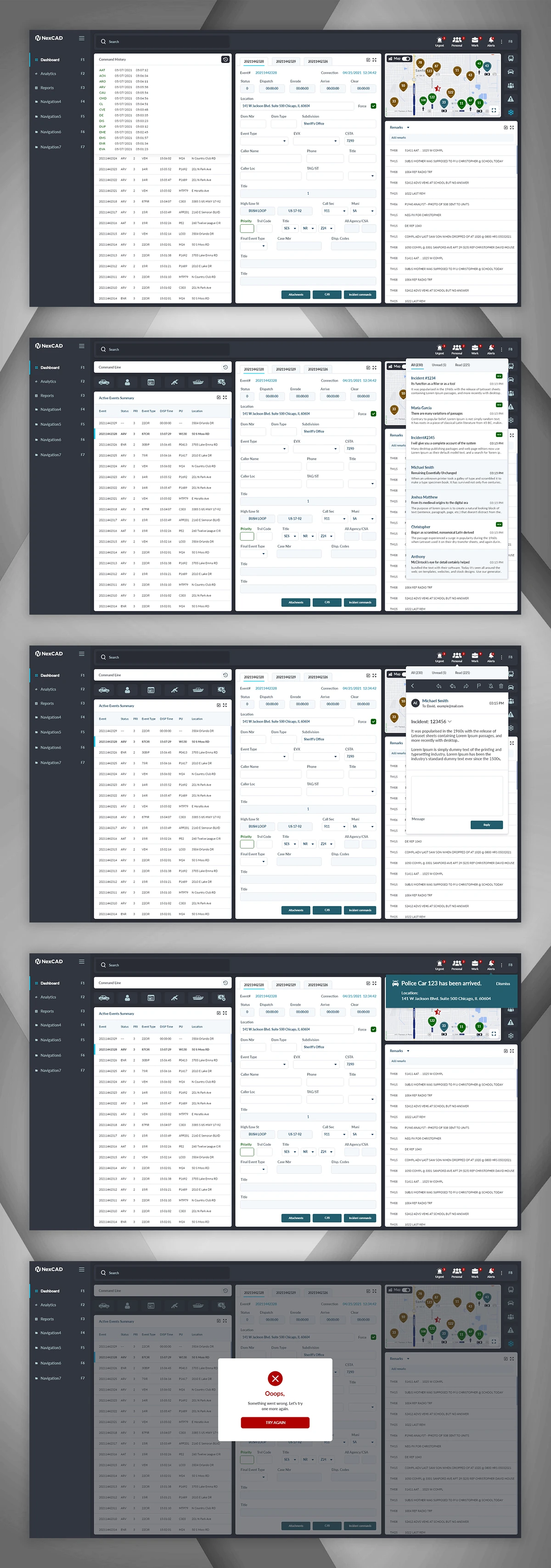
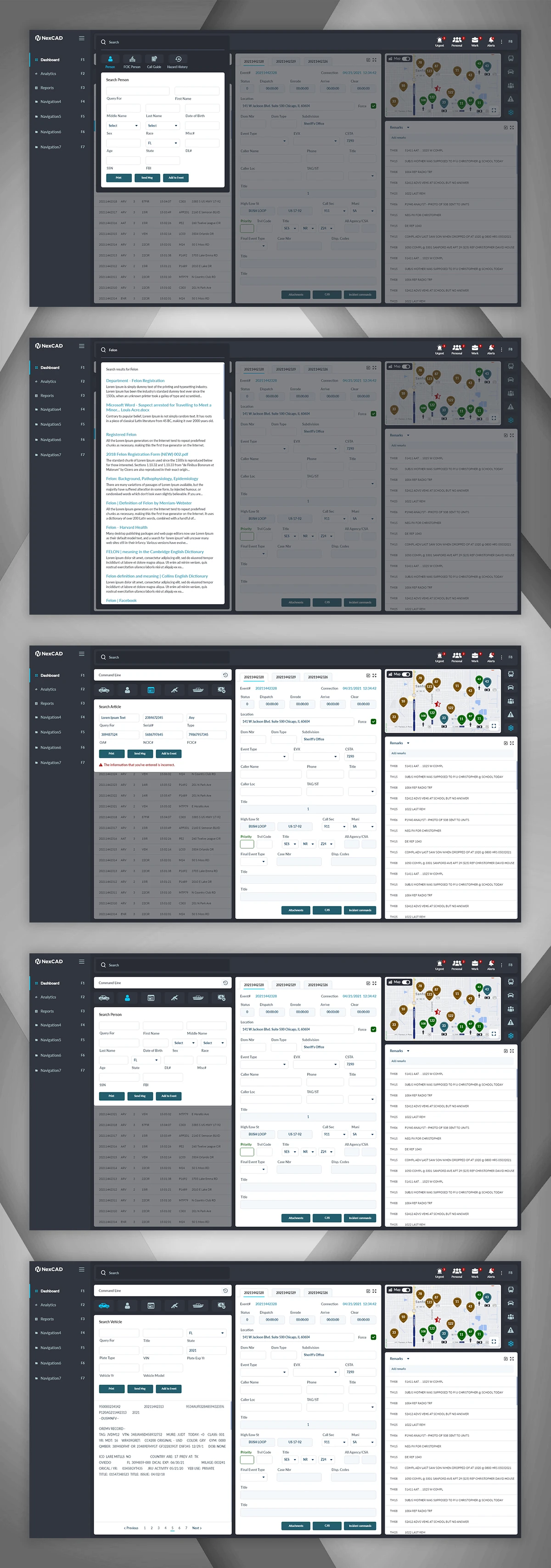
Officers and dispatchers need to cross-reference people, vehicles, firearms, boats, and equipment against records instantly. I designed a consistent search pattern reused across every entity type - Person, Vehicle, Gun, Boat, Fire Parts, Article - so once a user learns the interaction once, it works everywhere. Inline validation (shown here catching an incorrectly entered article ID) prevents wasted queries and flags likely data-entry mistakes before they propagate.
Getting Units There Faster
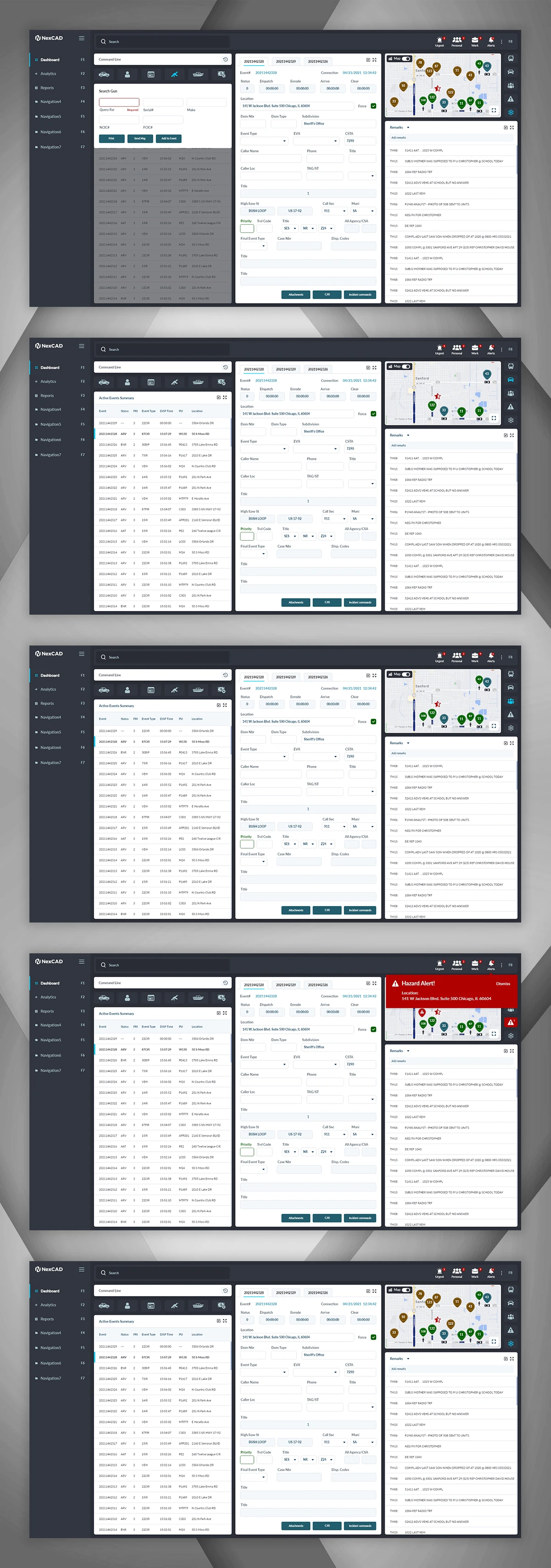
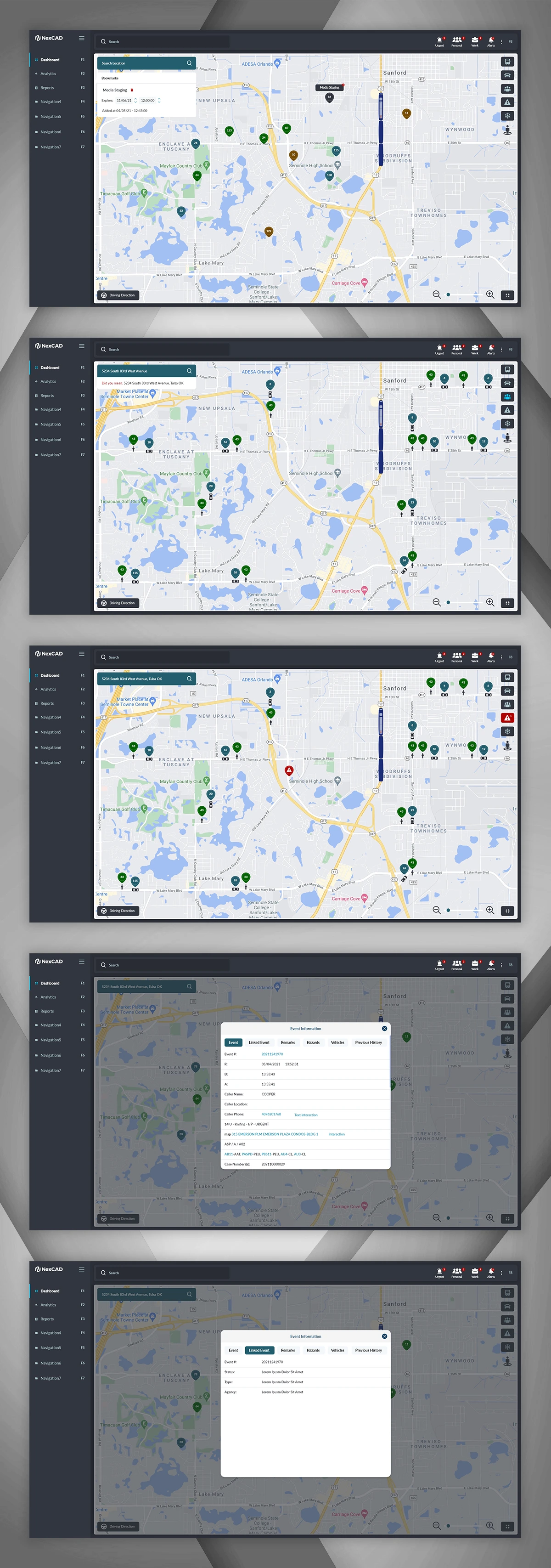
Beyond monitoring, the platform supports active navigation - a full-screen map mode with turn-by-turn directions and a highlighted route, letting a dispatcher or unit see the fastest path to an incident overlaid with live traffic and hazard context, rather than switching to a separate consumer maps app mid-response.
Designing for the One Alert That Matters Most
Hazard alerts (chemical spills, structural danger, armed suspects near a route) needed to break through every other piece of information on screen instantly. I used a high-contrast red banner reserved exclusively for this alert type, positioned to interrupt without fully blocking the map underneath - ensuring dispatchers see it immediately without losing situational awareness of the incident they were already managing.
Answering "What's Nearby?" in One Tap
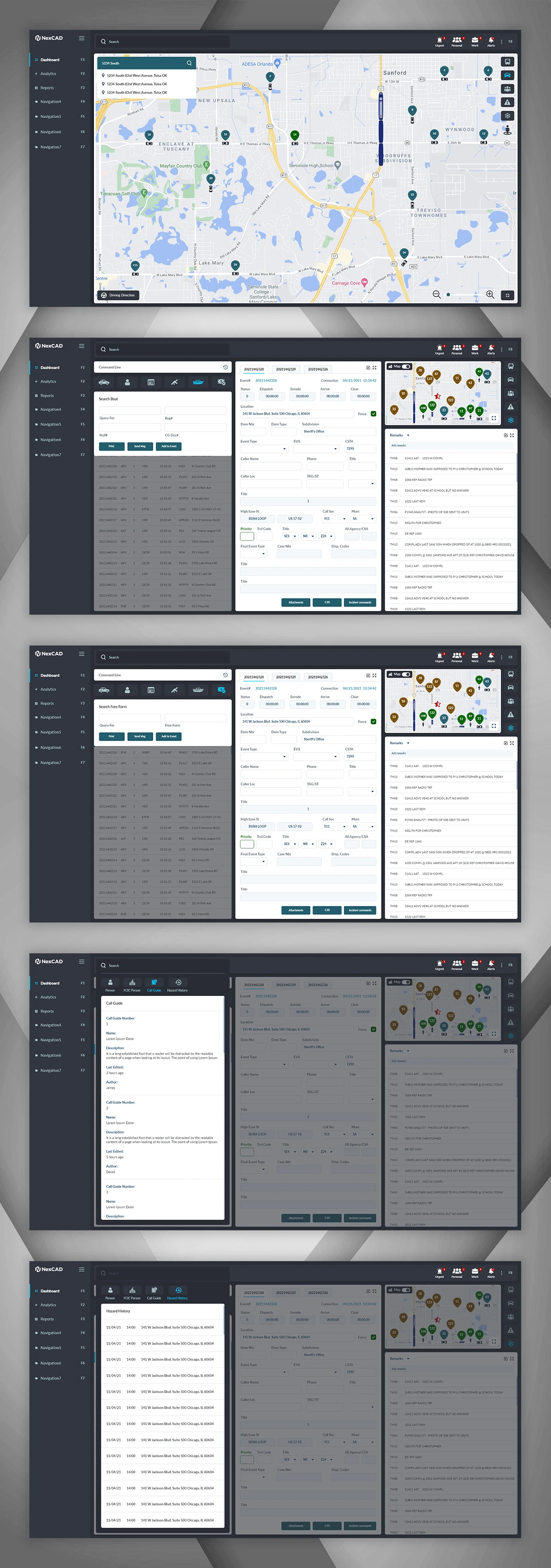
During an active incident, knowing what's physically nearby - fire hydrants, hospitals, schools, known hazards - can change how a response is handled. I designed a category-based quick filter so dispatchers can toggle these points of interest on and off the map instantly, instead of manually searching for each one.
Replaying What Happened, Not Just What's Happening Now
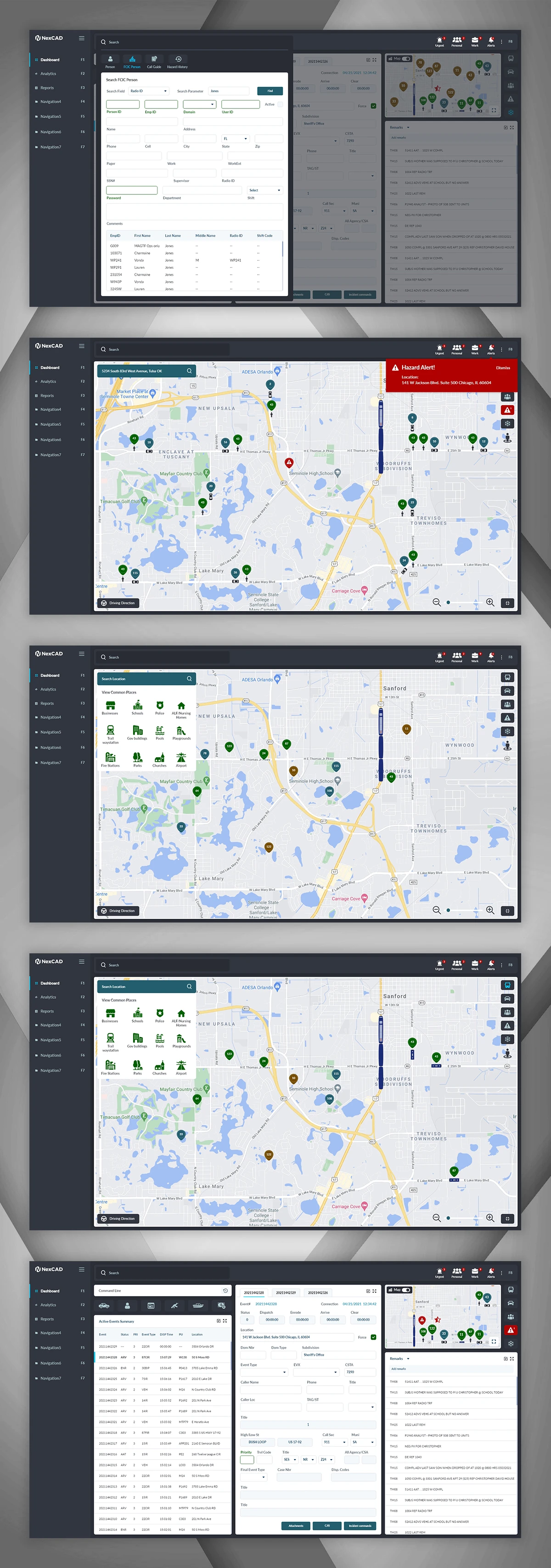
For after-action review and reporting, I designed a media replay tool that lets users scrub through historical unit movements and events across a specified date and time range - turning the live operational map into a retrospective investigation tool without needing a separate reporting system.
Every Detail of an Incident, Organized Into One Modal
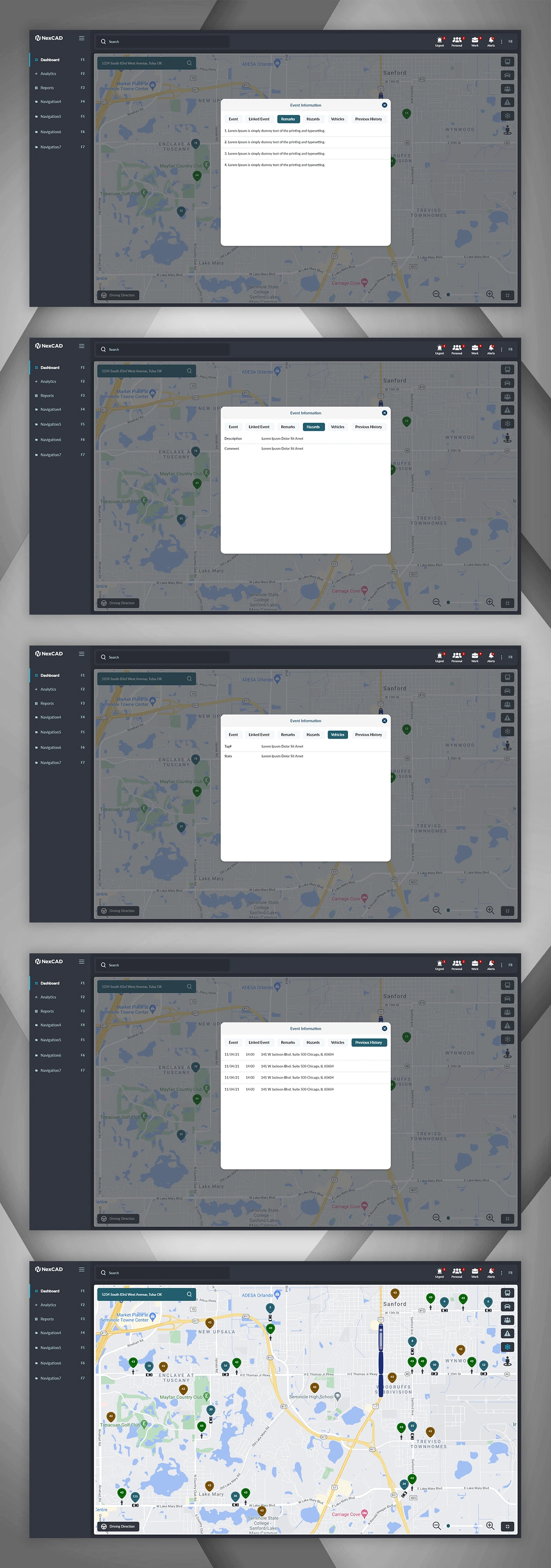
A single incident can accumulate a large amount of related data - linked events, remarks, hazard notes, involved vehicles, and prior history at the same location. Rather than spreading this across separate pages, I organized it into a tabbed modal so a dispatcher or investigator can move between categories of information without losing their place on the underlying map.
Everything About One Unit, One Click Away
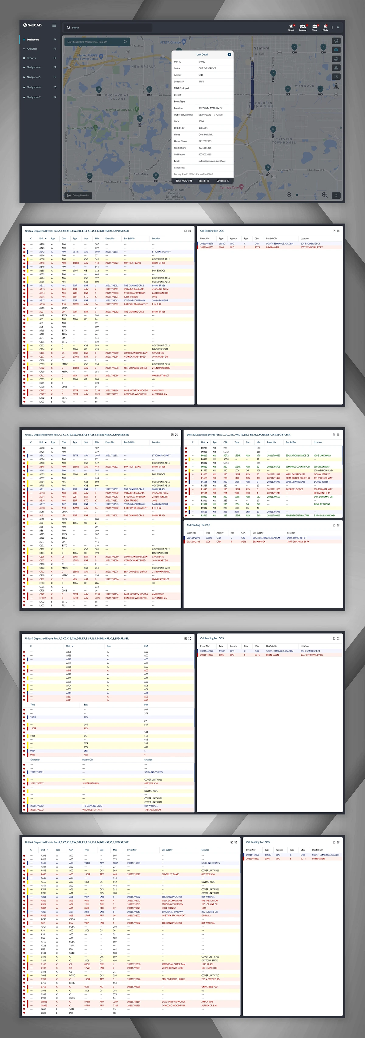
Clicking any unit on the map surfaces a compact detail card - status, current assignment, contact info, and live telemetry like speed and direction - giving dispatchers a fast way to check on a specific unit without leaving the map view or interrupting the broader operational picture.
The Full Operational Picture: Who's Busy, What's Waiting
The dispatch board gives a supervisor-level view across an entire jurisdiction: every unit's current assignment and status colour-coded by type, alongside a live queue of calls still pending assignment. This was designed as the highest-density screen in the product, deliberately - at this level, dispatch supervisors need maximum information per glance to balance workload and catch bottlenecks before they become delays.
Like this project
Posted Sep 3, 2026
NexCAD is a mission-critical dispatch platform used by 911 call centers and field responders to manage live incidents, track units, and pull investigative data.