Aline Moraes
GIS developer | Environmental mapping and spatial analysis
- 5.00
- Rating
- 6
- Followers
Some tools in QGIS available for use in precision agriculture:
• Cadastral Plugin: used to divide polygons into equal parts; it requires a line layer to define the direction/angle of the division.
• Polygon Divider Plugin: divides a polygon into equal parts, with the division...
GIS (Geographic Information Systems) is a powerful tool for mapping and analyzing spatial data.
It provides valuable insights, supports better decision-making, and enhances data visualization in your projects.
It can be applied to a wide range of work, such as identifying...
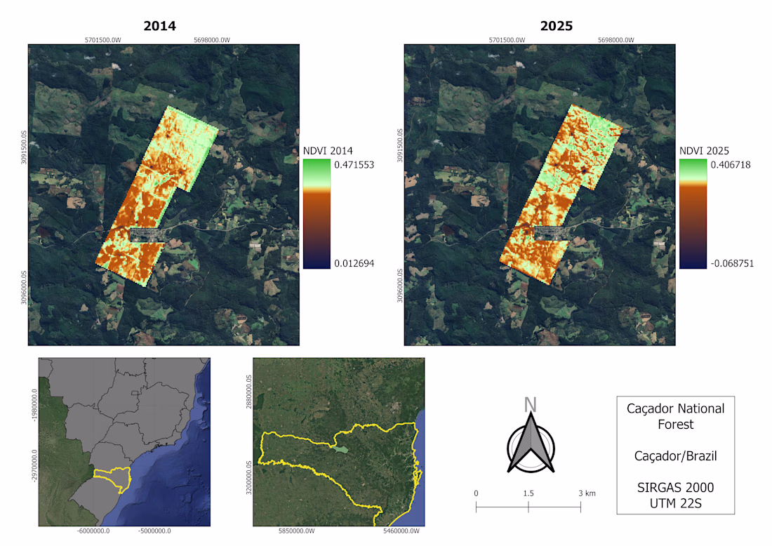
We use satellite imagery to monitor different types of environmental data.
The map below shows the NDVI (Normalized Difference Vegetation Index) calculated using Landsat 8 imagery, which indicates vegetation health.
You can find more details on this topic in my papers and reports.
Technologies for the carbon market
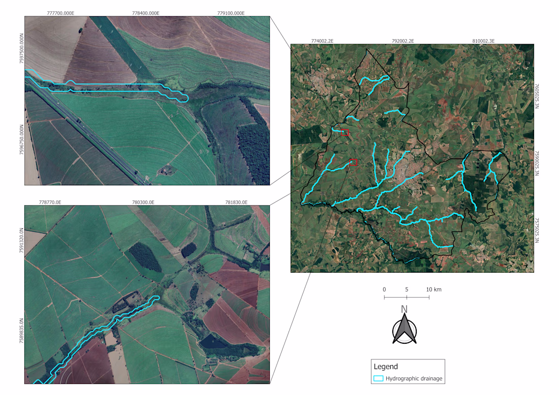
In the map below, hydrograph drainage was generated using satellite imagery (Copernicus Global DSM 30m). The satellite imagery reveals that, in many cases where rivers and springs occur, the required vegetation cover is not properly maintained.
...