The network for creativity
Join 1.25M professional creatives like you
Connect with clients, get discovered, and run your business 100% commission-free
Creatives on Contra have earned over $150M and we are just getting started
Back to feedPost
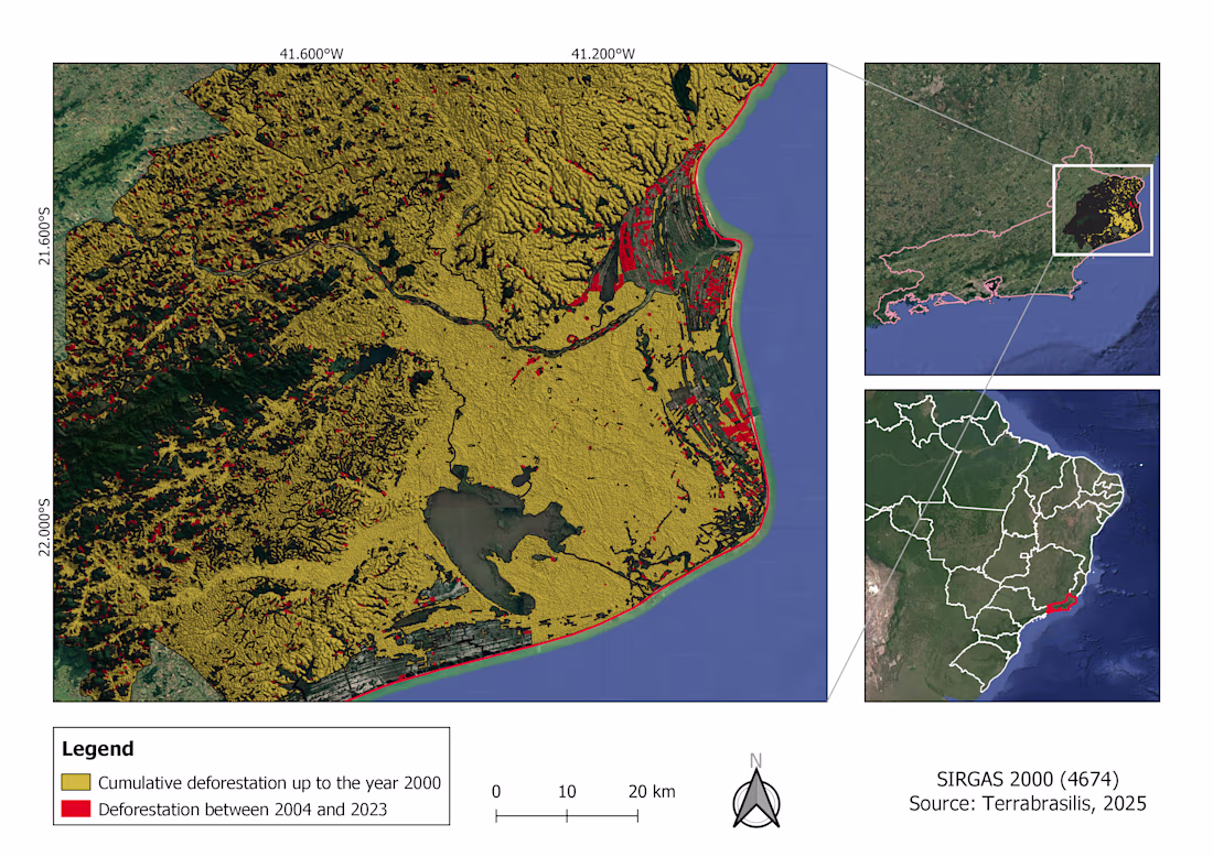
GIS (Geographic Information Systems) is a powerful tool for mapping and analyzing spatial data.
It provides valuable insights, supports better decision-making, and enhances data visualization in your projects.
It can be applied to a wide range of work, such as identifying neighborhoods, mapping hydrography, analyzing relief and land use, and, as shown in the example below, monitoring deforestation over the years.
The network for creativity
Join 1.25M professional creatives like you
Connect with clients, get discovered, and run your business 100% commission-free
Creatives on Contra have earned over $150M and we are just getting started
Trending
Claude
Claude has entered the design space. How are you using Claude Design?
Contra University
Learn from expert creatives how to earn more using next-gen AI tools.
creativeaiflow
Creative AI workflows are evolving. What tools do you use, and what are their strengths and weaknesses?
freelancerlife
Freelancer life is wins, pivots, and everything in between. What’s yours right now?