Projects using ArcGIS in Norfolk
Projects using ArcGIS in Norfolk
Sign Up
Post a job
Sign Up
Log In
Filters
2
Projects
People
Results that are similar to your search
Similar results
Message
0
Aneeq Abbasi
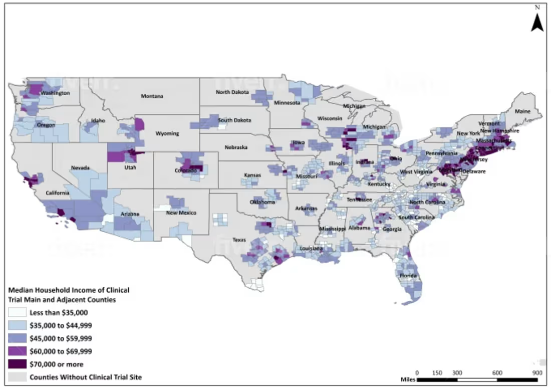
Performed county-level spatial analysis by integrating clinical trial site data with U.S. socioeconomic datasets, classifying median household income ranges, and producing a choropleth map to visualize geographic disparities in clinical trial coverage.
0
17
Message
0
Ahmad Mustafa
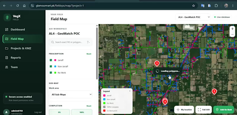
🗺️ Web GIS for Field Operations & Location-Based Data Collection I developed an interactive geospatial platform designed to help teams visualize, manage and update field-work information directly on a map. The application combines Web GIS, satellite imagery, spatial data management and field reporting in a single workflow. Key capabilities include: • Interactive field map with spatial work areas • Color-coded work / prescription classifications • Multiple GIS sub-maps and project views • Satellite and OpenStreetMap basemap switching • Work completion and status tracking • Location-based field-point creation • GPS coordinate capture • Field categorization and notes • Photo attachment support for field observations • Map-based project and team workflows The goal is to replace disconnected field records with a centralized spatial workflow, where teams can see exactly where work is required, record observations from the field, and maintain geographically accurate project information. Built around Web GIS, spatial databases and interactive mapping. Interested in projects involving GIS development, field-data collection, asset management, spatial dashboards and geospatial workflow automation.
0
50
Message
0
Daniela Lucia Troncoso Hernández
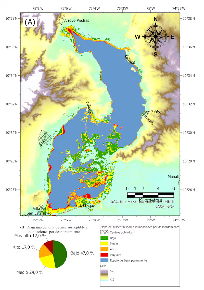
Flood map susceptibility
0
7
Message
0
Sadaqat Ali
Designed and developed an interactive web visualization application featuring dynamic maps, data dashboards, and user-friendly analytics. The platform enables efficient exploration of complex data through responsive and visually engaging interfaces.
0
55
Message
0
Gabriel Homoky
AERIAL RENDERS - MANCHESTER AIRPORT HOTELS
0
70
Message
1
Sunbeam Rahman
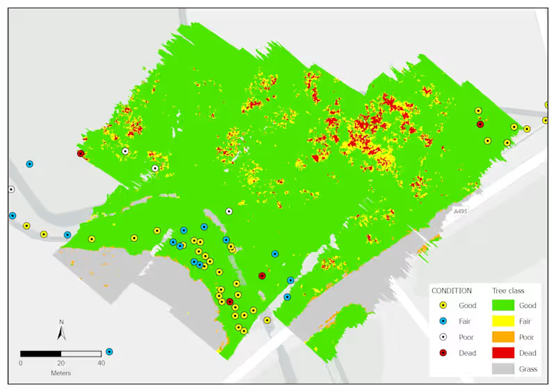
Forest health assessment using GEOBIA
1
1
59
Message
1
Andi Ramdani
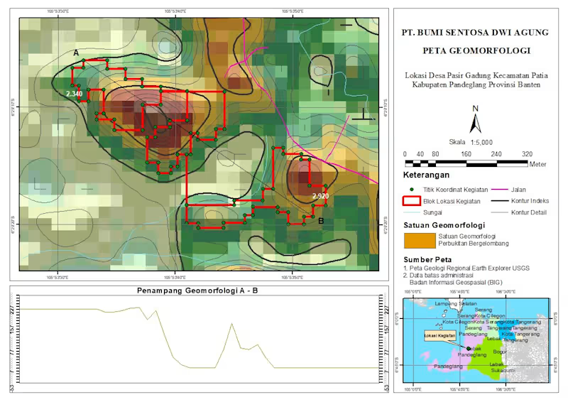
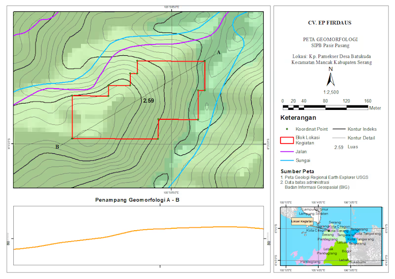
Geomorphological Mapping Project | GIS Analysis Just wrapped up a geomorphological mapping project for a site located in Pasir Gadung Village, Pandeglang, Banten. This work focuses on identifying landform characteristics and terrain variation to support better spatial understanding and decision-making. In this map, I combined elevation data, contour analysis, and spatial interpretation to classify geomorphological units—highlighting areas dominated by undulating hill formations. The red polygons represent the project activity zones, supported by coordinate points collected from the field. I also included a cross-section (A–B) to visualize terrain changes more clearly, giving a better perspective of slope variation and landform structure across the site. Tools & Approach: - GIS processing and spatial analysis - Contour and elevation modeling - Geomorphological interpretation - Map layout and visualization This kind of analysis is essential for projects related to land development, environmental assessment, and infrastructure planning. Always open to feedback and collaboration—let’s connect 🚀
1
195
Message
2
HONGDAN CHEN
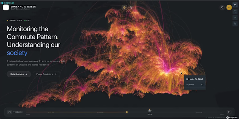
From static maps → interactive spatial experiences. 🚀 Recently experimented with building a Geo-inspired commute dashboard using Vibe Coding + geospatial visualization. The interesting shift for me: Instead of spending days moving between GIS software, frontend development, and UI iteration, ideas can become working interfaces much faster. Still early, but it opens up interesting possibilities: → spatial analytics that feel more accessible → interfaces ready for predictive layers and AI workflows → reducing the barrier between geographic data and end users Curious where GIS + AI + Vibe Coding goes next.
2
119
Message
0
Michael Jeffreys
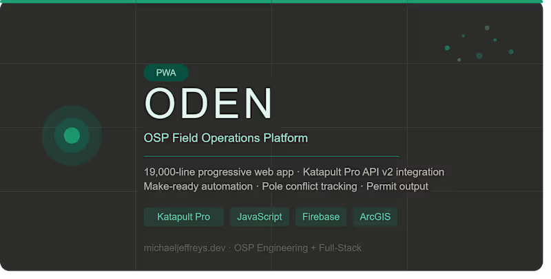
Fiber Optic Field Operations PWA (19,000 Lines)
0
3
Message
1
Dian Eka Putra
Technical & Engineering
1
54
Message
0
Daniela Lucia Troncoso Hernández
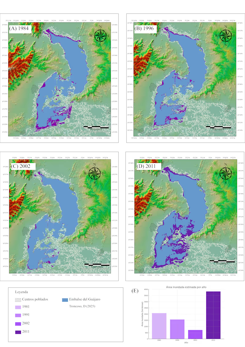
Water area of four different Niña event 1981, 1991, 2022, 2011. E) the total area of flood terrain.
0
12
Message
0
Aneeq Abbasi
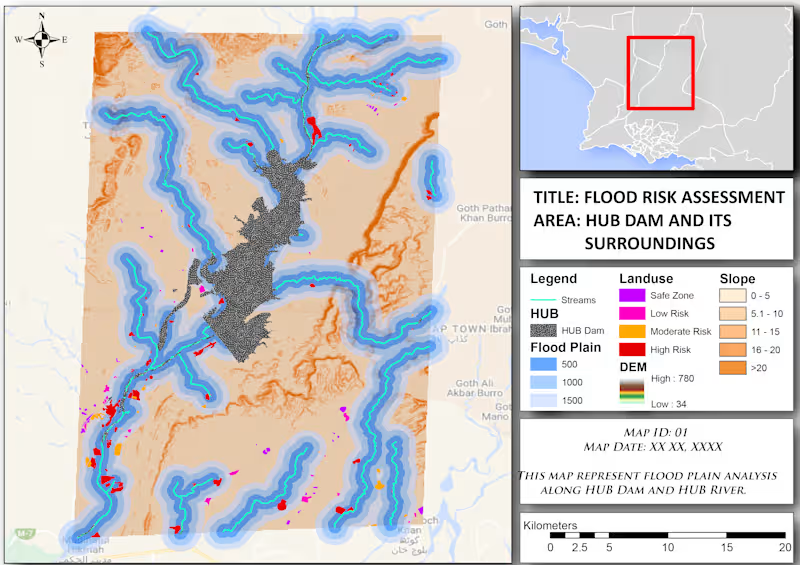
Performed flood risk assessment around Hub Dam by integrating stream networks, multi-distance floodplain buffers, DEM/elevation, slope analysis, and land-use classification to identify safe, low, moderate, and high flood-risk zones.
0
32
Message
0
Ahmad Mustafa
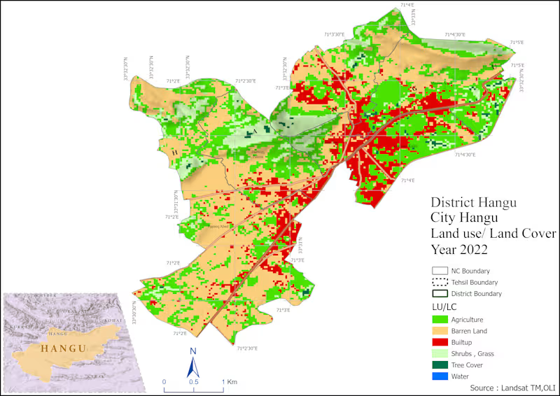
GIS-based spatial analysis and mapping project using ArcGIS, QGIS, and Remote Sensing data. Developed accessibility, land use, and spatial distribution maps to support urban planning and decision-making.
0
33
Message
0
Sadaqat Ali
Created a 3D urban parking facility model for a city development project, showcasing efficient parking layouts, traffic circulation, and public accessibility. The visualization supported urban planning, infrastructure design, and decision-making processes.
0
66
Message
1
Sunbeam Rahman
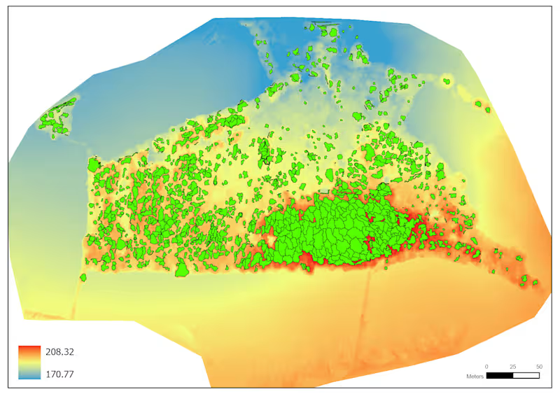
Canopy crown indentification using LiDAR
1
16
Message
4
Andi Ramdani
Professional Geomorphology Map & Terrain Profile (ArcGIS/QGIS) I create precise and visually clear geomorphological maps like this, including: - Contour mapping (index & detailed) - Landform interpretation - River and infrastructure overlay - Project boundary mapping - Elevation cross-section analysis (A–B profile) Perfect for research, environmental analysis, mining, or land development projects.
5
4
245
Explore projects