
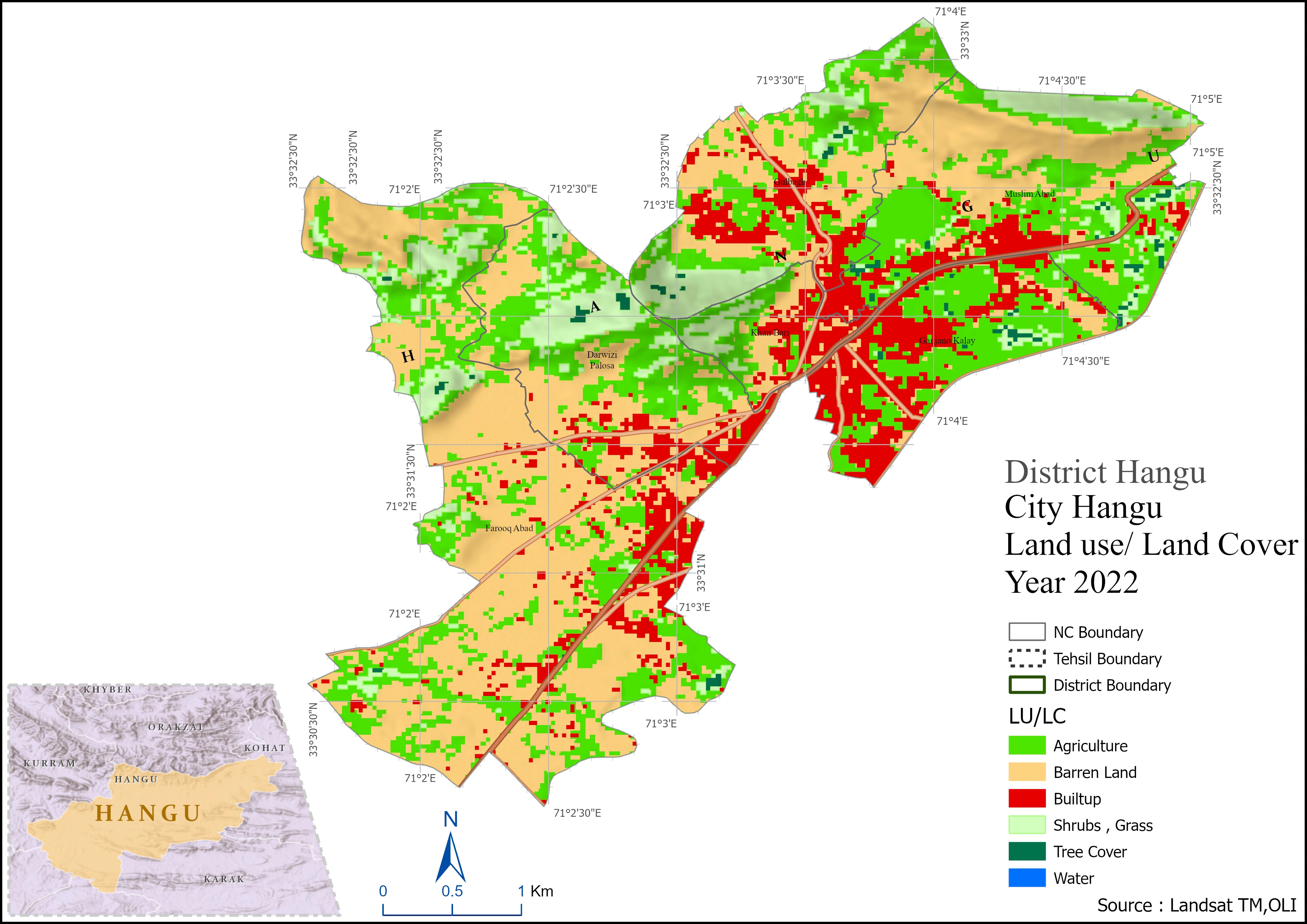
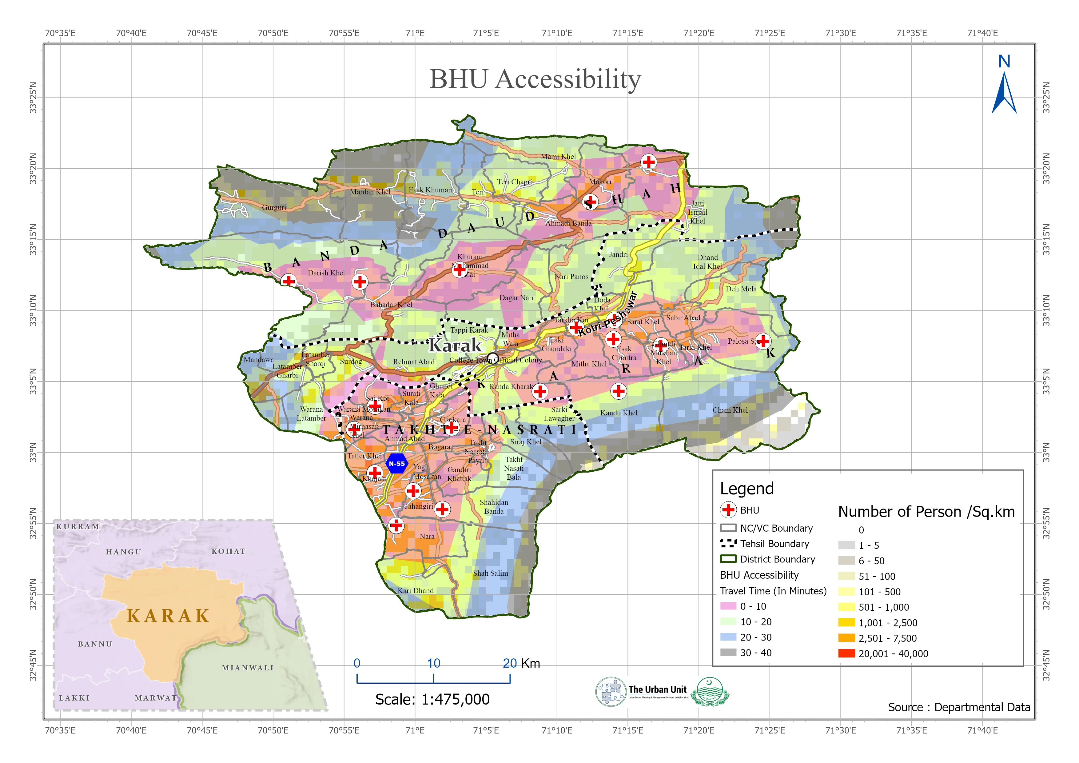
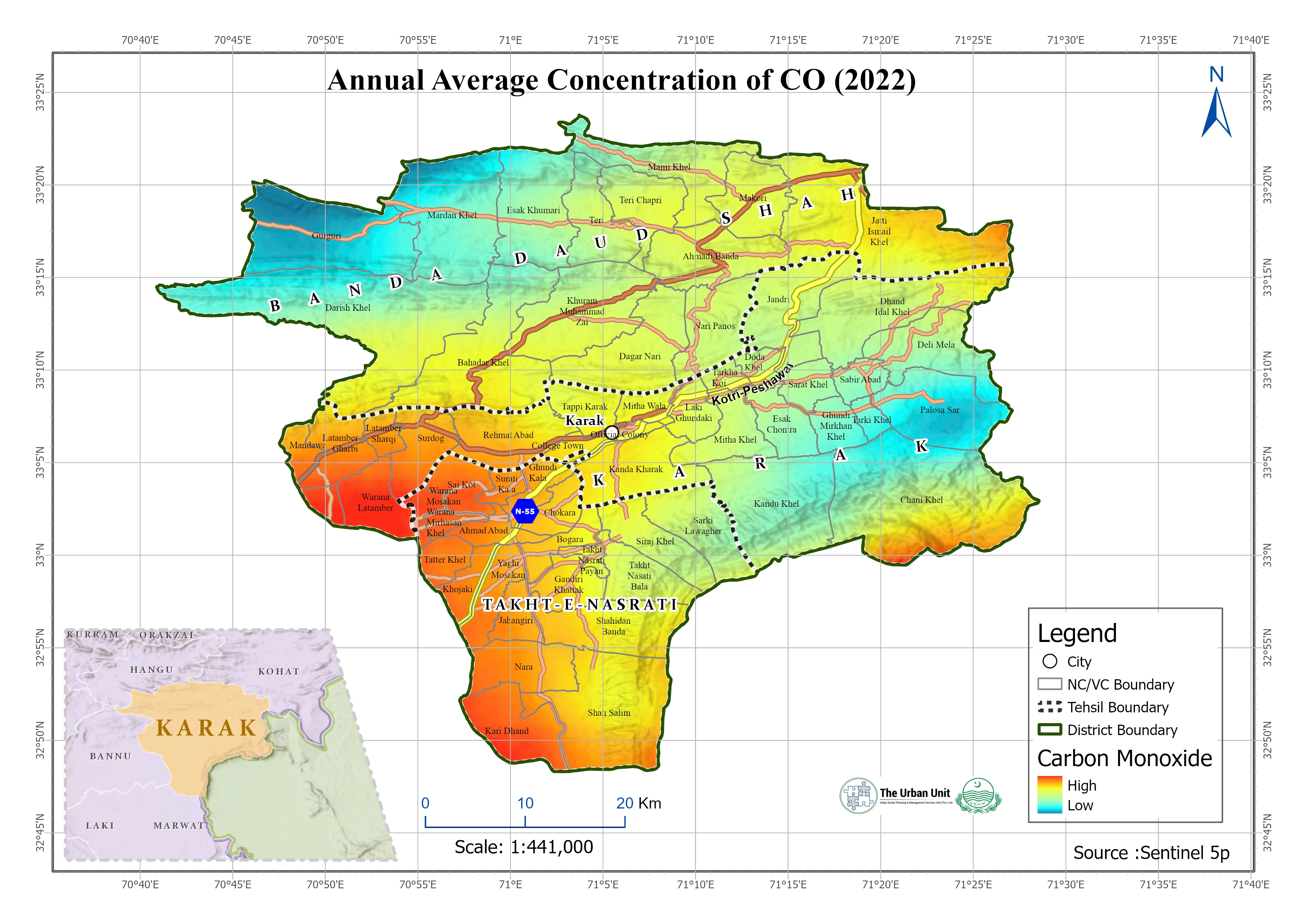
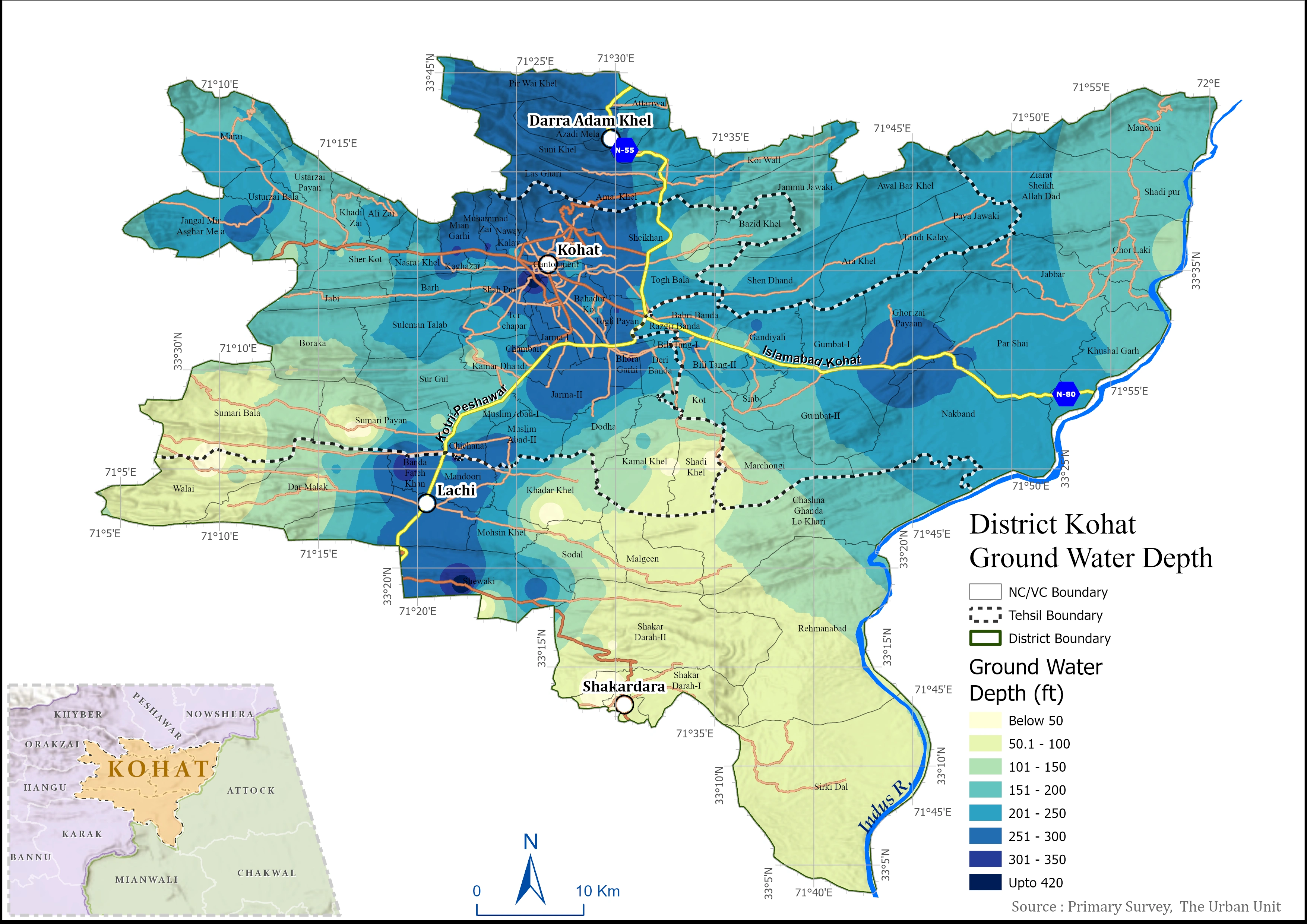
GIS-based spatial analysis and mapping project using ArcGIS, QGIS, and Remote Sensing data. Developed accessibility, land use, and spatial distribution maps to support urban planning and decision-making.
0 likes · 0 views · Jun 19, 2026
GIS-based spatial analysis and mapping project using ArcGIS, QGIS, and Remote Sensing data. Developed accessibility, land use, and spatial distribution maps ...


