Graphic Design - Signage - Metro Manila Intermodal Transit Map
Étienne Haché
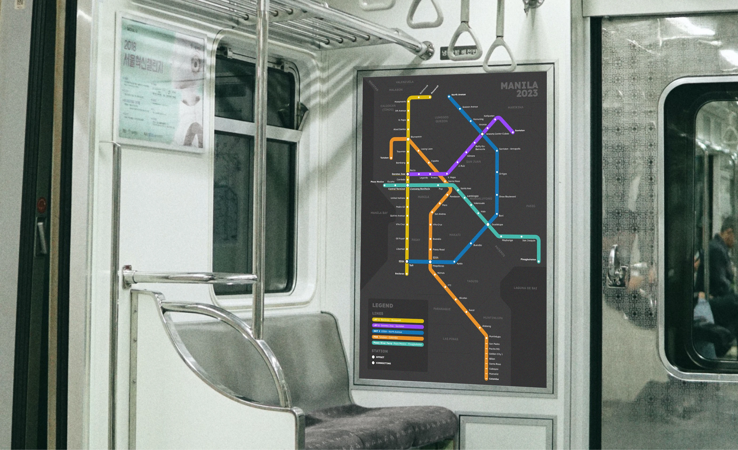
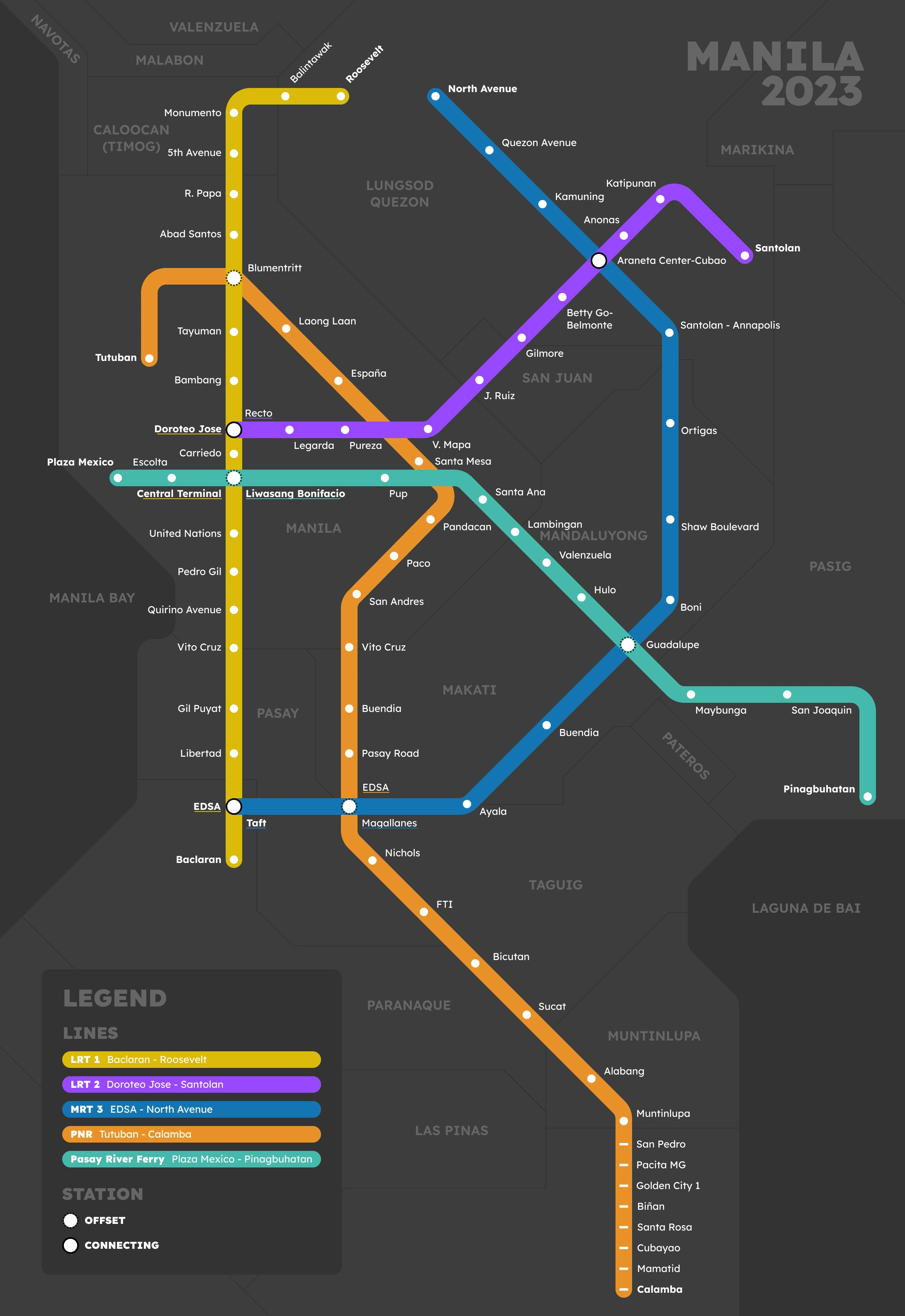
Metro Manila's bustling transit network often leaves commuters puzzled. From train lines to ferry routes, each mode of transportation seems like a jigsaw piece. Determined to transform the daily commute, I set out to create a single, unified map that brings clarity to the chaos.
Key Features
🗺️ Holistic Design: The map encapsulates the entirety of Metro Manila's transit system, elegantly weaving together trains, ferries, and other modes of travel.
🚆 Train Clarity: I meticulously plotted the train lines, ensuring passengers can seamlessly navigate from station to station.
⛴️ Ferry Finesse: Beyond tracks, I incorporated ferry routes to connect river and coastal transportation, enhancing the map's intermodal essence.
🎨 Visual Brilliance: The map boasts a minimalist yet informative design, making navigation intuitive for both locals and newcomers.
Why This Matters
With urbanites in mind, I stitched together an information tapestry that paints a clear picture of Metro Manila's mobility options. No longer will commuters be caught in the labyrinth of conflicting transit information. It's a way for me to give back to my temporary community and making the transit experience better for thousands of commuters by filling a critical information gap.
Like this project
Posted Aug 27, 2023
Crafted the Metro Manila Intermodal Transit Map, uniting trains and ferries. Navigating the urban jungle made easy for thousands of commuters.
Likes
0
Views
62