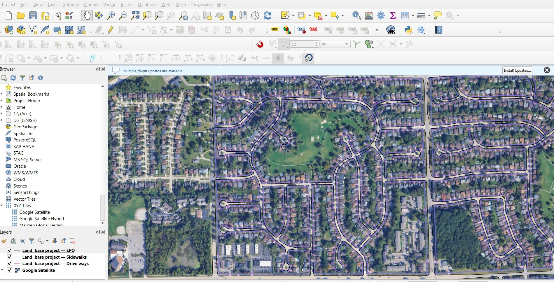
Utility Mapping & Asset Digitization using GIS
Description
Accurate utility mapping is essential for infrastructure planning and asset management. In this project, I developed a comprehensive GIS-based utility map by integrating field-collected GPS data with spatial datasets.
I digitized utility assets such as pipelines, electrical lines, and infrastructure features, ensuring proper alignment and georeferencing. Using ArcGIS and QGIS, I organized the data into structured layers, making it easy to analyze, update, and use for decision-making.
The final output included clean, high-precision maps and GIS datasets (Shapefile/GeoJSON) that can be used for planning, maintenance, and future expansion of utility networks.
This project highlights my ability to handle large datasets, ensure spatial accuracy, and deliver professional GIS solutions for real-world applications.
👉 Available for utility mapping, asset digitization, and GIS data management projects. Feel free to message me.