
Human–Wildlife Conflict Map
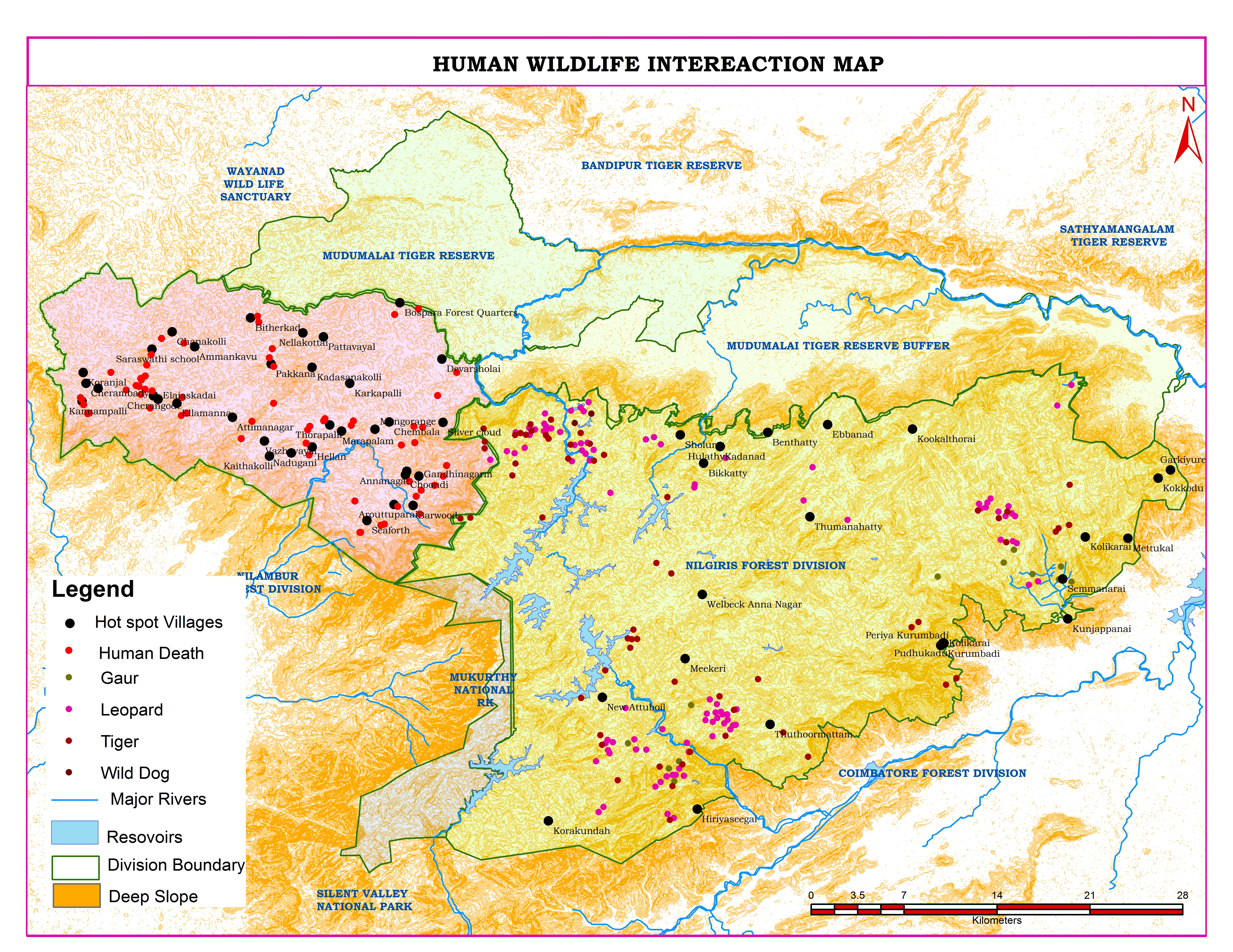
Human–wildlife conflict is a major challenge in forest fringe areas. In this project, I analyzed conflict incidents across the Nilgiris landscape to identify high-risk zones and support better decision-making.
Using ArcGIS and QGIS, I mapped human death incidents, wildlife presence (leopard, tiger, gaur, wild dog), and hotspot villages. I integrated terrain (slope), forest boundaries, rivers, and reservoirs to understand patterns of wildlife movement and interaction with human settlements.
The analysis revealed that most conflict incidents occur near forest edges and buffer zones, especially in villages close to protected areas. Leopard activity was widely distributed, indicating higher interaction risk with human populations.This project demonstrates my ability to transform complex geospatial data into clear, actionable insights for forest management and conservation planning.
👉 Available for similar GIS mapping and spatial analysis projects. Feel free to message me.
0 likes · 0 views · Apr 25, 2026
Human–Wildlife Conflict Map Human–wildlife conflict is a major challenge in forest fringe areas. In this project, I analyzed conflict incidents across the Ni...
