
Reserved Land & Reserved Forest Map – Pandalur & Nadugani Ranges
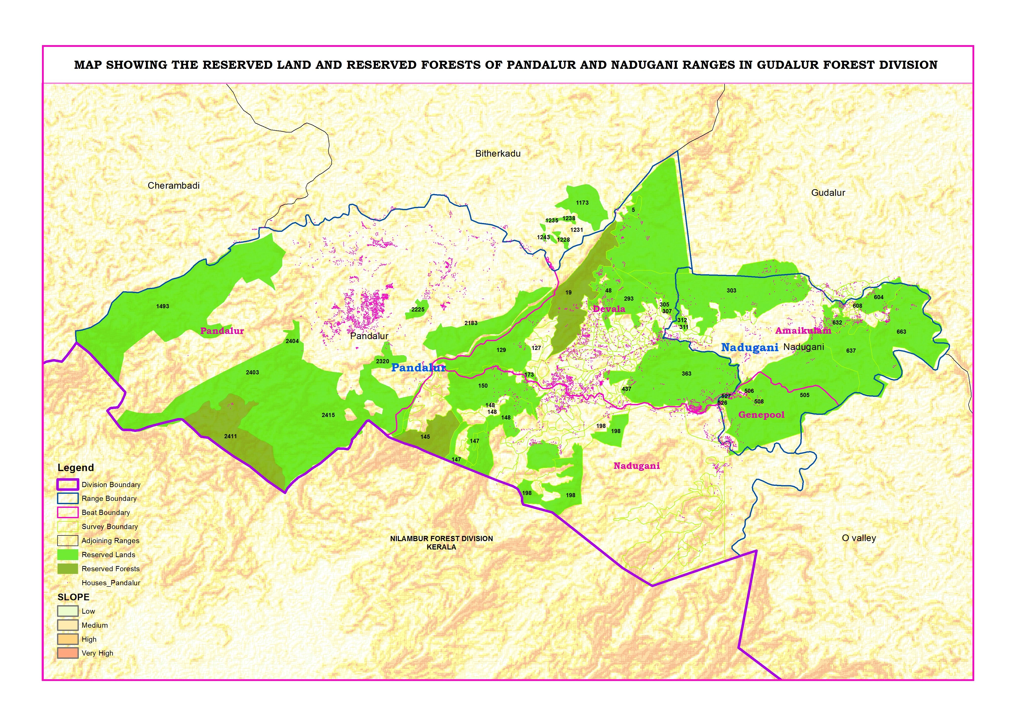
This project focuses on mapping reserved lands and reserved forests in the Pandalur and Nadugani ranges under the Gudalur Forest Division.
Using QGIS, I created a detailed administrative map including division, range, beat, and survey boundaries. I integrated forest classification data with terrain (slope) analysis to provide a clear understanding of land distribution and landscape characteristics.
The map also highlights human settlements within and around forest areas, helping in planning, management, and decision-making.
This project demonstrates my expertise in administrative mapping, boundary digitization, and geospatial data visualization for government and environmental applications.
👉 Available for administrative mapping and GIS projects. Feel free to message me.
0 likes · 0 views · Apr 25, 2026
Reserved Land & Reserved Forest Map – Pandalur & Nadugani Ranges This project focuses on mapping reserved lands and reserved forests in the Pandalur and Nadu...
