Kestrel Orbital: brand and product UI

Blomdahl&Co Design


Kestrel Orbital: brand and product UI
Kestrel Orbital is an Earth-observation company. It monitors places from orbit and tells its customers what has changed: a river rising, a field under water, a berth occupied longer than usual. Blomdahl&Co developed the brand strategy and visual identity, and designed the website and product interface as one system.
The challenge.
Satellite data companies tend to look like defence contractors or like every other data startup. Neither works for Kestrel’s buyers: risk analysts and operations managers who need an answer about a place, and who assume orbital data is too specialised for them.
The approach.
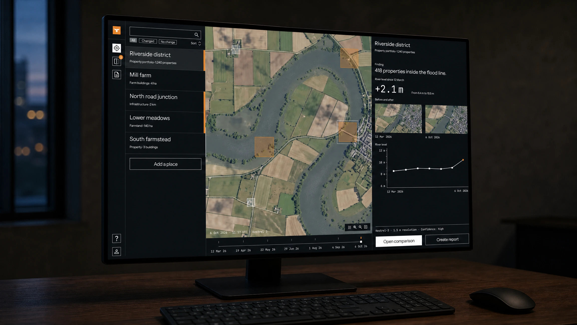
Competitors sell imagery and resolution. Kestrel sells the conclusion. The positioning, “See what changed.”, describes the product exactly. Every screen follows from it: one plain sentence first, the evidence one click away.
The identity.
The palette is taken from the bird the company is named after, with a single accent: Rufous, the orange of a kestrel’s plumage. Rufous does one job, marking change, so the brand colour is also the product’s most important signal. The logo, a hovering kestrel inside a Rufous square, uses the same square the product draws around a place where something has changed.
Color Palette
Color palette
The website.
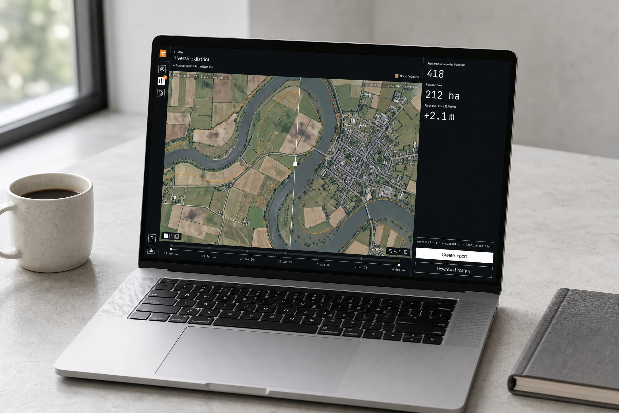
A single landing page, white where it explains and dark where it shows the product. The hero is a live before/after slider: it demonstrates the product and the positioning in one interaction, with no copy needed.
Website
The product.
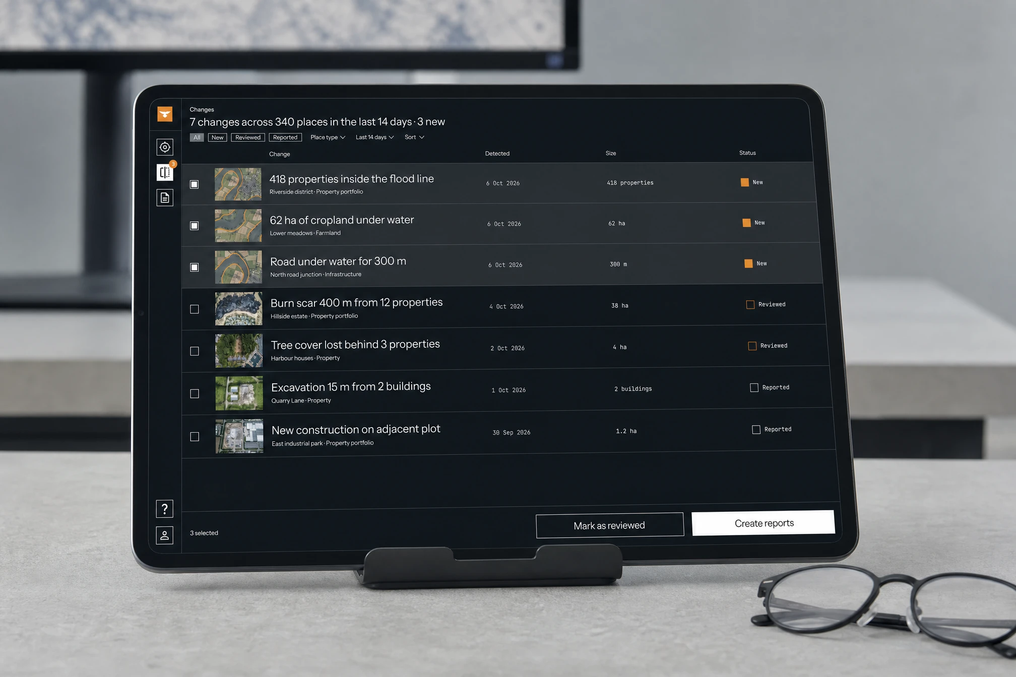
A map view, a before/after comparison, a changes list and a one-page change report, built from one set of components. Every screen leads with a finding a risk analyst could forward to a colleague. Sensor, resolution and confidence are always one click away, never the headline.
Product UI
Product UI
Product UI
Product UI
Product UI
Outcome.
A brand that makes a technical capability legible in three words, and a product where the identity does functional work instead of sitting on top of it.
Imagery is generated and captioned as from Kestrel’s own fictional satellites. No real sensor data or locations are shown.
Like this project
Posted Oct 13, 2026
Brand strategy, visual identity, marketing website and product interface for a satellite monitoring company, designed as one system.
Likes
1
Views
4
Timeline
Sep 7, 2026 - Oct 13, 2026