Hassan gegu
Geospatial Engineer | Web Maps & Spatial Analysis
New to Contra
Hassan is ready for their next project!
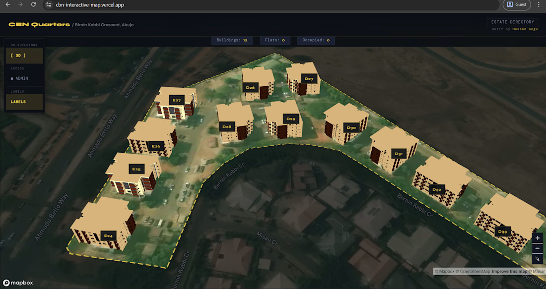
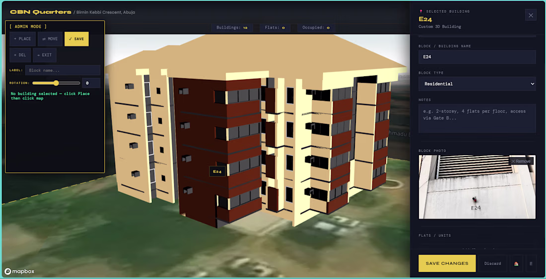
A full stack geospatial estate management tool built for CBN Quarters, Abuja. Custom Revit-derived 3D building models are placed at real-world coordinates on a live satellite map. Estate managers can click any building to log block details, flat numbers, residents, occupancy,...
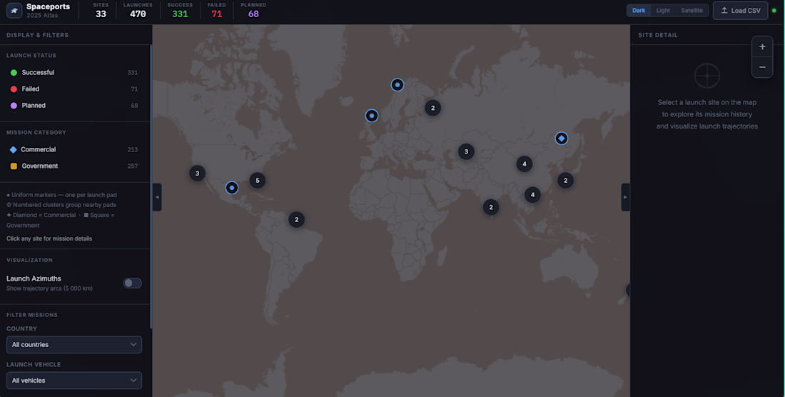
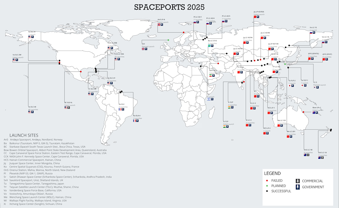
This project started as a minimalist global map of spaceports built in QGIS. I researched worldwide spaceport locations, compiled them into a structured CSV dataset, and brought them into QGIS to produce a clean, modern cartographic design inspired by contemporary data...
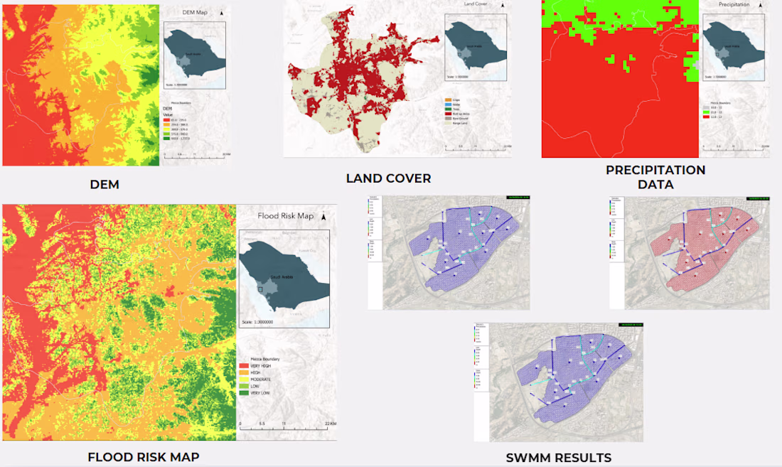
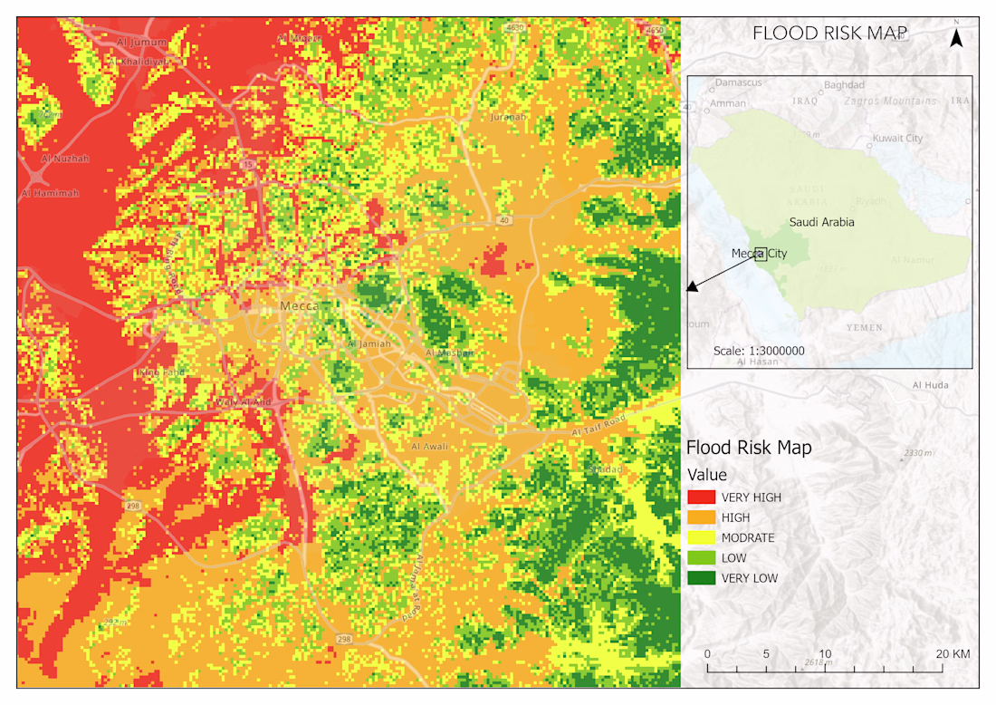
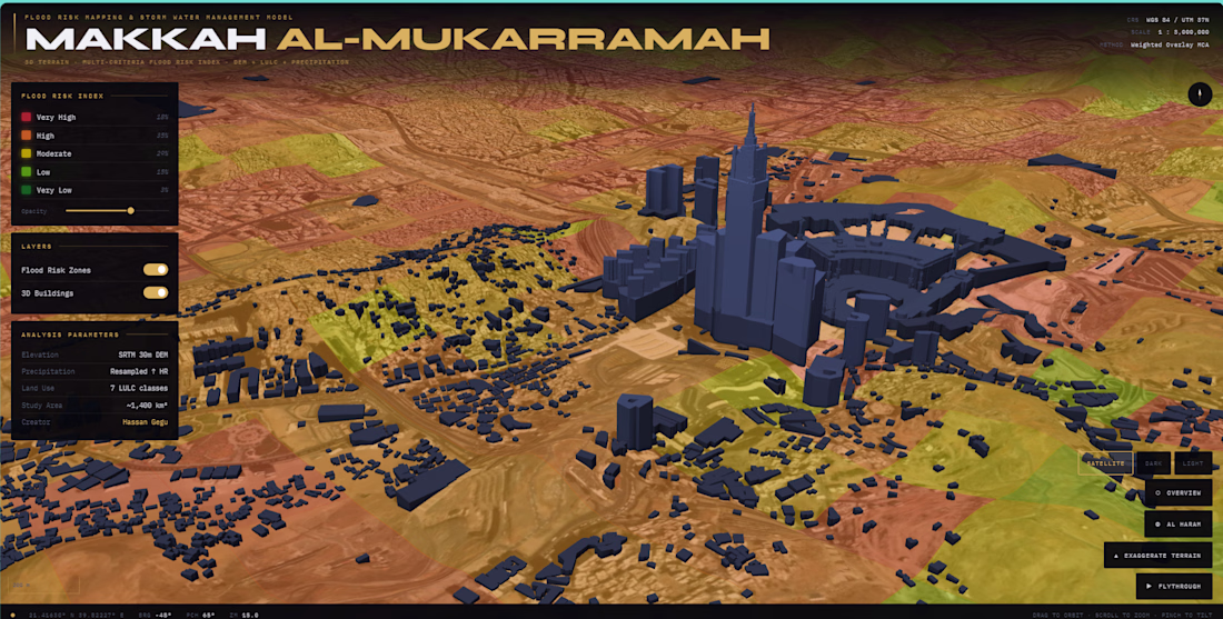
This project maps flood risk across Makkah City using GIS analysis, remote sensing, and hydrological modeling. I combined a 30m SRTM DEM, land cover classification, slope analysis, precipitation data, and SWMM simulations into a weighted overlay that classified the entire city...