The network for creativity
Join 1.25M professional creatives like you
Connect with clients, get discovered, and run your business 100% commission-free
Creatives on Contra have earned over $150M and we are just getting started
Back to feedPost

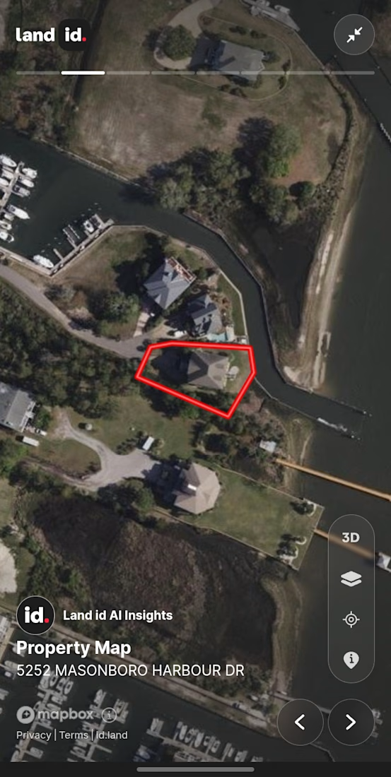
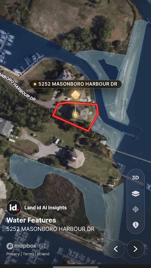
I build interactive Land & Real Estate maps with Land.id + GIS
I turn property boundaries, flood zones, and survey data into clean, clickable maps for agents, developers, and land buyers.
Stack: QGIS, ArcGIS, Land.id, Mapbox
Open to small fixes and full projects - DM if you need a property map, parcel report, or GIS cleanup.
Portfolio in bio.
#QGIS #ArcGIS #Land #RealEstate #GIS
The network for creativity
Join 1.25M professional creatives like you
Connect with clients, get discovered, and run your business 100% commission-free
Creatives on Contra have earned over $150M and we are just getting started





Related posts

Vintage Map Ad — Two Creative Directions
I’ve been testing two ways to reveal the product.
In one version, the space builds around it, creating a more magical feel.
In the other, I went for a more restrained approach — pulling back to reveal the setting without any transformation.
Which one would you go for?
9 votes
Ends in 1h

The pullback is beautiful, I like the concept

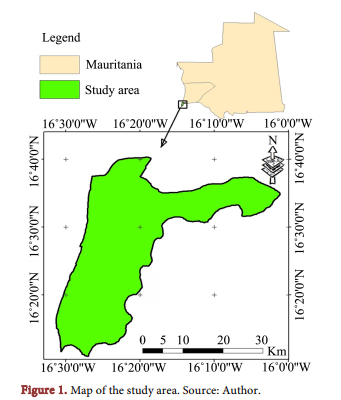
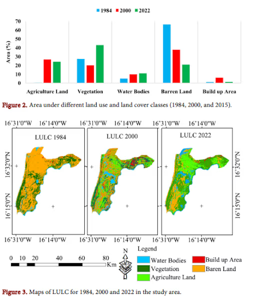
Just published: my peer-reviewed paper in Advances in Remote Sensing on land use and land cover change in Southwest Mauritania.
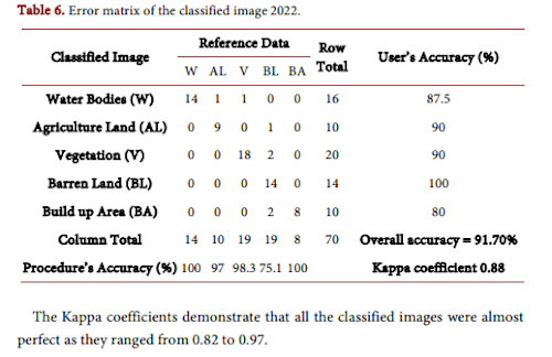
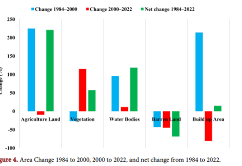
I used satellite imagery and GIS to analyse how agricultural land, vegetation, and water bodies have changed over time — providing baseline data for climate adaptation and sustainable land management.
This work is part of my broader research on climate change mitigation in West Africa.
If you need GIS analysis, remote sensing, or academic writing support for your project, let's connect.



Version Log — Framer Map Locator CMS Component Update
Version 1.0.3
Custom Marker Improvements
The map now supports custom marker artwork for individual locations and for all pins through the default marker setting. Uploaded SVG, PNG, JPG, and WebP icons are rendered inside the custom pin while preserving their proportions. The main custom marker pin was increased by 16%, while the icon artwork remains at its existing size and is centered within the pin’s circular head to prevent overlap with the marker edges.
Category Filter Improvements
Clicking a category tab now resets the map viewport and automatically fits all visible locations in the selected category. Clicking the currently selected category again also resets the map view, and any selected location popup is cleared when changing categories. The behavior is applied consistently across both category-tab layouts.
Apple Maps and Waze Directions
Location details now include direct navigation links for Apple Maps and Waze. Visitors can select the configured Apple Maps or Waze action to get directions to the selected location using its latitude and longitude coordinates. Both links support customizable button labels and can be enabled or disabled independently.
Distance from Your Location
The map can use the visitor’s current location to calculate and display how far each location is away in miles. Visitors can also sort locations by distance to find the nearest available place more quickly.
Office Local Time and Status
Office locations can display their current local time based on the configured timezone. The office details can also show operating hours and an availability or open-status indicator, helping visitors understand whether an office is currently open.

framer.link
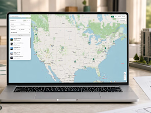
Map Locator CMS — Component for Framer
Interactive Map Location — Map Locator CMS is a premium Maps component for Framer, on the Framer Marketplace. Build on it with Framer’s agent, directly on the canvas.