
Rohma Shakoor
Gis and Remote sensing analyst



Can satellite machine learning tell a felled forest from a harvested field? 🛰️
At 10 metres, the answer is: only if your feature stack and your validation are built for it.
Most land-cover maps break at exactly this problem — forest loss and agricultural cycles look similar in a single image. So I built an end-to-end GeoAI system that separates them properly, from raw Sentinel-2 telemetry to an interactive cloud-native app on Google Earth Engine.
How the pipeline was engineered:
🔹 Data ingestion & atmospheric preprocessing
Harmonized Sentinel-2 Level-2A surface reflectance (10–20m) across multi-temporal epochs (2017 vs 2023), with rule-based cloud and shadow masking using the Scene Classification Layer (SCL).
🔹 Multi-spectral feature engineering
Beyond standard VNIR bands, a 10-dimensional feature stack — NDVI (canopy vigor), MNDWI (hydrological discrimination), NDMI (canopy moisture, B8 + B11), NBR (disturbance sensitivity, SWIR-2 B12).
🔹 Supervised ML & validation
100-tree Smile Random Forest with stratified random sampling referenced to ESA WorldCover v200. Performance reported through confusion matrices, Overall Accuracy, and Cohen's Kappa — not just a pretty map.
🔹 Interactive split-map deployment
A synchronized ui.SplitPanel with a docked analytics dashboard, live class legends, and non-blocking client-side statistics via evaluate() — stakeholders can explore change without touching GIS software.
Why this matters to the people who need it:
Conservation and REDD+ teams need defensible deforestation evidence. Urban planners need land-use change they can rerun. Agri-tech and environmental consultancies need a reproducible baseline fast. That's who this workflow is built for — and why every deliverable ships with a methodology report and a rerunnable script, not a dead static PDF.
Working on land-cover change, forest monitoring, or LULC classification in GEE? Send me your area of interest and time range — I'll tell you within 24 hours whether Sentinel-2 can answer your question, and what the workflow would involve.
2
139
50-Year Flood Inundation & Critical Asset Risk Engine for Pakistan
1
133
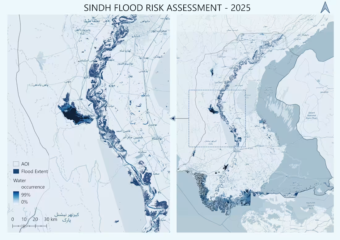
Mapping Flood Vulnerability: Flood Risk Assessment of Sindh, Pakistan (2025).
My latest spatial analysis project focusing on inundation dynamics and surface water occurrence across the Sindh province!
Using Multi-Criteria Decision Analysis (MCDA), satellite remote sensing, and cloud computing in Google Earth Engine (GEE) and QGIS, this analysis maps high-risk flood zones and permanent vs. seasonal water extents across the Indus River basin.
Key Technical Steps:
🔹 Processing multi-temporal satellite imagery to extract surface water occurrence (0–99%).
🔹 Integrating SRTM DEM elevation, slope, and hydrological river networks for terrain analysis.
🔹 Multi-scale cartographic visualization detailing localized riverine flood extents alongside regional impacts.
Spatial data and predictive mapping remain crucial tools for early warning systems, disaster management, and climate resilience planning across vulnerable catchments.
I’d love to hear your thoughts or feedback from fellow GIS and Remote Sensing professionals!
1
141
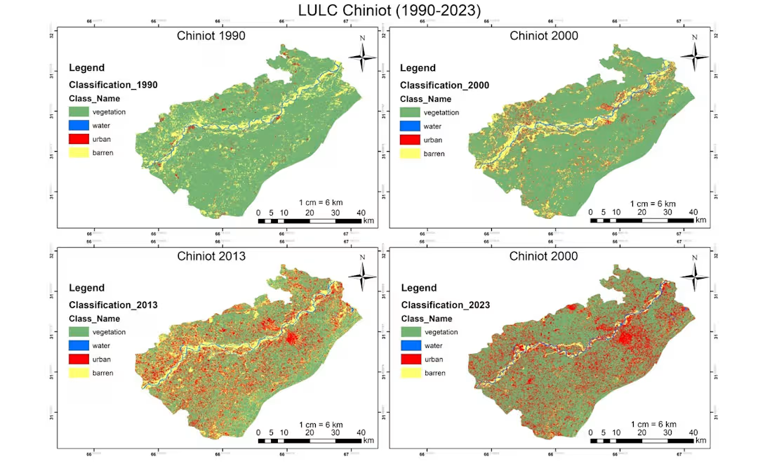
Supervised Land Use Land Cover (LULC) Classification of Chiniot (1990–2023)
1
127