
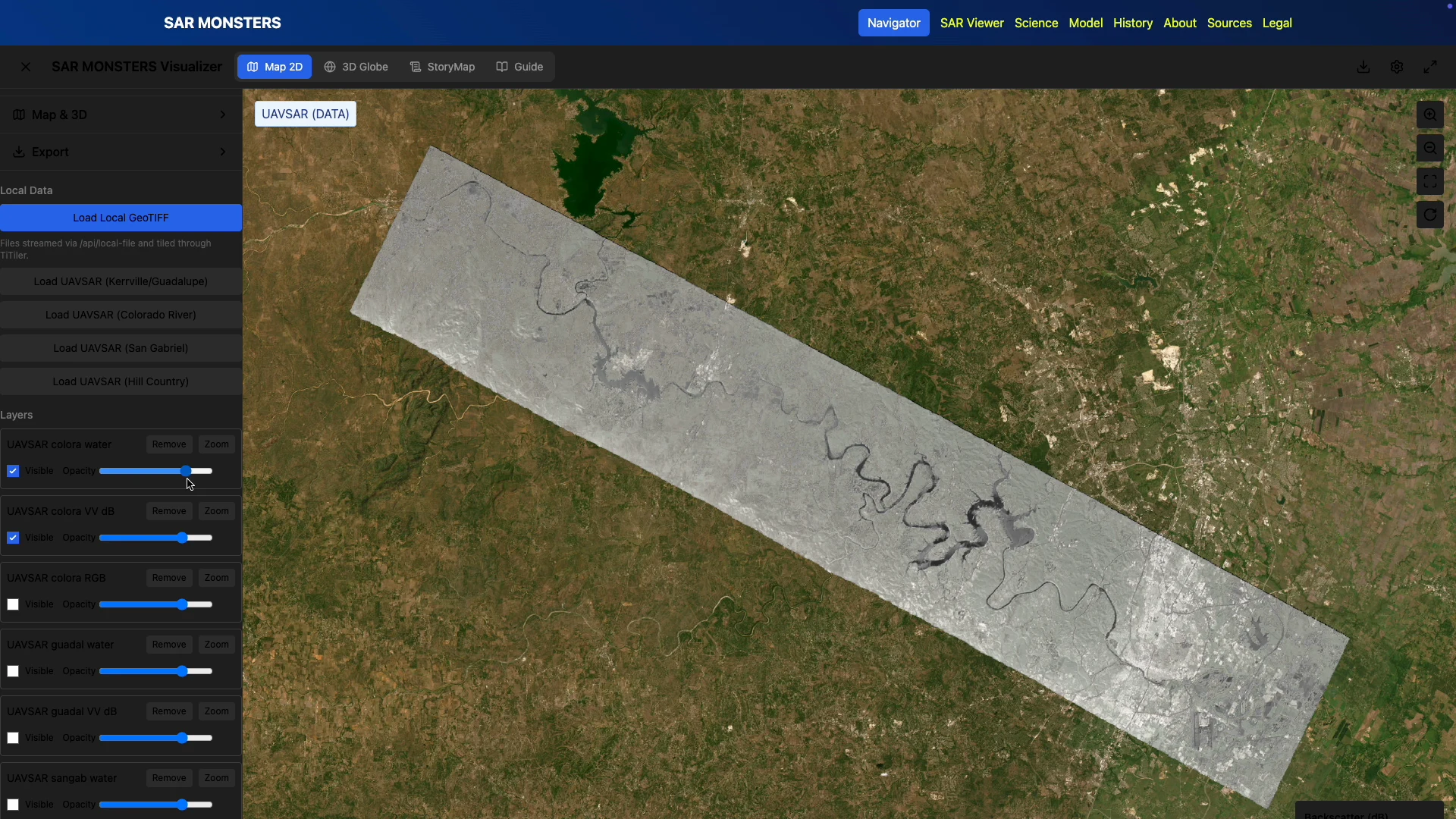
SAR Monsters turns radar imagery into a map workspace where users can compare raster layers and investigate an area.
I developed the Next.js interface with MapLibre/Cesium views, GeoTIFF loading, raster overlays and visibility and opacity controls. The later Flood Navigator iteration adds time and precipitation controls to a map-based scenario.
Role: application development, map integration and interaction design. These are research prototypes for imagery exploration and route-planning scenarios, not an operational flood forecast.
Selected screens
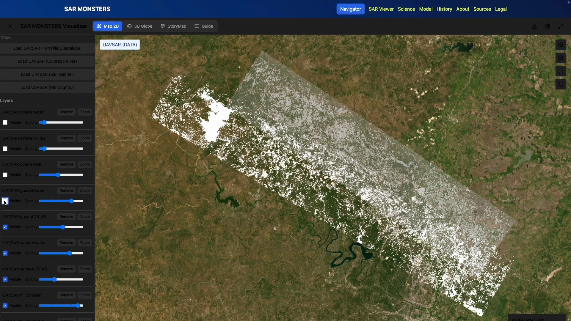
Layer comparison — use visibility and opacity to compare radar imagery with the basemap.
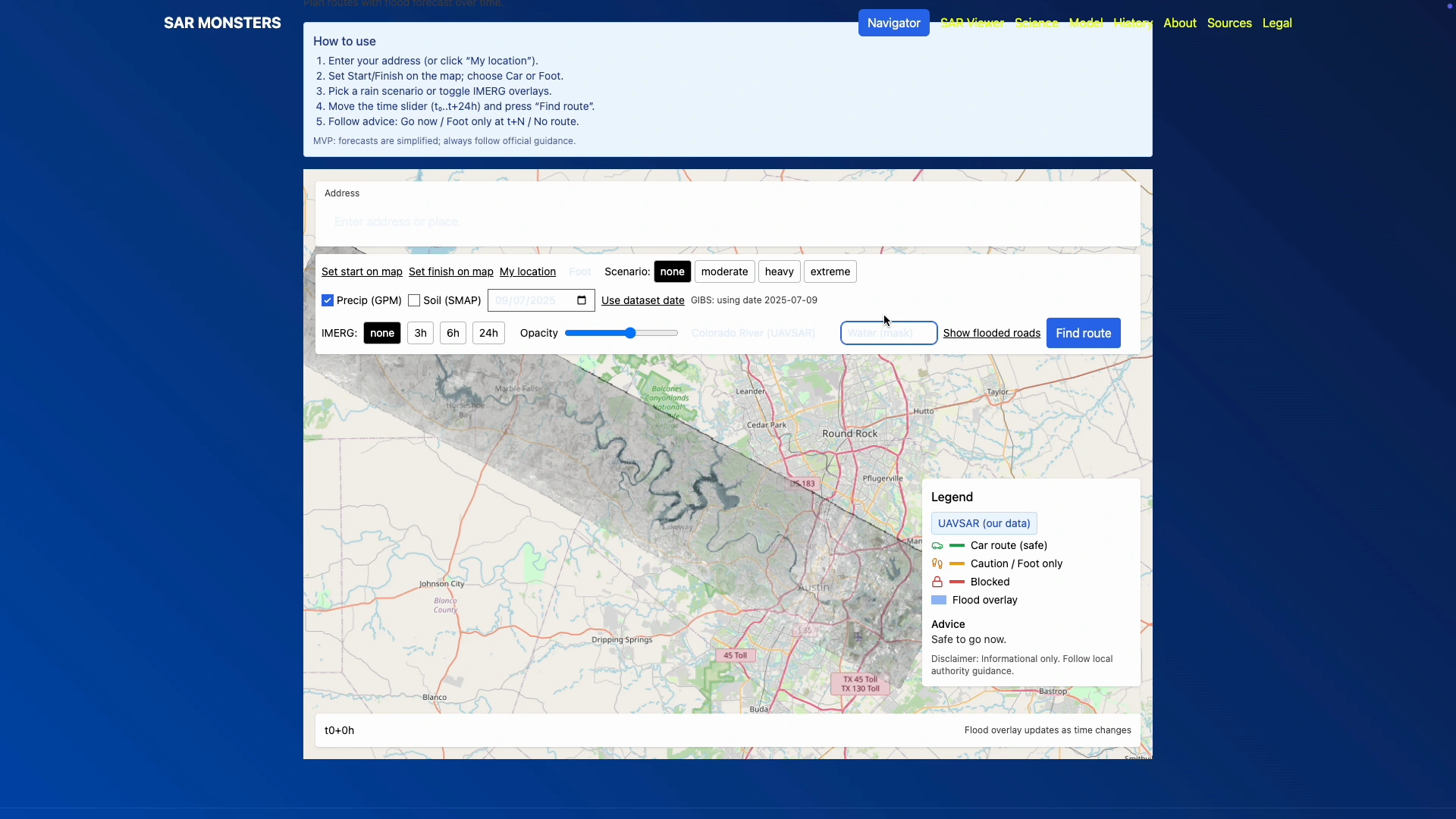
Flood Navigator — the later iteration with a timeline and precipitation controls.
0 likes · 3 views · Sep 27, 2026
Interactive radar imagery with 2D/3D maps, GeoTIFF overlays and layer controls, plus the later Flood Navigator prototype.
