Virtual World Exploration System Development
Jaime Ponce
Construkted Reality
Project Overview
Our vision is to give everyone the ability to explore and understand our physical world through a virtual representation.
Key Objectives
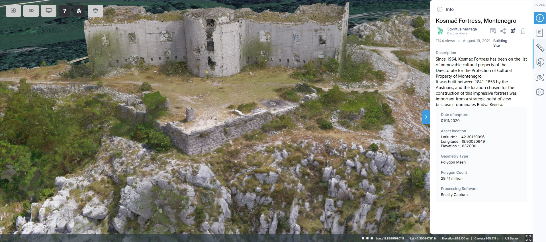
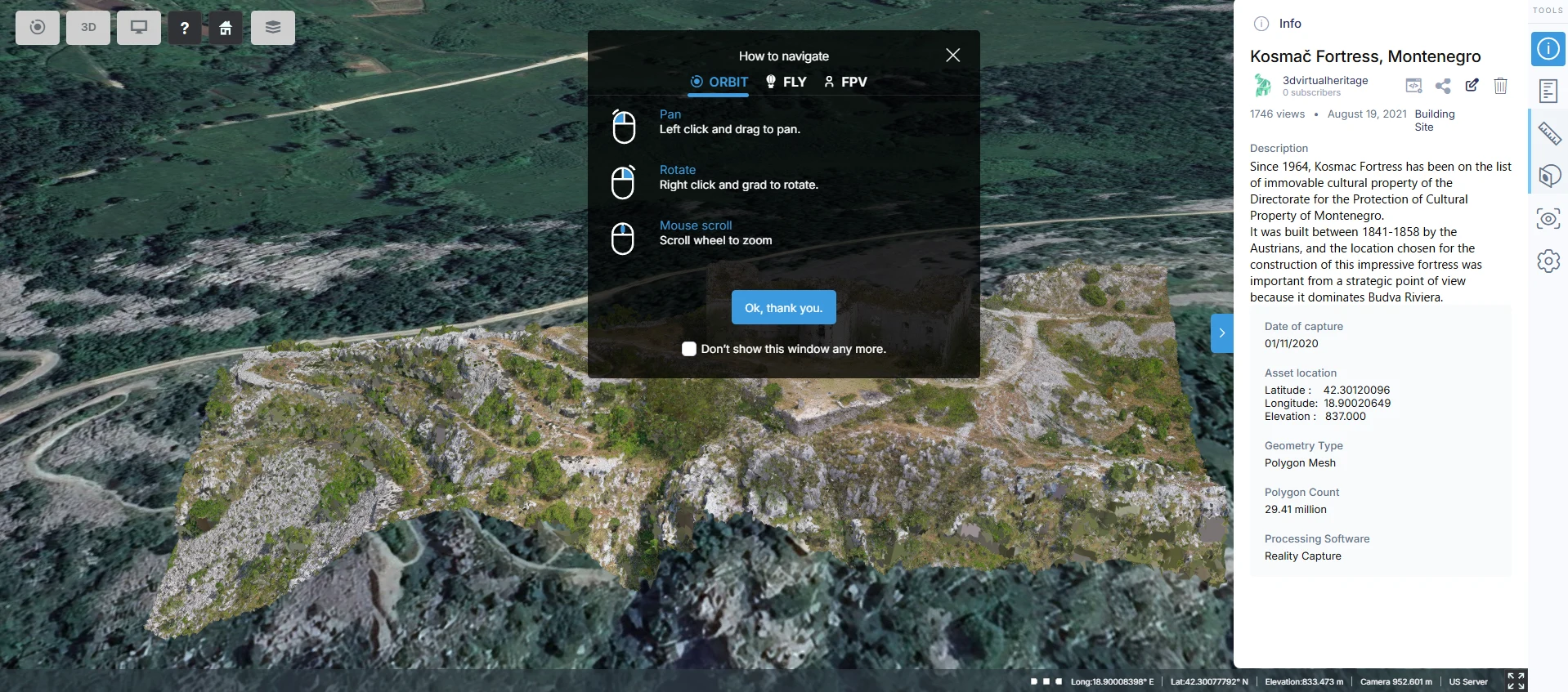
Interactive Virtual Exploration: Designed and developed a system that allows users to interactively explore the world through virtual representations, enhancing the user’s spatial understanding of real-world locations.
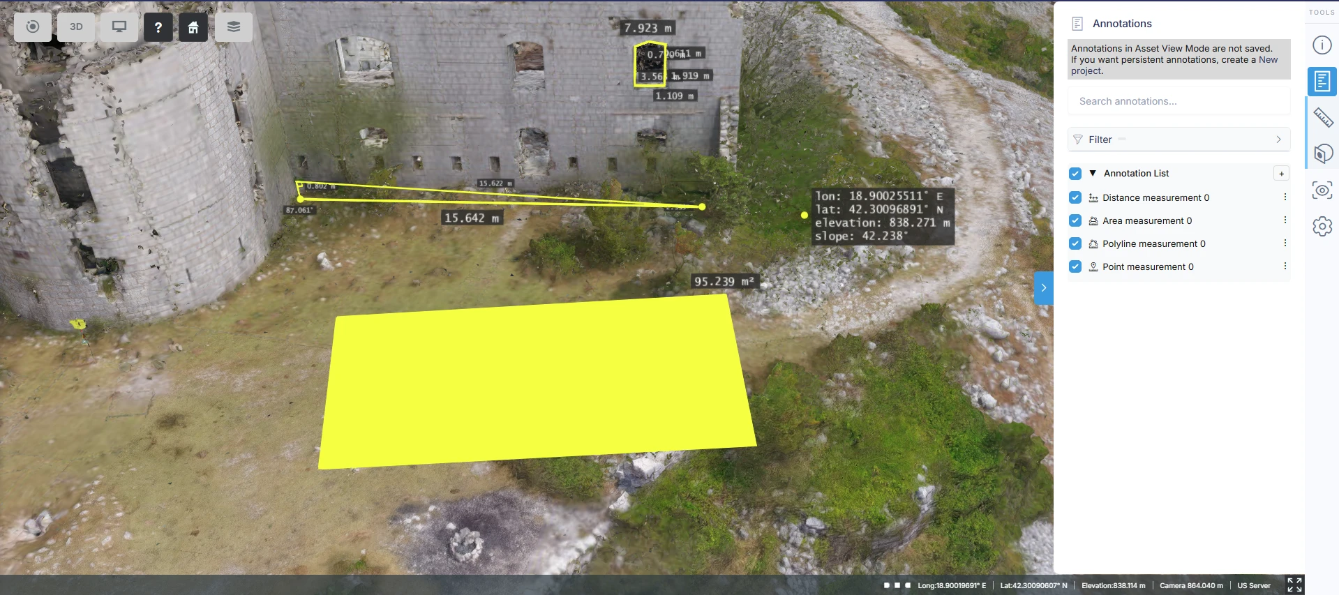
Geospatial Measurement: Integrated tools to measure key data points such as distance, location, and other environmental metrics within the virtual representation.
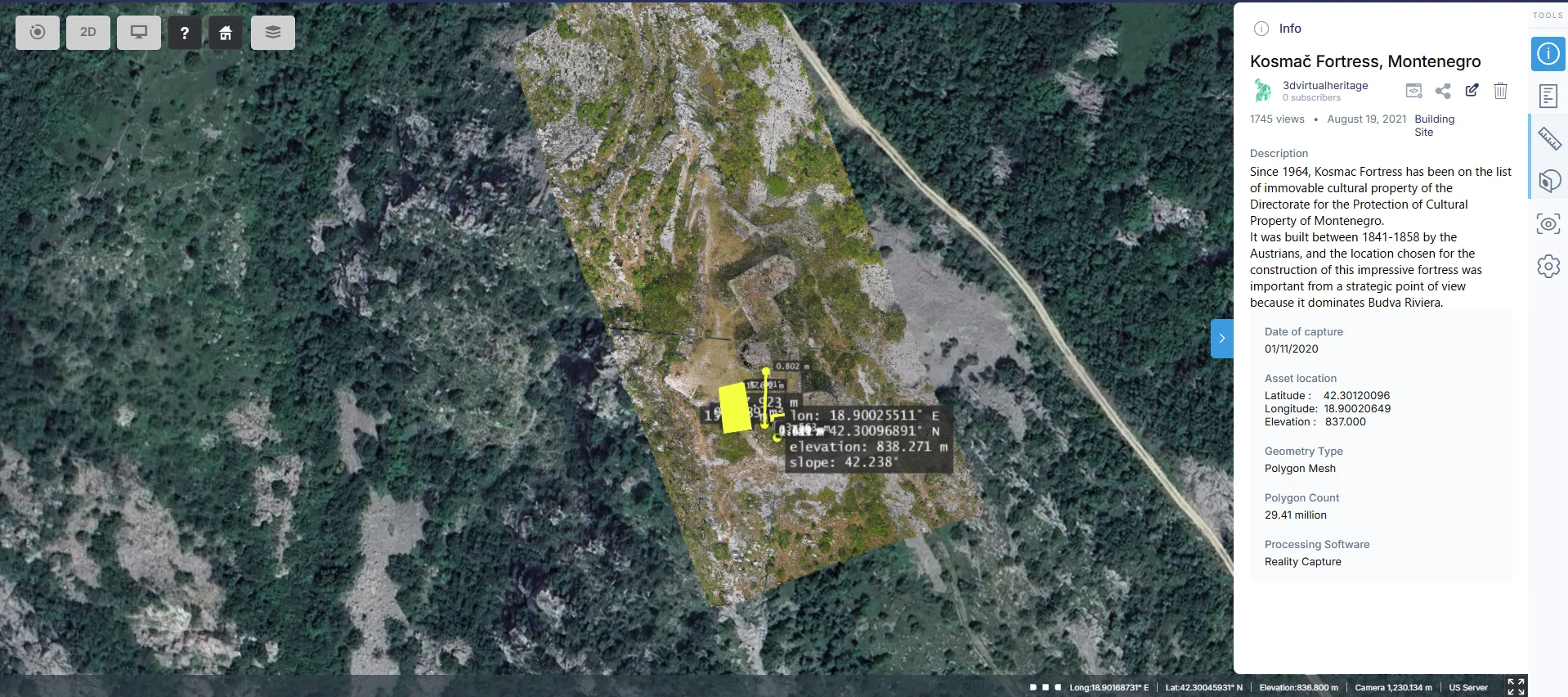
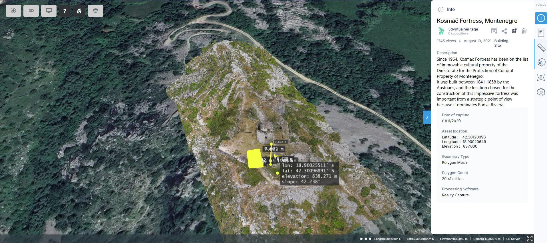
Dynamic Map Switching: Implemented the ability to seamlessly switch between 3D and 2D maps, providing versatile navigation and exploration experiences.
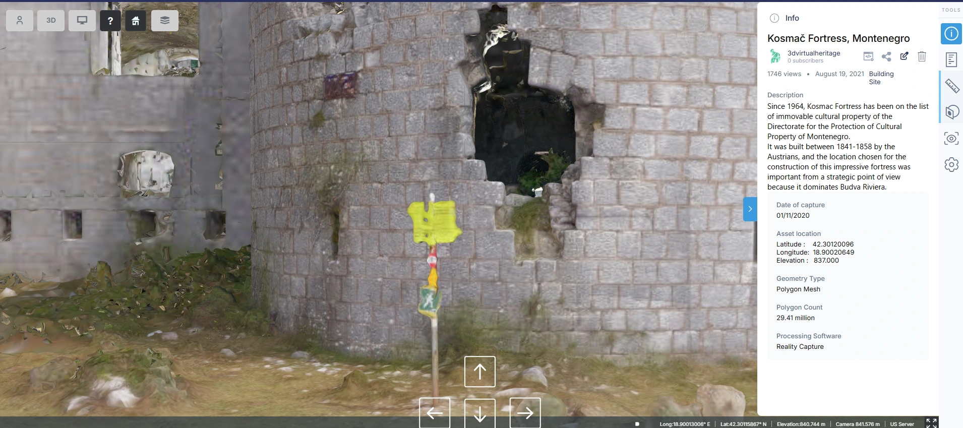
FPV Exploration: Enabled users to explore virtual environments through a First-Person View(FPV) system, offering a human-like perspective of the world
Multi-Camera System: Developed a flexible camera system with multiple perspectives to enhance virtual navigation and user immersion.
Technologies Used
Frontend
WordPress, CesiumJs, TypeScript, JavaScript
Backend (Data Processing & APIs)
WordPress, QGIS, TypeScript
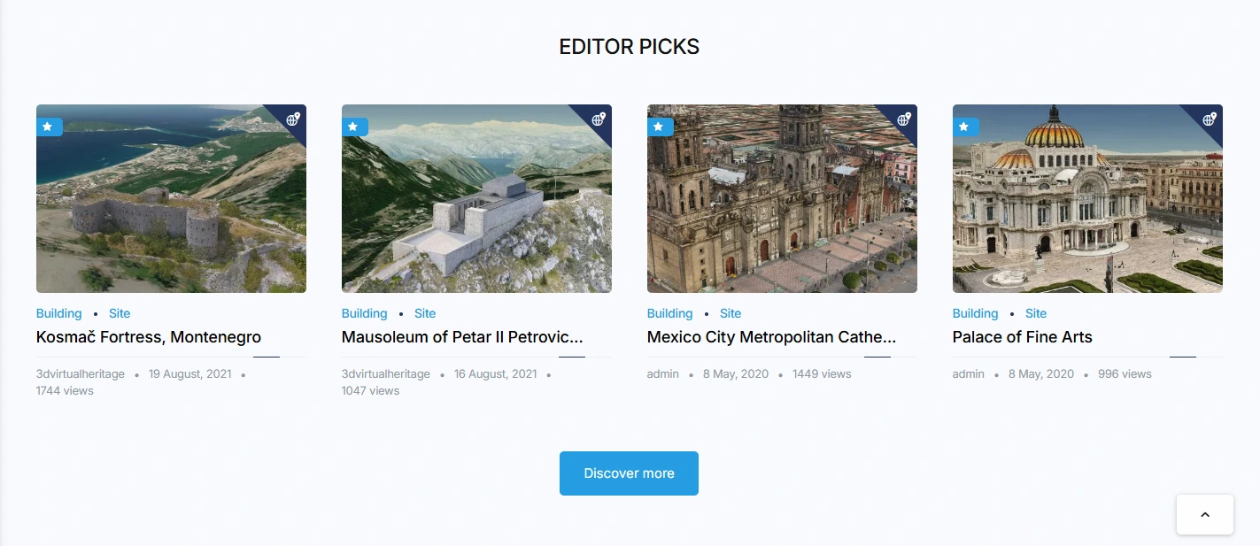
Core Features & Functionalities of Construkted Reality
3D Virtual World Exploration
Real-time rendering of the physical world in 3D for immersive virtual exploration.
Dynamic loading of landscapes, locations, and landmarks with realistic textures.
Interactive navigation through virtual environments, enabling a true-to-life experience.
Geospatial Measurement & Location Data
Tools for measuring distances, locations, and key geographical points within the virtual world.
Support for various types of data visualization, including topography, elevation, and spatial relationships.
Accurate geo-referencing with location-based services, integrating real-world coordinates.
3D & 2D Map Toggle
Seamless switching between 3D and 2D map views for versatile navigation.
Dynamic map updates with the option to zoom, pan, and rotate in 3D.
Optimized user experience for visualizing detailed and simplified geographical information.
FPV Camera System for Virtual Exploration
First-Person View (FPV) camera system allowing users to navigate the virtual world as if they were physically present.
Customizable camera positions and angles for varied user experiences.
Immersive exploration with interactive controls, simulating human-like movement and perspectives.
Like this project
Posted Mar 23, 2026
Built a geo-accurate 2D/3D map with FPV navigation using CesiumJS, JavaScript and WordPress, improving user engagement and real-time spatial exploration.
Likes
0
Views
2
Clients
Construkted Reality