Highway 395 Safety Investigation

Stefa Groves
The Problem
US Highway 395 runs 25 miles through Franklin County, Washington, connecting Connell to Pasco through flat, open desert. It's the only route for rural residents to reach the city. Between 2020 and 2025, at least 17 people died in fatal crashes on this stretch, accounting for a quarter of all county road deaths concentrated on one highway.
The pattern was consistent: at-grade intersections with yield or stop signs where drivers crossed or turned onto a divided highway with traffic moving at 60–75 mph. Reaction times were impossible. The deadliest intersections (Crestloch Road, Foster Wells Road, Vineyard Drive, near Myers Road) kept killing people, and the fixes weren't coming fast enough.
By late 2025, six people had died on this road that year alone, including a mother and her 17-year-old daughter, a 73-year-old woman, and a newly elected city councilman. These weren't statistics. They were people from the community I live in.
The official response from local law enforcement was to blame the drivers. The county sheriff posted publicly on Facebook attributing the crashes to citizens driving too fast. The community pushed back hard. Blaming the dead doesn't fix the infrastructure that killed them, and it doesn't explain why yield signs are the only thing standing between farm roads and a highway where traffic moves at freeway speeds.
What I Did
I spent one evening building a comprehensive, sourced investigation of the crisis. The goal was to make it impossible to ignore.
Data collection and verification:
Pulled fatal crash records from the Washington State Patrol Fatal Collision Database
Cross-referenced with WSDOT crash data portal (filtered by SR 395, Franklin County, fatal)
Verified individual incidents against local news coverage from Tri-City Herald, KEPR, NBC Right Now, and KXLY
Used AI to help organize and cross-reference source links so I could focus on analysis and writing
Referenced NHTSA economic impact data ($7–10 million per fatality in economic losses)
Reviewed WSDOT's own project pages acknowledging the dangerous intersections
Pattern analysis:
Mapped every fatal incident chronologically from 2019–2025
Identified the specific intersections responsible for the majority of deaths
Documented the acceleration: from an annual average of 21 serious injuries (2014–2019) to 36 per year (2020–2022), with fatalities climbing each year
Showed that Crestloch Road alone had 5 deaths in 5 years
Identified the root cause: yield signs on farm road crossings feeding into a highway where traffic moves at freeway speeds
The deliverable:
A detailed letter cataloging every fatal incident with names, ages, dates, circumstances, and source citations
Analysis of the ripple effects: survivor injuries, first responder trauma, economic costs, generational impact on families
Five specific engineering solutions (traffic signals, grade separation, upgraded ramps, road consolidation, speed enforcement)
All sources publicly accessible and linked
I sent it anonymously via encrypted email to 33 recipients: government officials, WSDOT, law enforcement, state legislators, local news outlets, and nonprofits.
What Happened
The timeline moved fast.
November 30 – December 1, 2025: Email distributed to 33 organizations and individuals.
~December 3, 2025: The county sheriff posted on Facebook blaming drivers for the crashes. Citizens responded by calling him out publicly. (The sheriff has since dropped out of his re-election race.)
December 11, 2025: A town hall was held in Pasco. A U.S. senator attended alongside other political officials, the sheriff's department, and community members. News coverage of the town hall echoed specific points from my letter, in some cases nearly word-for-word. A woman from my own town spoke at the meeting; I never sent her the email directly, which means it was forwarded and reached people beyond my original distribution list.
Early 2026: WSDOT installed a large warning sign at the beginning of the dangerous stretch: "PRIOR HIGH CRASH AREA / WATCH FOR CROSS TRAFFIC." A second sign was later installed in the opposite direction, funded by a nonprofit.
2026: The speed limit for the entire stretch was reduced from 70 mph to 65 mph.
2026: Washington's Legislature passed a bill specifically authorizing a crash-prevention zone on US 395 between mileposts 23 and 32, with an engineering investigation, possible further speed reductions, and increased enforcement. 37 days passed between the original email and a signed bill.
Ongoing: A survivor of one of the crashes has initiated litigation. The yield signs on farm road crossings, which I identified as the core design failure, have not yet been replaced, but the state has now legislated action on this corridor.
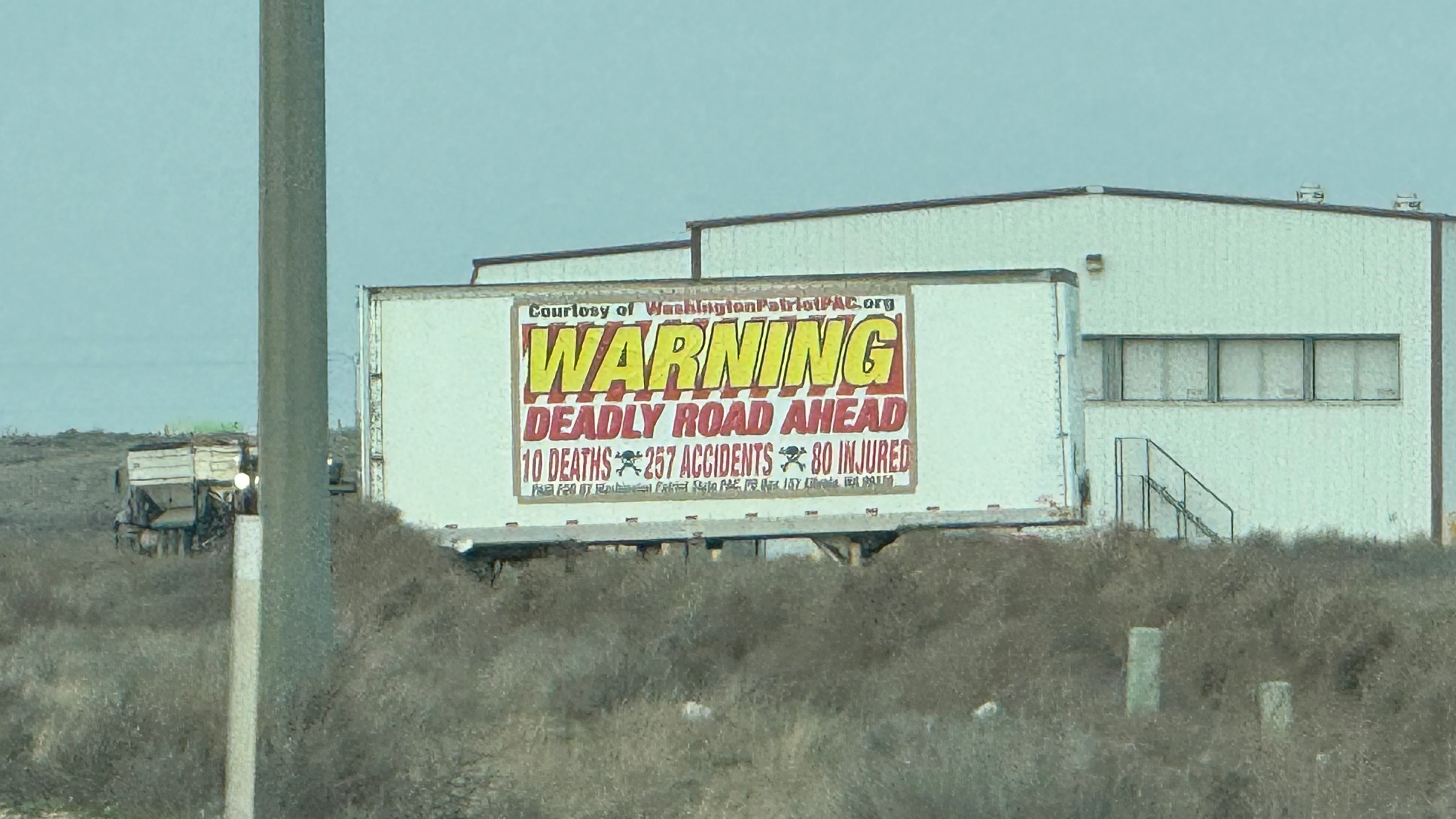
Highway 395 warning sign installed after the investigation
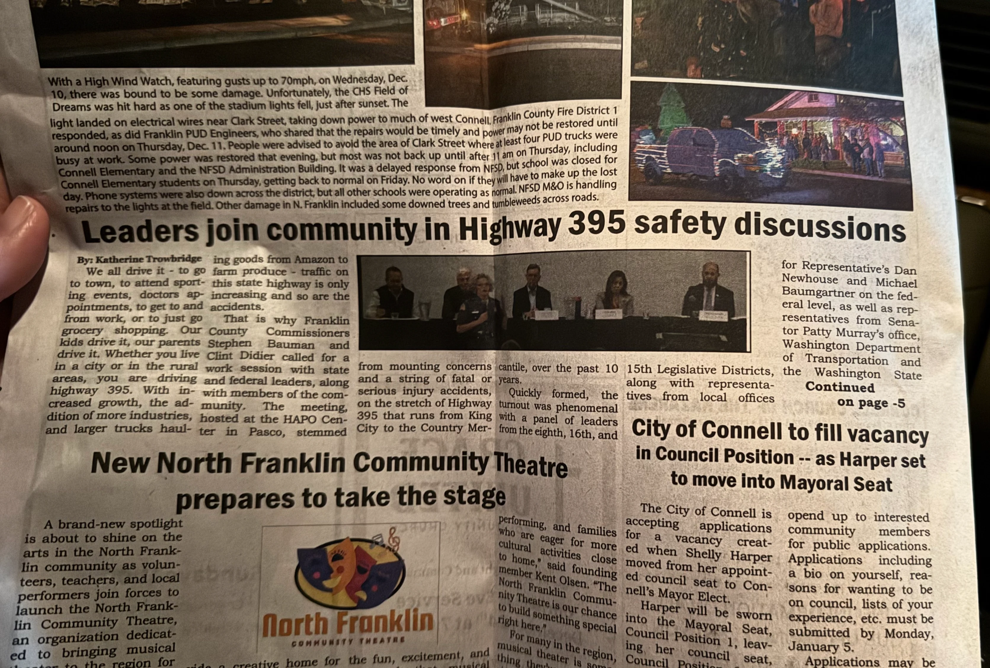
Tri-City Herald coverage of the Highway 395 safety crisis
The Method
This project used the same investigative research methodology I apply to all my work:
Public records analysis — crash databases, government data portals, state patrol records
Source verification — every claim backed by at least one publicly accessible source
Pattern recognition — connecting individual incidents into a systemic failure narrative
Strategic distribution — identifying the right 33 recipients across government, media, law enforcement, and nonprofits to maximize pressure
Anonymous operational security — dedicated encrypted email, no phone contact, no in-person meetings
Solution-oriented framing — not just documenting the problem but proposing specific, feasible engineering fixes with cost precedents
Why This Matters
Anyone can complain. The difference is showing up with the data, the pattern, the names, and the solutions. I didn't just say "this road is dangerous." I proved it was dangerous, showed exactly where and why, put human faces on the numbers, and told them what to build.
Within 11 days of sending one email to 33 people, a senator was in a room talking about it. Within 37 days, the state legislature passed a bill creating a crash-prevention zone on the corridor. Within months, signs went up and the speed limit dropped. The work isn't done (those yield signs are still there), but the conversation changed because someone sat down for one evening and did the research.
I'm still watching.
Like this project
Posted Jul 20, 2026
An anonymous, data-driven investigation into 17 fatal crashes on a rural Washington highway. Sent to 33 organizations. Within 11 days, a senator attended a town hall. Within 37 days, the state legislature passed a bill creating a crash-prevention zone on the corridor.