Geo Referencing

Prasad Pala
I did Georeferencing of any,
Old Maps
Aerial Photographs
Scanned Paper Maps and Images
Satellite Imagery
Historical Documents
Survey Plans
Utility Infrastructure Maps
Custom Drawings/Plans (including AutoCAD drawings)
GIS Data from Different Coordinate Systems
Non-Geospatial Data, etc.
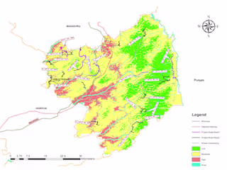
Like this project
Posted Aug 10, 2024
I did Georeferencing, Old Maps Aerial Photographs Scanned Paper Maps and Images Satellite Imagery Historical Documents Survey Plans etc..
Likes
0
Views
1
Tags


FLOOD SUSCEPTIBILITY MAPPING

GIS Expert