NDBI of Nairobi City, Kenya
FELIX OMOLO
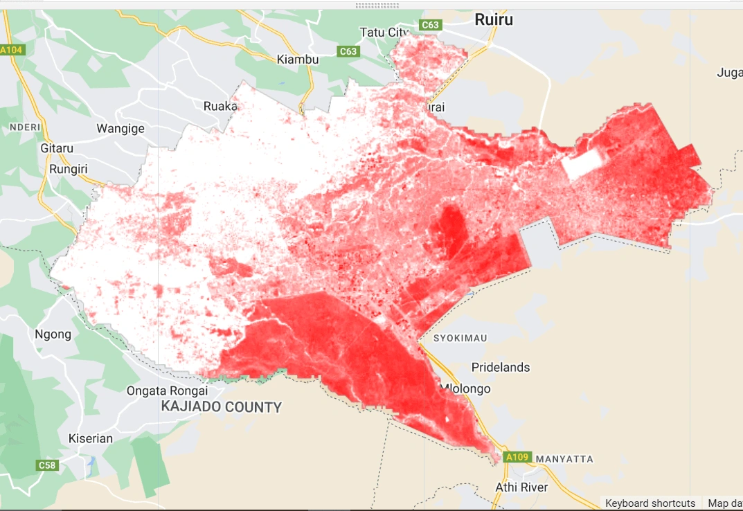
This project utilizes Google Earth Engine to map the Normalized Difference Built-up Index (NDBI) for the Nairobi region. The NDBI highlights built-up areas by distinguishing between urban and non-urban land cover. The red areas on the map indicate high NDBI values, representing regions of significant urban development and infrastructure. This visualization aids in analyzing urban expansion, planning, and management efforts, providing valuable insights into the region's growth patterns.
Like this project
Posted Aug 2, 2024
Using Google Earth Engine, I mapped the Normalized Difference Built-up Index (NDBI) for the Nairobi area, highlighting urban expansion and development.
Likes
0
Views
18