Built with Rive
Australia's Interactive Climate Map for Digital Lesson
Ayaka Fuji
🦘Australia's Climate Map for Digital Lesson
💪Role
Graphic Design
Rive Animation
🔧Tools
Figma (Graphic Design)
Rive (Animation & Interactive Design)
📝Project Information
Inquisitive is an Australia-based EdTech company that provides rich, deep, and adaptable teaching programs for Preschool and Primary School students across Australia and the United States.
For this project, I created an interactive digital map of Australia using Rive for a geography lesson.
All graphics were designed in vector format for scalability and clarity. The map includes toggle features that allow users to show or hide state names and borders.
Combined with a kid- and teacher-friendly UI, this digital lesson enables students to explore Australia’s rainfall patterns and climate classifications interactively — all in a single, engaging visual learning experience.
⚙️Process
1. Graphic Design Preparation
Since the content is designed for children, special attention was given to color selection. I carefully adjusted color tones to ensure clear visibility and distinct separation between each classification.
To make the assets reusable across other lessons, all elements — including the base map, state lines, and the four categories (Climate Zone, Temperature, Humidity, and Vegetation) — were created as separate layers in Figma.
This structure allowed for a smooth integration into Rive during the animation phase.
In Rive, each classification was set up as a separate component, making it easy to edit or adjust each map individually if any changes are needed later.
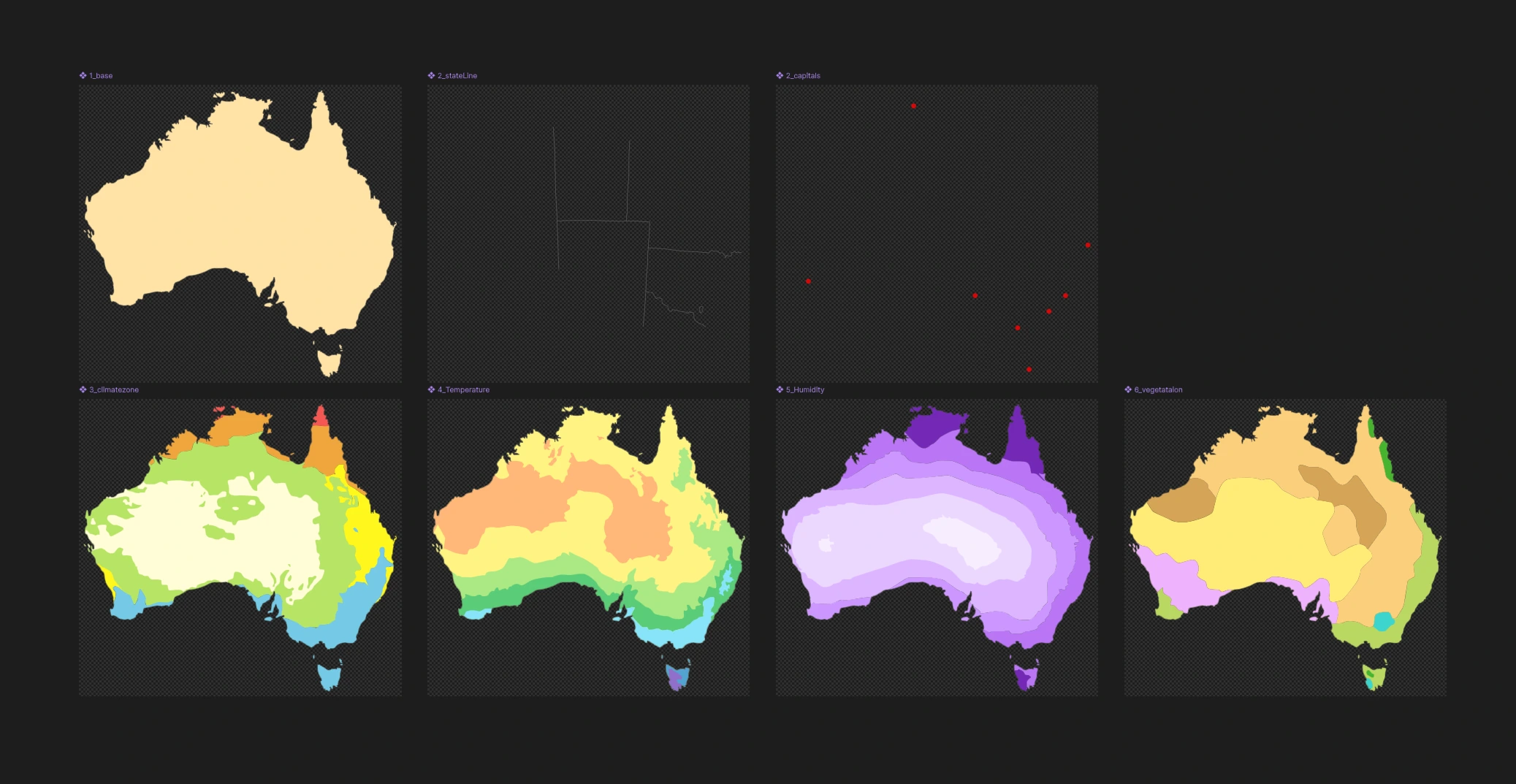
Components in Rive file
2. Rive Animation & State Machine Setup
After importing the graphic assets into Rive, I created individual states using the Solo layers feature. All text information was configured as text runs, allowing for centralized and manageable updates in the background.
A subtle looping wave animation was added to the background, making the digital lesson more engaging and enjoyable for children while maintaining an interactive learning experience.
Like this project
Posted Oct 13, 2025
Designed an interactive digital map of Australia for a geography lesson using Rive and Figma.
Likes
4
Views
84