SOARNET, Deep Learning Thermal Detection for Free Flight
Like this project
Posted Dec 6, 2023
Thermals are regions of rising hot air formed on the ground through the warming of the surface by the sun. Thermals are commonly used by birds and glider pilot…
Likes
0
Views
10
Clients

California Polytechnic State University
Date of Award
6-2021
Department/Program
Computer Science
Abstract
Thermals are regions of rising hot air formed on the ground through the warming of the surface by the sun. Thermals are commonly used by birds and glider pilots to extend flight duration, increase cross-country distance, and conserve energy. This kind of powerless flight using natural sources of lift is called soaring. Once a thermal is encountered, the pilot flies in circles to keep within the thermal, so gaining altitude before flying off to the next thermal and towards the destination. A single thermal can net a pilot thousands of feet of elevation gain, however estimating thermal locations is not an easy task. Pilots look for different indicators: color variation on the ground because the difference in the amount of heat absorbed by the ground varies based on the color/composition, birds circling in an area gaining lift, and certain types of cloud formations (cumulus clouds).
The above methods are not always reliable enough and pilots study the weather for thermals by estimating solar heating of the ground using cloud cover and time of year and the lapse rate and dew point of the troposphere. In this paper, we present a Machine Learning based solution for assisting in forecasting thermals. We created a custom dataset using flight data recorded and uploaded to public databases by soaring pilots. We determine where and when the pilot encountered thermals to pull weather and satellite images corresponding to the location and time of the flight. Using this dataset we train an algorithm to automatically predict the location of thermals given as input the current weather conditions and terrain information obtained from Google Earth Engine and thermal regions encountered as truth labels.

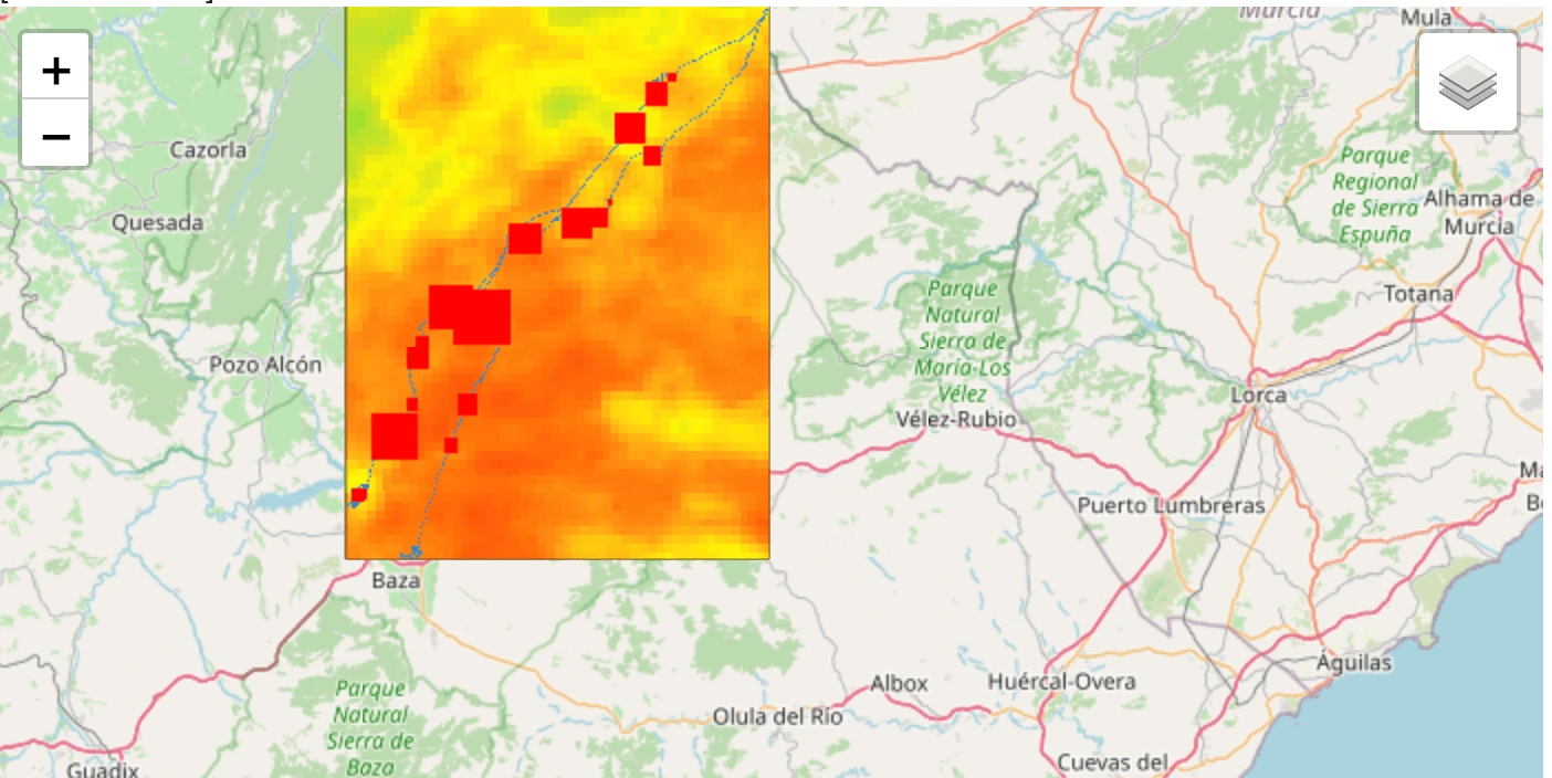
Data Transformation and Visualization
Data used was satellite imagery and segmentations were created from thousands of recorded paraglider flights.

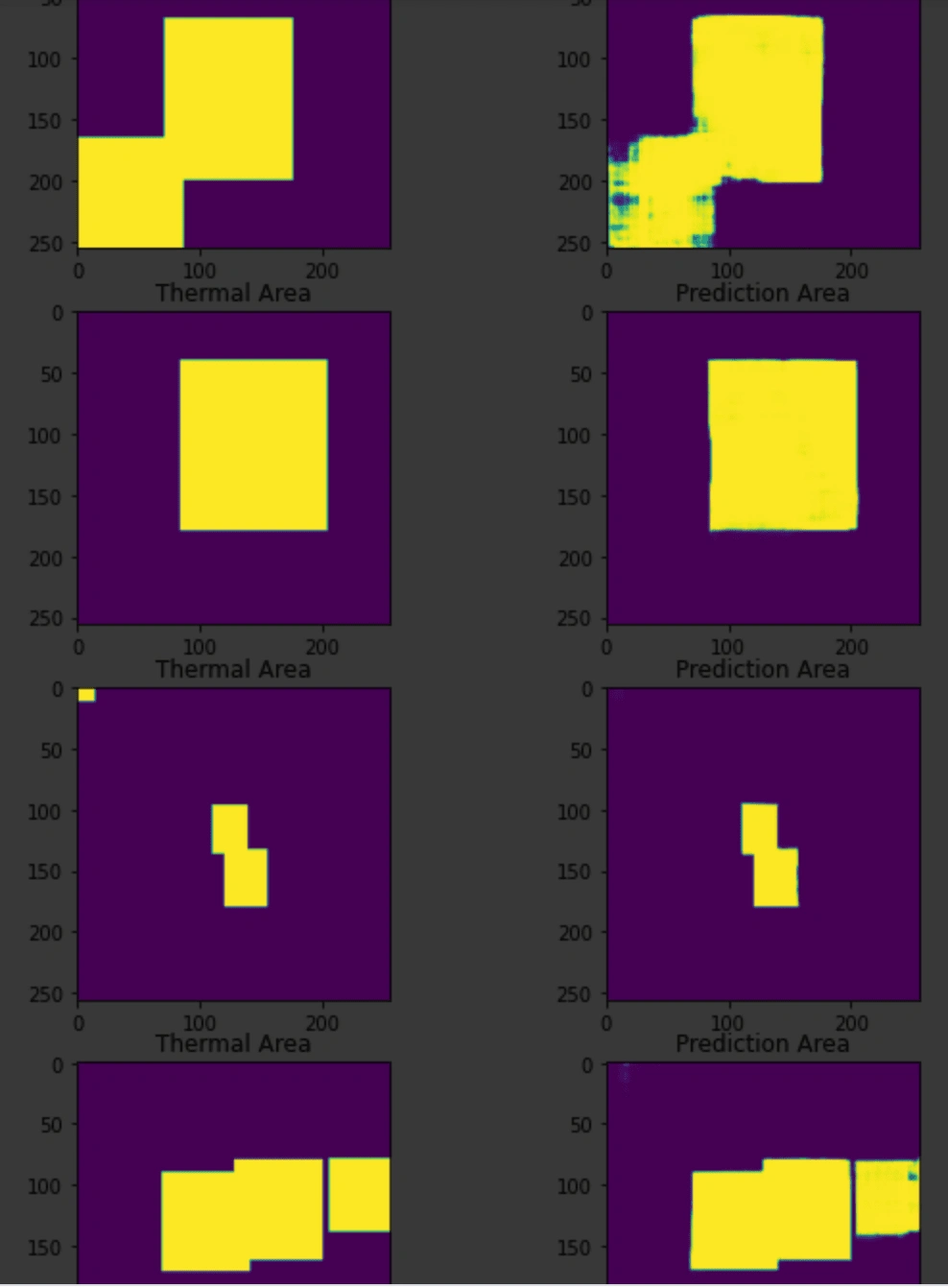
Segmentation Results vs Truth Data
Training Segmentation of the model was very accurate as shown above.

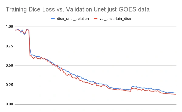
Validation Accuracy
Validation vs Training showing an absence of overfitting.
Awards received:
Publications: Journal of Physics: Conference Series (Volume 1828, 2021). Presented at: Proceedings in the 2020 International Symposium on Automation, Information, and Computing (ISAIC 2020) December 2-4, 2020 Beijing China. NVIDIA GTC 2021 March, San Jose, California


