3D Elevation Mapping from Satellite Imagery Using DNNs
Jake Tallman
The task of this project was to create a neural network that could take satellite imagery and create a 3D mapping of the landscape. Mapping 3D elevation using LIDAR or other sensors to a high accuracy is extremely expensive. A model that could do so using satellite imagery would be incredibly useful for cutting costs.
Data
Copernicus Satellite Images (RGB) mapped over a desired region.
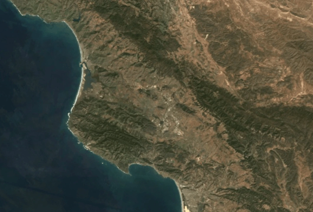
Copernicus over the California Central Coast
Copernicus LIDAR imagery mapped over the desired region. This was used for segmentation. Expensive to gather.
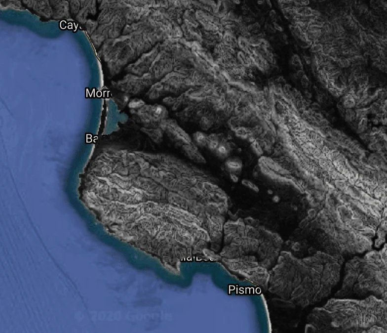
LIDAR over the Central Coast
Model
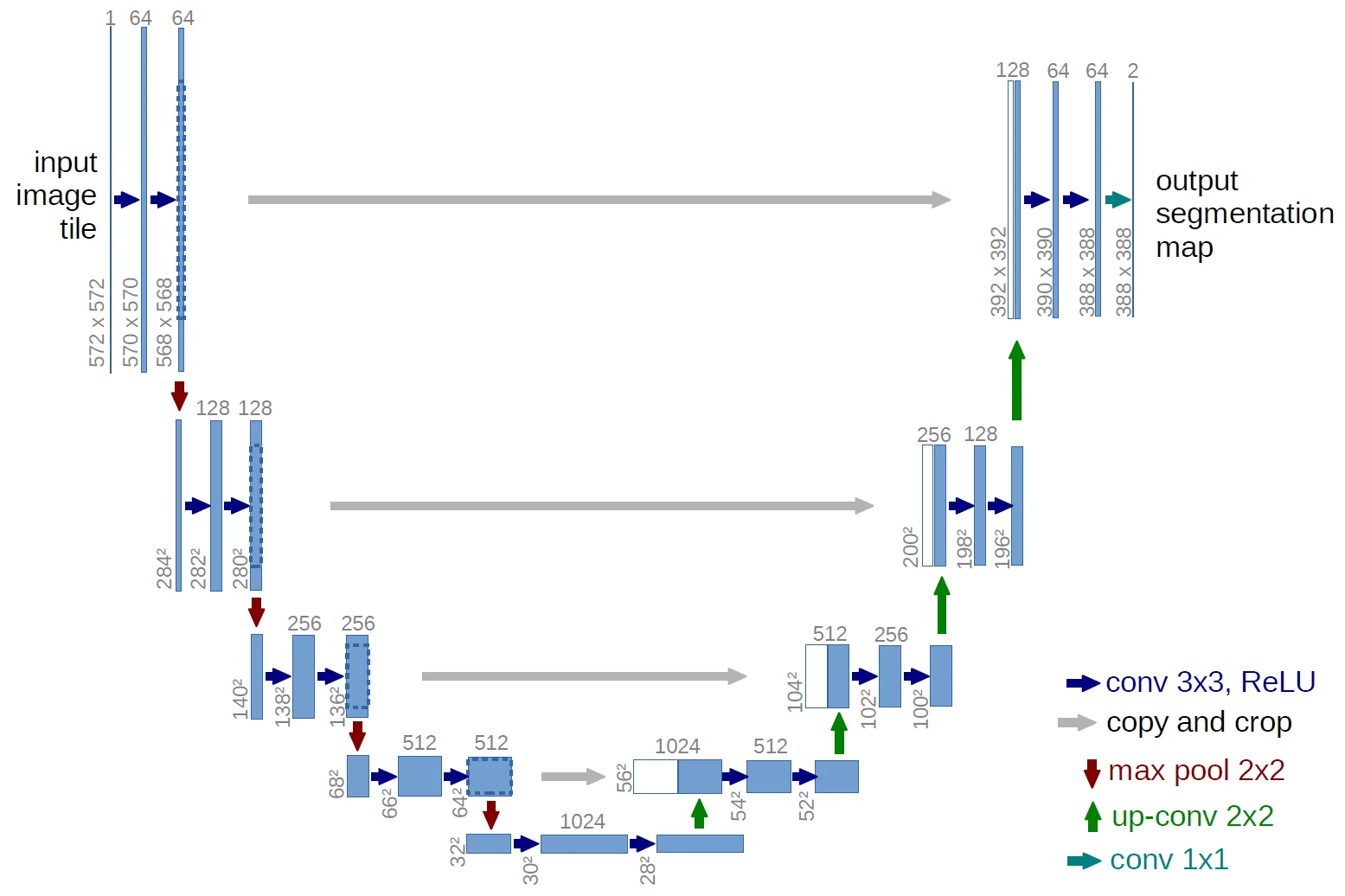
The model structure we determined would work the best was the UNET. The UNET was asked to predict on the directional slope angle of elevation as a segmentation task broken into 10 classes consisting of a range of slopes.
The Unet Model structure
Data Transformation
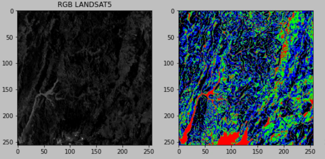
The truth data was determined using the LIDAR dataset. This data was mapped into the 10 segmentation classes.
Satellite input vs Truth data to be used for training the UNET
Training
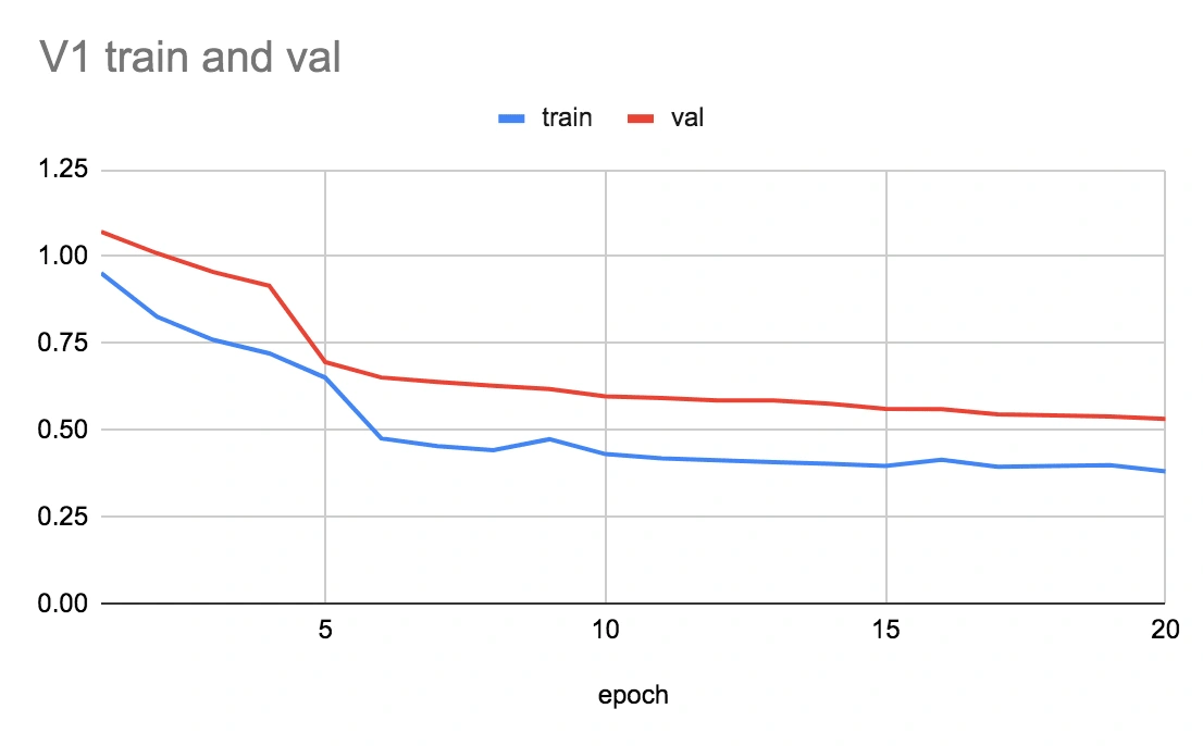
Initial training vs validation set. This shows overfitting to training data.
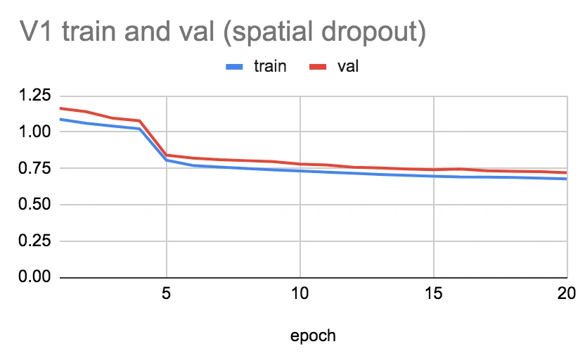
Spatial dropout was applied to mitigate overfitting. Validation improved.
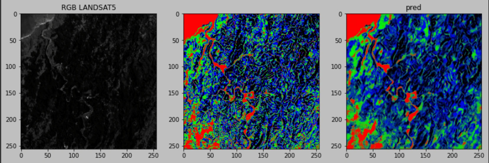
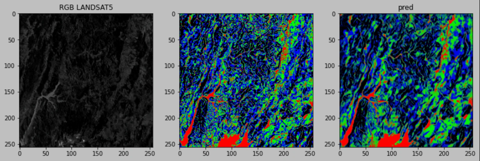
Results
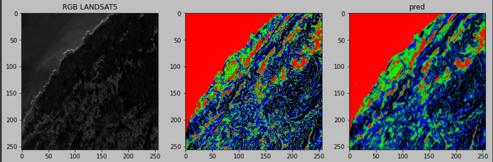
Input, Truth, Prediction
Post Processing
Slope data was used to construct a 3D image of the terrain.

Like this project
Posted Dec 6, 2023
Designed and trained a custom Deep Neural Network for creating 3D maps of satellite imagery.
Likes
1
Views
17