
Jenish Jana
Senior GIS Specialist | ArcGIS & QGIS Expert
New to Contra
Jenish is ready for their next project!

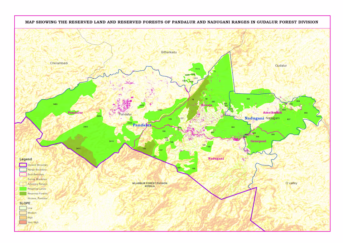
Reserved Land & Reserved Forest Map – Pandalur & Nadugani Ranges
This project focuses on mapping reserved lands and reserved forests in the Pandalur and Nadugani ranges under the Gudalur Forest Division.
Using QGIS, I created a detailed administrative map including division, range, beat, and survey boundaries. I integrated forest classification data with terrain (slope) analysis to provide a clear understanding of land distribution and landscape characteristics.
The map also highlights human settlements within and around forest areas, helping in planning, management, and decision-making.
This project demonstrates my expertise in administrative mapping, boundary digitization, and geospatial data visualization for government and environmental applications.
👉 Available for administrative mapping and GIS projects. Feel free to message me.
0
48
Administrative Boundary Mapping & GIS Solutions
I provide accurate and professional administrative boundary mapping services using ArcGIS and QGIS. With 12+ years of GIS experience, I create clear and reliable maps for districts, taluks, villages, and other administrative units.
I can digitize boundaries from maps, georeference data, and prepare clean GIS layers (Shapefile, GeoJSON, KML). These maps are useful for planning, governance, reporting, and decision-making.
Whether you need boundary correction, map visualization, or data preparation, I ensure high accuracy, proper alignment, and professional output.
👉 Message me to discuss your mapping requirements.
0
50
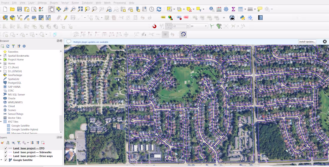
Utility Mapping & Asset Digitization using GIS
Description
Accurate utility mapping is essential for infrastructure planning and asset management. In this project, I developed a comprehensive GIS-based utility map by integrating field-collected GPS data with spatial datasets.
I digitized utility assets such as pipelines, electrical lines, and infrastructure features, ensuring proper alignment and georeferencing. Using ArcGIS and QGIS, I organized the data into structured layers, making it easy to analyze, update, and use for decision-making.
The final output included clean, high-precision maps and GIS datasets (Shapefile/GeoJSON) that can be used for planning, maintenance, and future expansion of utility networks.
This project highlights my ability to handle large datasets, ensure spatial accuracy, and deliver professional GIS solutions for real-world applications.
👉 Available for utility mapping, asset digitization, and GIS data management projects. Feel free to message me.
0
72
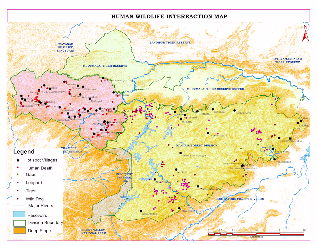
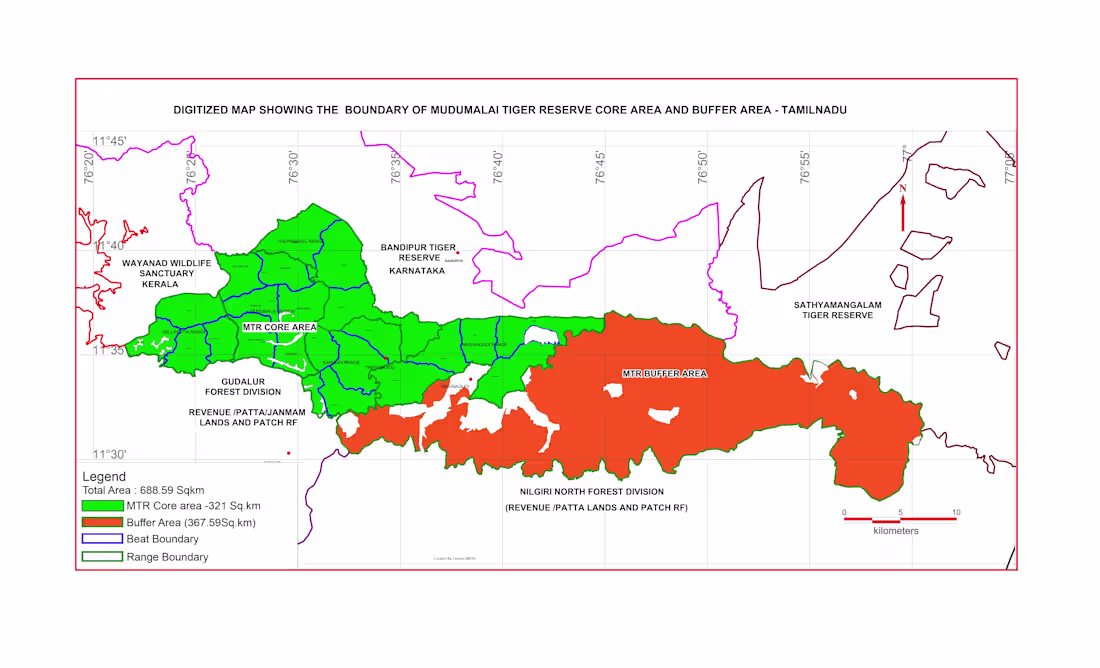
Human–Wildlife Conflict Map
Human–wildlife conflict is a major challenge in forest fringe areas. In this project, I analyzed conflict incidents across the Nilgiris landscape to identify high-risk zones and support better decision-making.
Using ArcGIS and QGIS, I mapped human death incidents, wildlife presence (leopard, tiger, gaur, wild dog), and hotspot villages. I integrated terrain (slope), forest boundaries, rivers, and reservoirs to understand patterns of wildlife movement and interaction with human settlements.
The analysis revealed that most conflict incidents occur near forest edges and buffer zones, especially in villages close to protected areas. Leopard activity was widely distributed, indicating higher interaction risk with human populations.This project demonstrates my ability to transform complex geospatial data into clear, actionable insights for forest management and conservation planning.
👉 Available for similar GIS mapping and spatial analysis projects. Feel free to message me.
0
66