Simonas Valatka - Data Visualizer | Contra
Work by Simonas Valatka
Sign Up
Post a job
Sign Up
Log In
Simonas Valatka
Interactive Maps & Intelligent Data Solutions
Message
Follow
Ready for work
Simonas Valatka is ready for their next project!
Vilnius, Lithuania
Work
Services
About
Vilnius, Lithuania
0
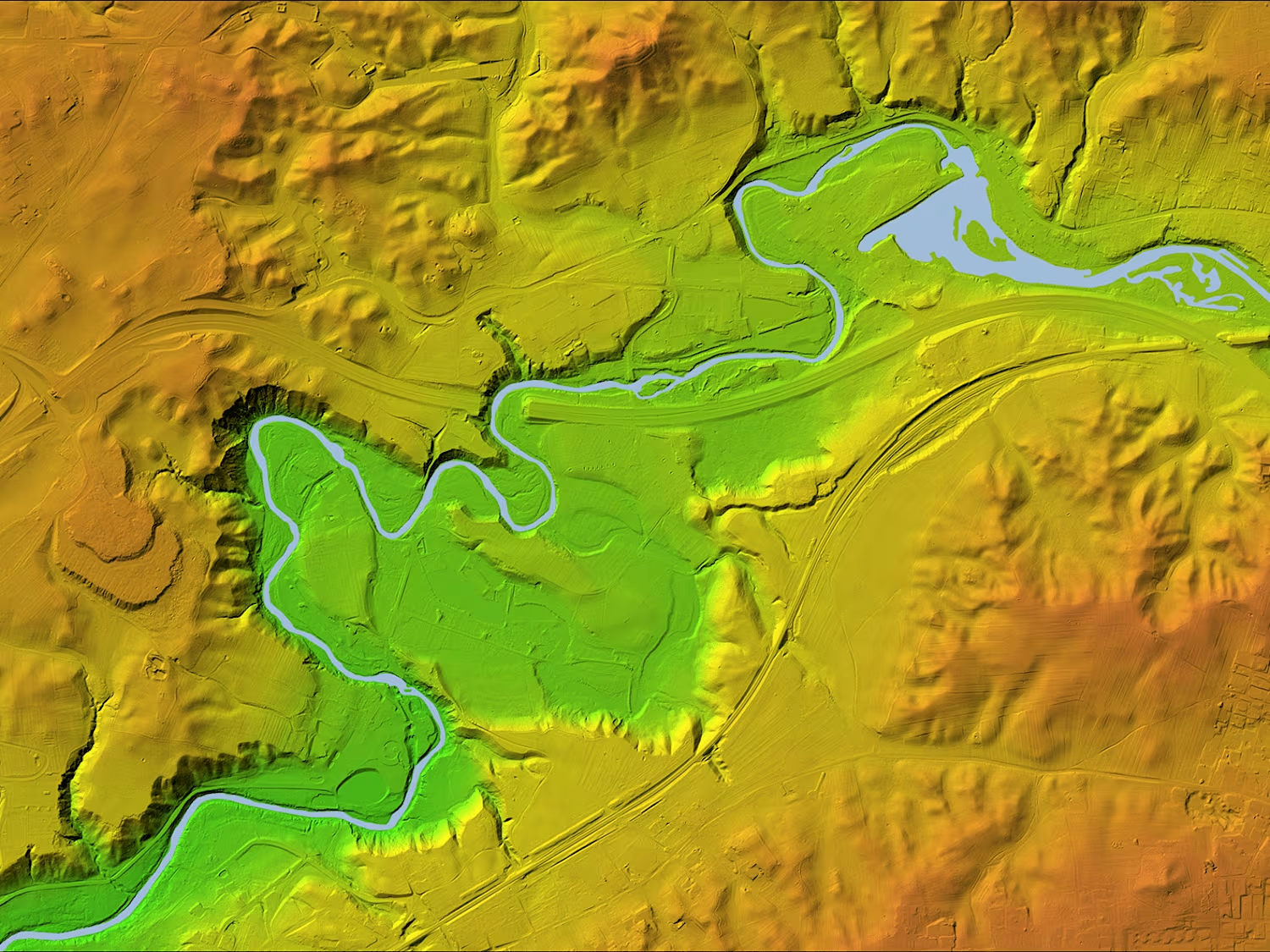
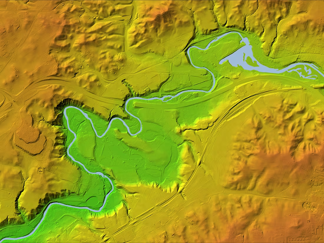
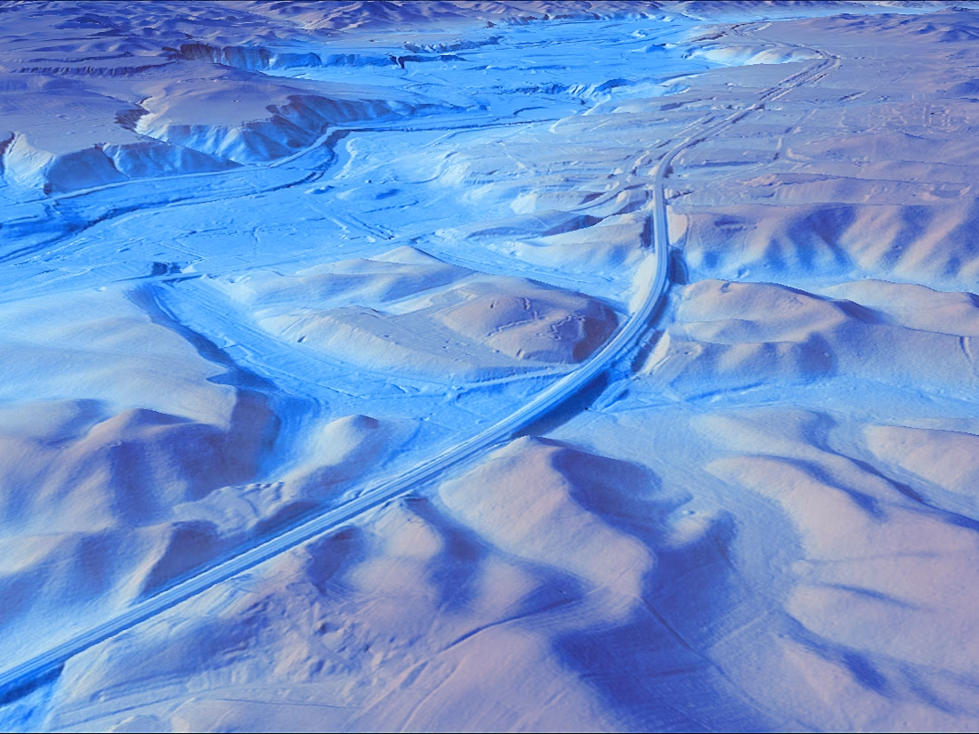
Digital Elevation Models
0
3
0
3D mapping
0
1
0
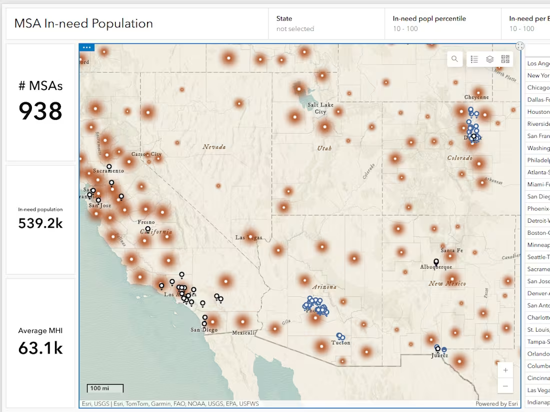
ArcGIS dashboard
0
1
0
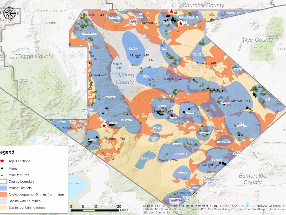
GIS for mining industry
0
0
0
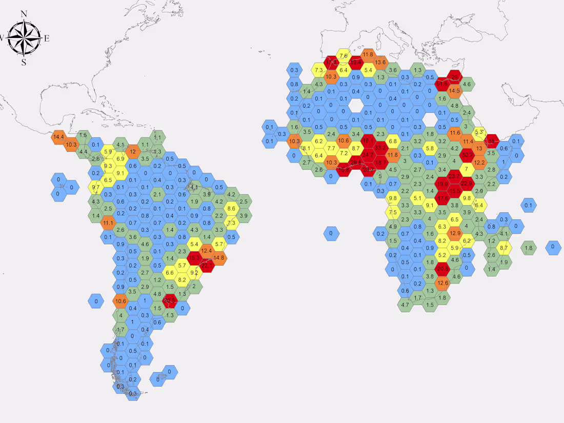
Population density mapping
0
1
0
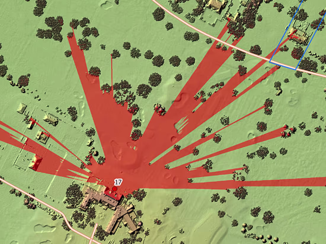
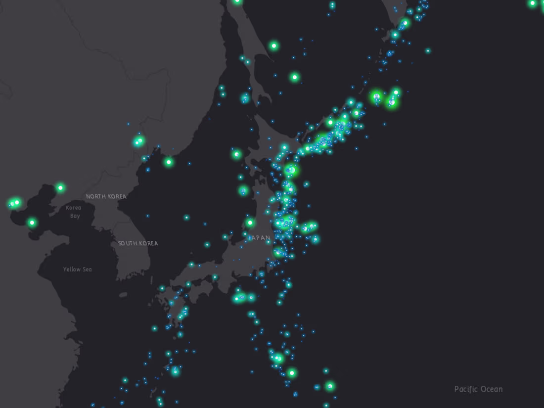
Visibility analysis
0
0
0
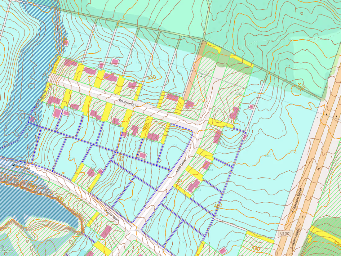
GIS analysis for real estate
0
1
0
Data visualization
0
1
0
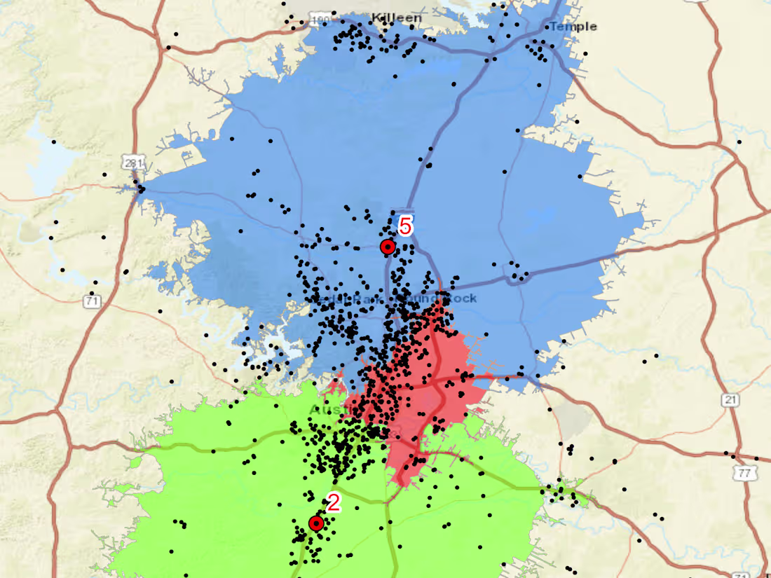
Drive time polygons
0
1
0
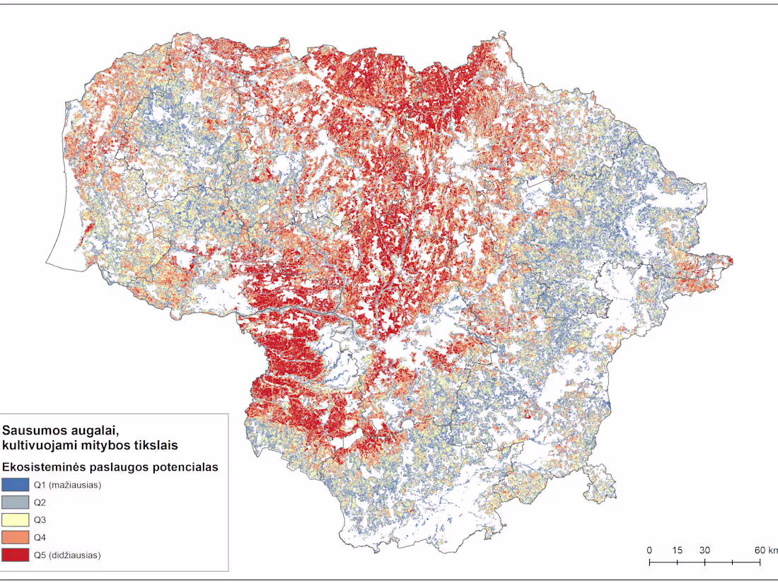
Ecosystem services mapping
0
2