
Donald Walker
Real Estate Data Engineer | Property Intelligence
- 1
- Followers


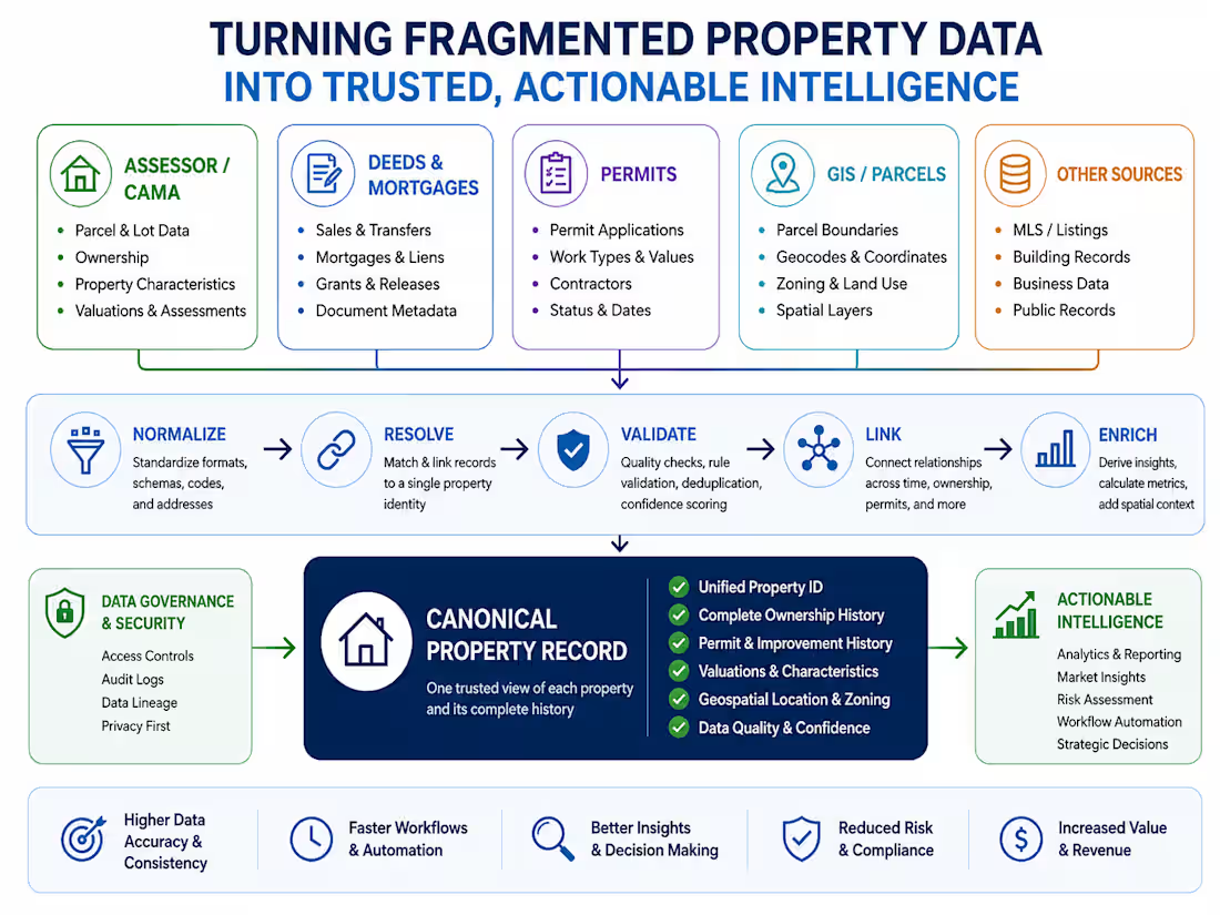
GIS, Parcel & Zoning Data Integration
Developed a property-level geospatial data workflow integrating parcel geometry, assessor records, zoning information, coordinates, land-use attributes and other spatial layers. The work focuses on resolving disparate geographic records to canonical properties, validating spatial relationships, standardizing zoning and dimensional information, and creating analysis-ready datasets for property, land-use and development research.
0
37
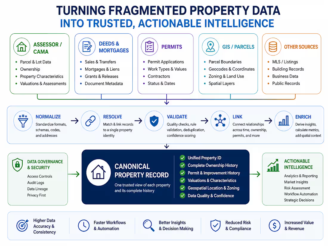
Engineered a multi-jurisdiction permit data workflow that standardizes inconsistent municipal records into a validated canonical structure. The project included source ingestion, schema normalization, address and property resolution, permit classification, applicant and contractor data handling, related-permit grouping, project histories, temporal sequencing, exception handling, and quality validation for property-level analysis.
0
30
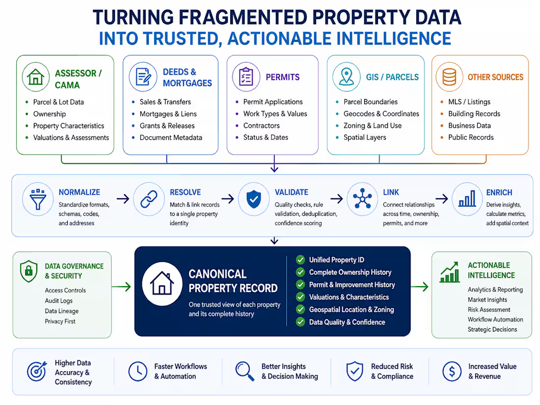
Designed a real estate data engineering workflow for transforming fragmented registry records into structured property transaction and ownership histories. The work included normalization of deeds, mortgages, assignments, discharges, releases, liens, foreclosure-related instruments and related records; party and property resolution; document relationship reconstruction; temporal sequencing; and validation of transaction histories for downstream property and market analysis.
0
32
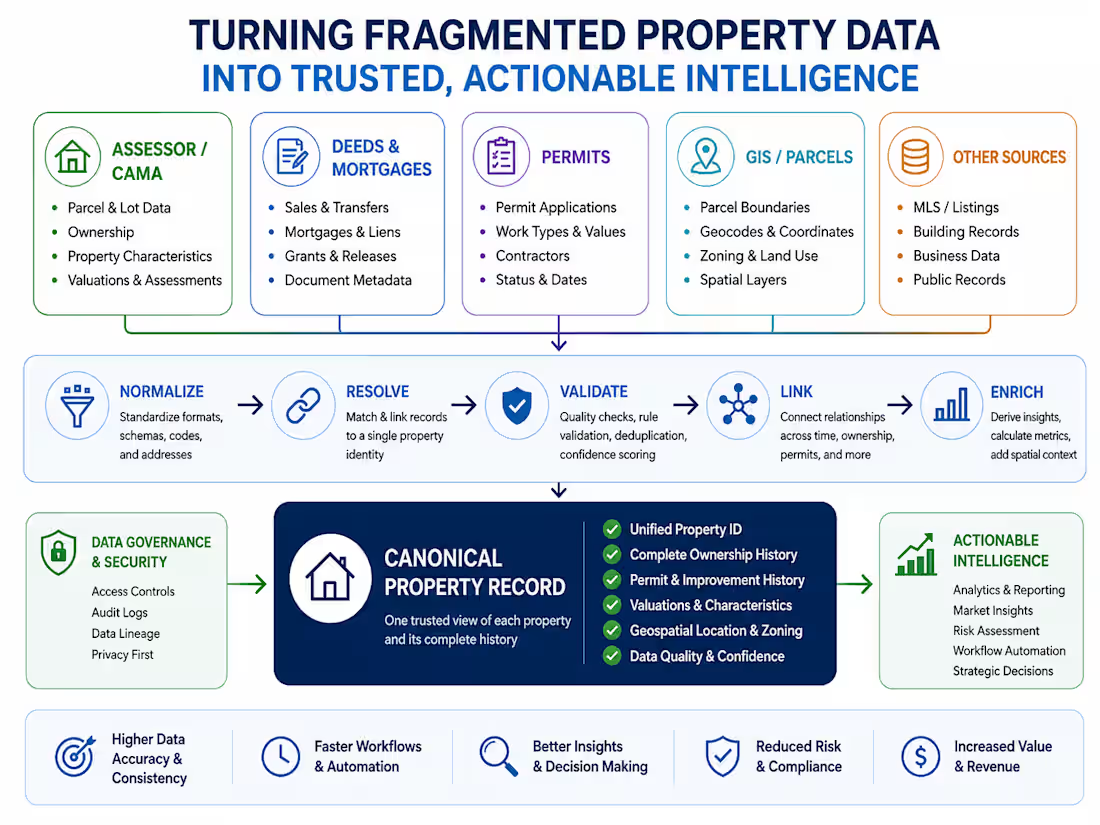
Built a multi-source real estate data engineering system that transforms fragmented property records into clean, validated, property-level datasets. The work included ETL, schema normalization, address and property resolution, record linkage, historical event reconstruction, data-quality validation, and integration across assessor, transaction, permit, GIS, and other property data sources.
0
98