The network for creativity
Join 1.25M professional creatives like you
Connect with clients, get discovered, and run your business 100% commission-free
Creatives on Contra have earned over $150M and we are just getting started
Back to feedPost

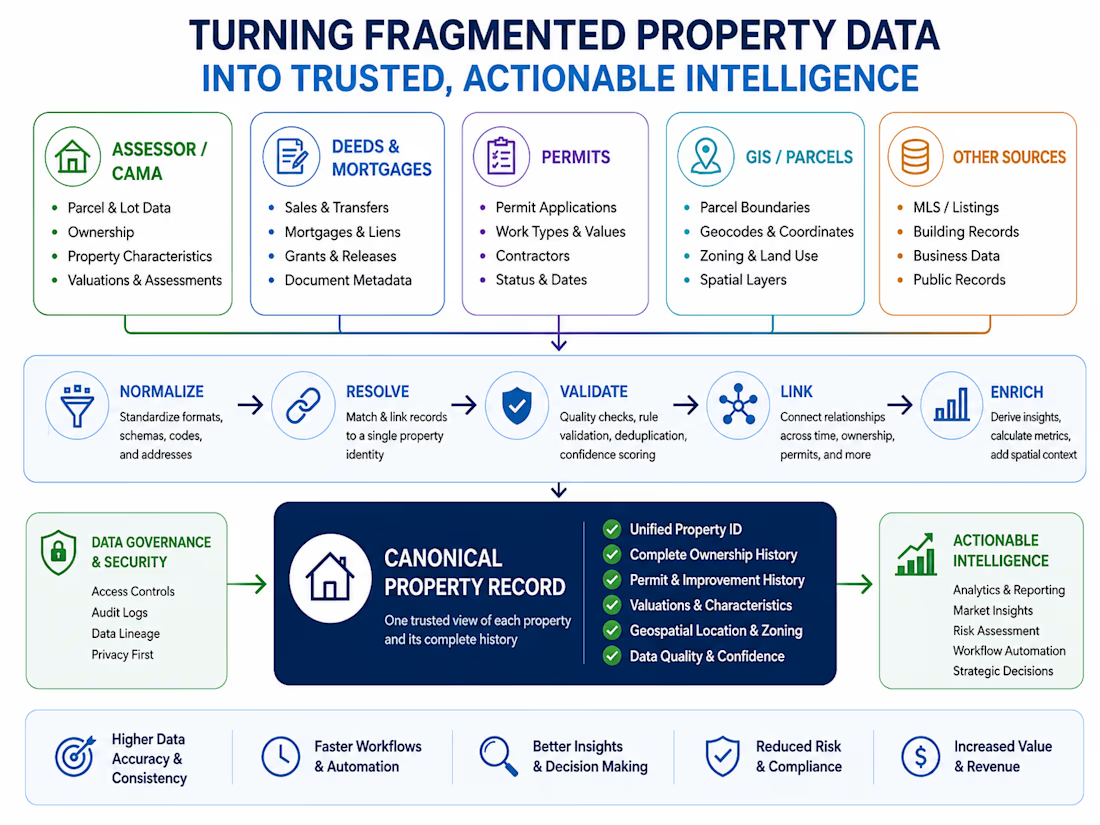
GIS, Parcel & Zoning Data Integration
Developed a property-level geospatial data workflow integrating parcel geometry, assessor records, zoning information, coordinates, land-use attributes and other spatial layers. The work focuses on resolving disparate geographic records to canonical properties, validating spatial relationships, standardizing zoning and dimensional information, and creating analysis-ready datasets for property, land-use and development research.


The network for creativity
Join 1.25M professional creatives like you
Connect with clients, get discovered, and run your business 100% commission-free
Creatives on Contra have earned over $150M and we are just getting started











Related posts

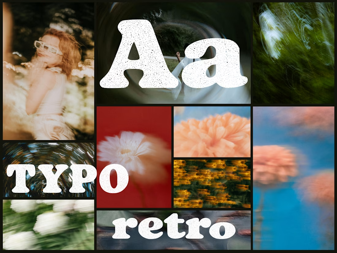
Anima is a self-initiated type design project inspired by vintage print, worn ink and analog photography.
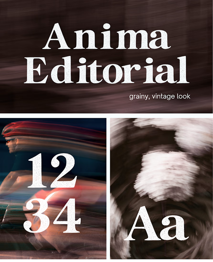
The collection includes two experimental serif typefaces: Anima Editorial, with elegant proportions and contrasting strokes, and Anima Retro, with softer, bolder shapes. Both feature grain built into the letterforms.
I developed the creative direction, custom fonts and promotional artwork, combining AI-assisted exploration with font development. The campaign pairs textured typography with motion-blurred photography to capture a warm, nostalgic mood. FREE DOWNLOAD AT https://twaperdigital.com/anima-retro





Great job Denisa the font style background and it's effects are great 🎉🎉🎉🎉
keep going Denisa🔥🔥🔥🔥
I created this font & it is free to download and use in your free or paid projects. Enjoy 🚀 find it at https://twaperdigital.com/anima-editorial




I like this font

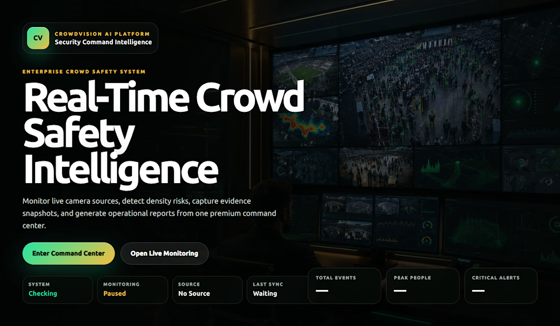
CrowdVision AI – Real-Time Crowd Monitoring & Intelligence System
An AI-powered computer vision platform that detects and counts people in real time, monitors crowd density and occupancy, tracks entry and exit movements, and provides actionable crowd intelligence through a live monitoring dashboard.
Overview
CrowdVision AI is an intelligent crowd monitoring and safety analytics platform designed to help organisations monitor public spaces, understand crowd behaviour, and identify potentially unsafe crowd conditions.
The system uses computer vision and machine learning inference to analyse camera feeds and video streams, detect people, estimate occupancy, classify crowd density, and monitor movement across designated zones.
The Problem:
Monitoring crowded environments manually can be difficult, time-consuming, and inefficient. Security personnel may struggle to maintain accurate occupancy counts, monitor multiple zones, and identify unusual crowd conditions quickly.
CrowdVision AI was developed to explore how computer vision and real-time analytics could improve crowd visibility and monitoring.
My Solution:
I developed a computer vision system integrating a pretrained YOLO object-detection model with OpenCV for video processing.
The platform includes:
Real-time people detection and counting.
Crowd occupancy estimation.
Crowd-density classification.
Entry and exit line counting.
Zone-based monitoring.
Incident and anomaly monitoring workflows.
Camera health and tamper monitoring.
Evidence management and reporting.
Telegram alert notifications.
Remote edge camera processing.
Live monitoring dashboard.
Technical Implementation:
Machine Learning & Computer Vision
Python
YOLO / Ultralytics
OpenCV
NumPy
Pandas
Backend:
Python
FastAPI
REST API
Frontend:
React
Vite
JavaScript
Other Technologies
Git
GitHub
Telegram Bot API
JSON/CSV data storage
My Role
Founder & Full-Stack Machine Learning Developer


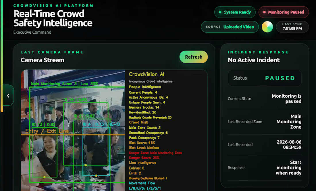

For entry/exit line counting, I'd test someone pausing on the boundary and stepping back without entering. Do you require a track to move fully between two zones before recording an entry, so small position changes don't become extra visits?