The network for creativity
Join 1.25M professional creatives like you
Connect with clients, get discovered, and run your business 100% commission-free
Creatives on Contra have earned over $150M and we are just getting started
Back to feedPost

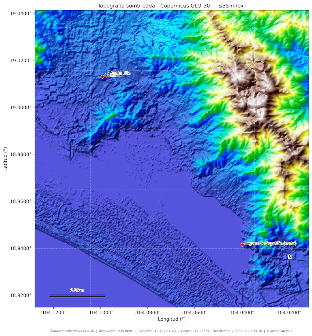
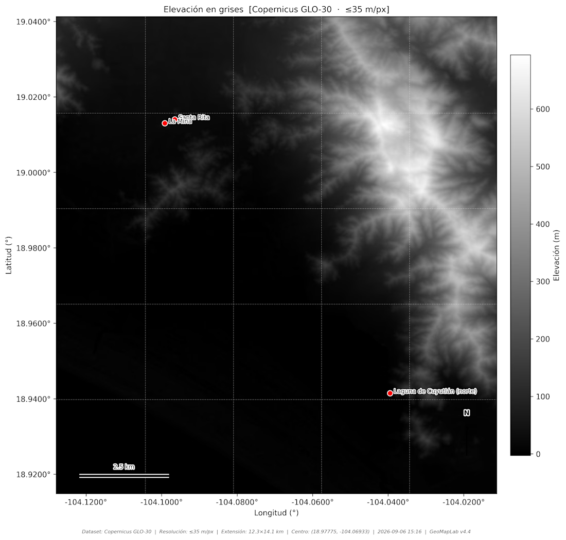
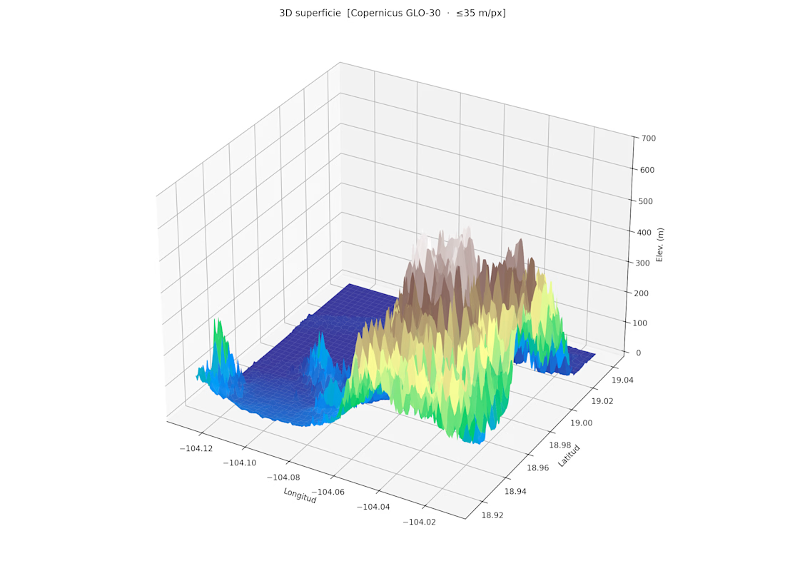
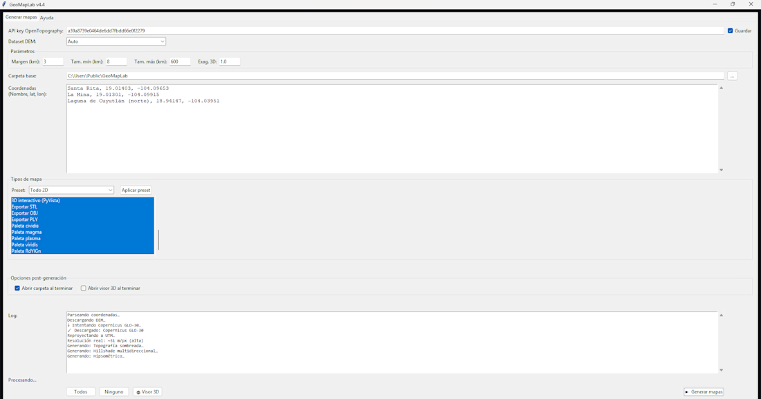
Terrain Intelligence & Mapping Tool (GeoMap v4)
Built a Python tool for collecting and analyzing terrain characteristics across user-defined geographic points.
The system integrates external data APIs to retrieve elevation, slope, terrain roughness, and related surface attributes, then transforms those inputs into structured datasets and map-ready outputs.
The project was created as an independent exploration of geospatial analysis, terrain modeling, and automated mapping workflows.
It demonstrates API integration, geospatial data processing, coordinate-based analysis, and technical visualization.

The network for creativity
Join 1.25M professional creatives like you
Connect with clients, get discovered, and run your business 100% commission-free
Creatives on Contra have earned over $150M and we are just getting started





Related posts

I wanted to test whether Invideo Editor’s AI timeline agent could replace hours of manual node compositing in After Effects to create a cinema-grade VFX shot from raw mobile footage.
How I built it:
The Footage: Raw 4K 60fps night plate of NYC with neon signs, streetlamps, and a wet puddle reflection.
Agent Direction: Using a prism refraction photo as a reference, I directed the agent in Ultra Mode to author a single custom shader that extracts luminance highlights, stretches them into 55° upward trails, and applies a spectral RGB dispersion gradient across the edges. It also layered a Screen composite and generated a procedural cyberpunk HUD tracking overlay.
Human Refinements: I manually used the exposed Inspector sliders to fine-tune the Highlight Threshold to 0.68 (isolating the Radio City marquee, streetlamps, and puddle reflection while eliminating building clutter) and dialed the Trail Length to 140 with an exponential falloff taper.
Editable Project Timeline:
👉 https://invideo.io/share/Chromatic-Stretch-GWJjyPAWPDb
Instagram Reel:
👉 https://www.instagram.com/p/DeB3NrJSbvd/
invideo Editor is free to try.
#invideocontrachallenge #invideoeditor #vfx #cinematography #aiagent


🚨 CODES, SHADERS & SPOOKY UI: WHY BUILDERS CAN’T MATCH HAND-CODED PRECISION
Most creators blend static assets in Figma or Canva. As a Full-Stack Engineer, I treat code itself as an art form.
For the Rive Halloween Challenge, I brought together raw code, terminal-driven workflows, and GPU shaders into one ultimate dev collage:
• Rive CLI & RML: Writing responsive interactive scenes directly inside VS Code—zero bloat.
• GPU Canvas (WGSL Shaders): Custom fog, flickering lights, and real-time spooky effects powered directly by the GPU.
• Cybersecurity & Clean Architecture: High-performance, pixel-perfect web apps built to convert in 0.05 seconds.
Forget laggy plugins and heavy template builders. True digital experiences are engineered from the ground up.
💬 Quick Question for Creatives & Devs:
Are you team Drag-and-Drop Builders or team 100% Hand-Coded Architecture?
👇 Drop your thoughts below, let's connect and push the boundaries of modern web tech!




The part where you drive fog and flickering lights with WGSL shaders on the GPU feels like the kind of low level control that really cuts latency.

I built an AI agent that handles customer operations — refunds, order lookups, and support tickets — with a human approval gate built into the workflow. The agent proposes the action, pauses, and waits for a human to approve before anything executes. The LLM never makes the final call. Role-based access and a full audit trail are enforced in code, not prompts. Deployed live on Azure Container Apps.


The pause for human sign off keeps refunds safe while still offloading the lookup work to the agent.