AgroMesh

Ayodele Davies
AgroMesh
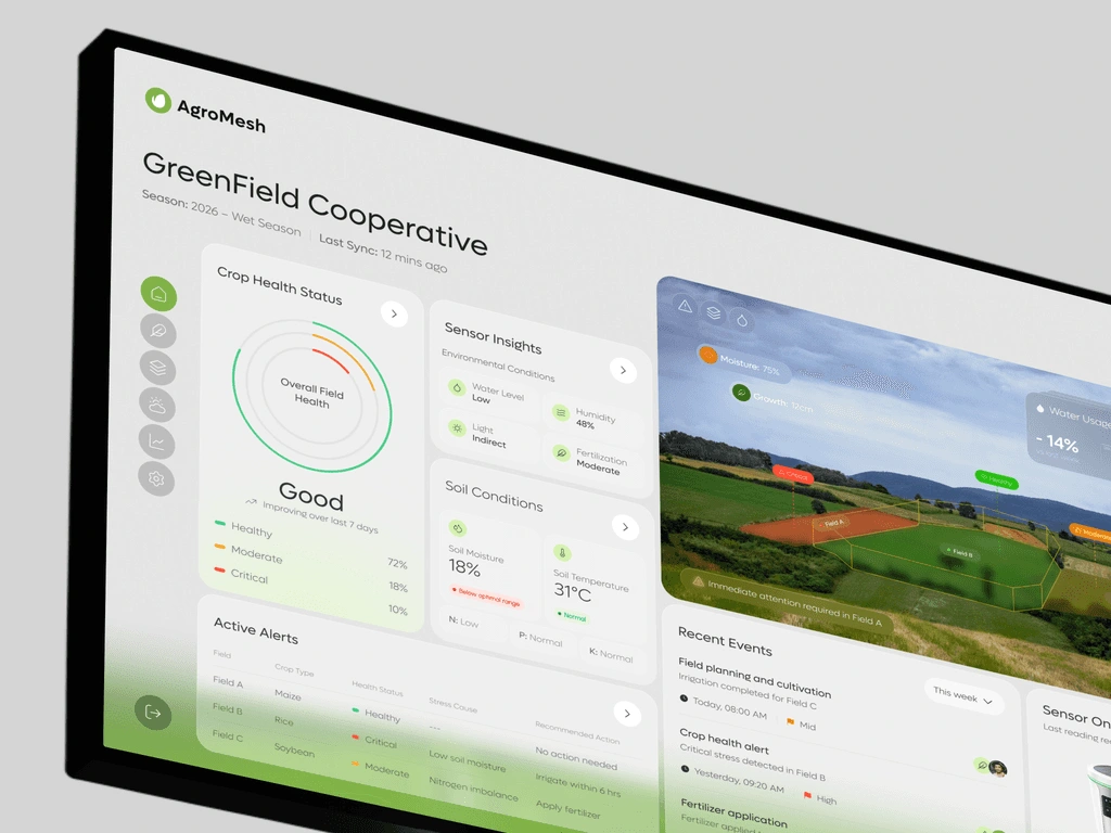
Agromesh is an AgriTech monitoring ecosystem designed for large-scale cooperatives and modern farmers.
Client:
Agromesh
Date:
May 26, 2026
Type:
Web App
Role:
UI/UX Designer
Client Request“We need an intuitive platform that allows agricultural cooperatives to monitor crop health and soil conditions in real-time. Our goal is to bridge the gap between IoT sensor data and field management, providing farmers with actionable insights to prevent crop stress and optimize resources.”
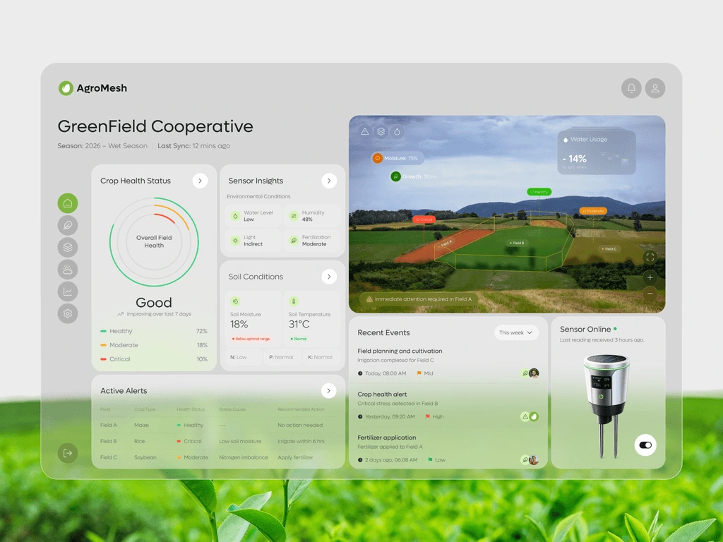
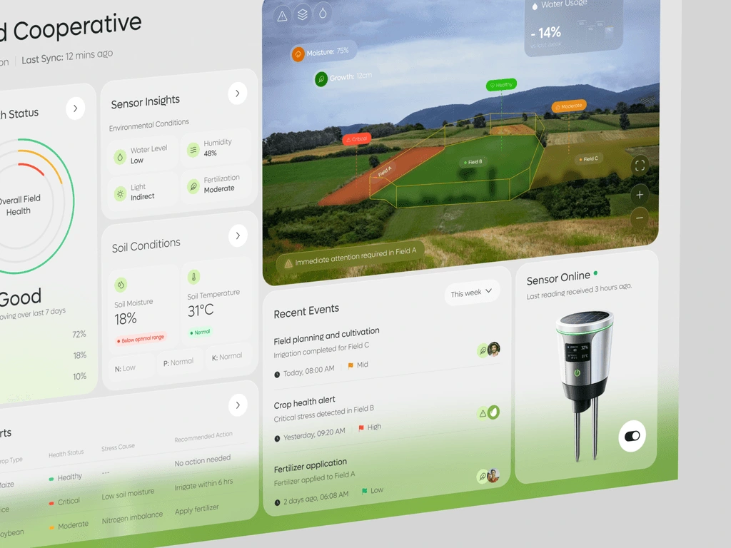
About ProjectAgromesh is an AgriTech monitoring ecosystem designed for large-scale cooperatives and modern farmers. It integrates data from IoT field sensors into a centralized dashboard, offering a "bird's-eye view" of multiple fields alongside deep-dive analytics into environmental conditions like moisture, pH, and nitrogen levels.
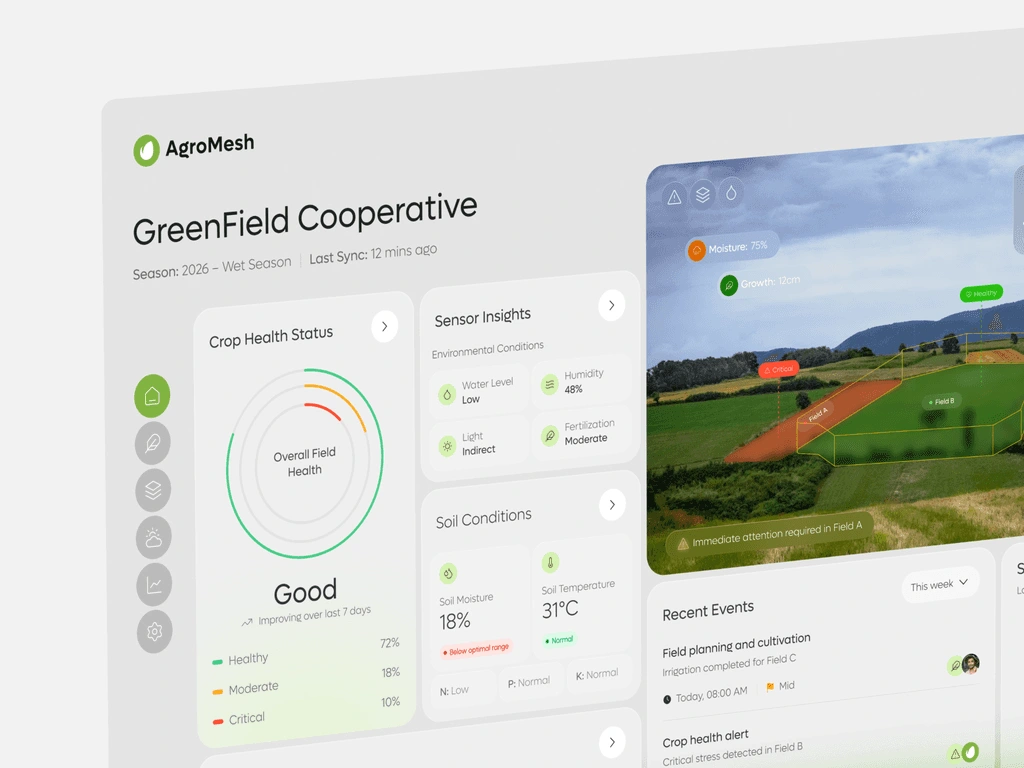
User Challenges Farmers often have to manually check vast fields, leading to delayed responses to pests, dehydration, or nutrient deficiencies. While many sensors exist, the data is often fragmented or too technical for quick decision-making. There is a critical need to visualize exactly where a "Critical" alert is occurring within a physical field.
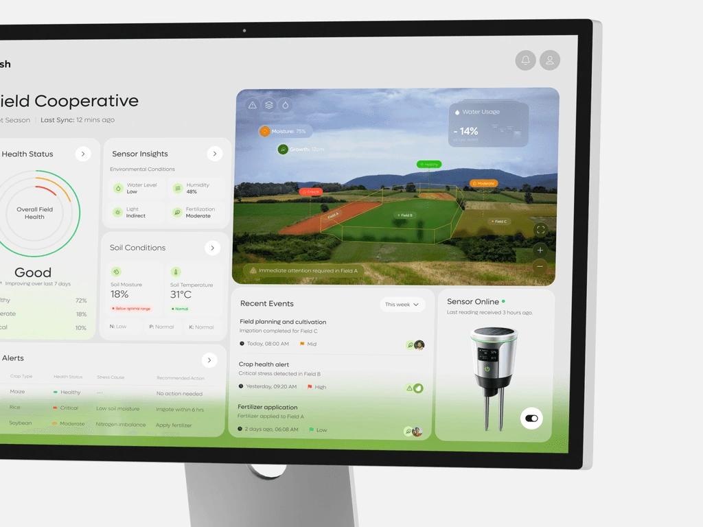
Our StrategyWe focused on a Geospatial-First approach, combining high-resolution field mapping with live data overlays. By using a "Traffic Light" status system (Healthy, Moderate, Critical), we ensured that the most urgent issues – like low soil moisture in specific zones – are prioritized visually, reducing the time from data collection to intervention.
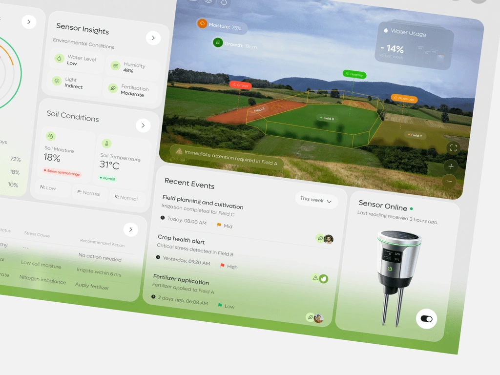
Our SolutionsAR Field Overlay: Developed a visual mapping interface that highlights field boundaries with color-coded status zones, allowing users to see exactly which sector requires "Immediate Attention."Environmental Health Ring: Designed a central "Overall Field Health" widget that aggregates multiple data points into a single, glanceable percentage and trend indicator.Proactive Alert System: Built an active alerts log that doesn't just identify a problem (e.g., "Critical Stress") but provides a Recommended Action (e.g., "Irrigate within 6 hours").Sensor Connectivity Hub: Integrated a hardware management panel to track the online status and battery life of individual ground sensors, ensuring data integrity across the network.
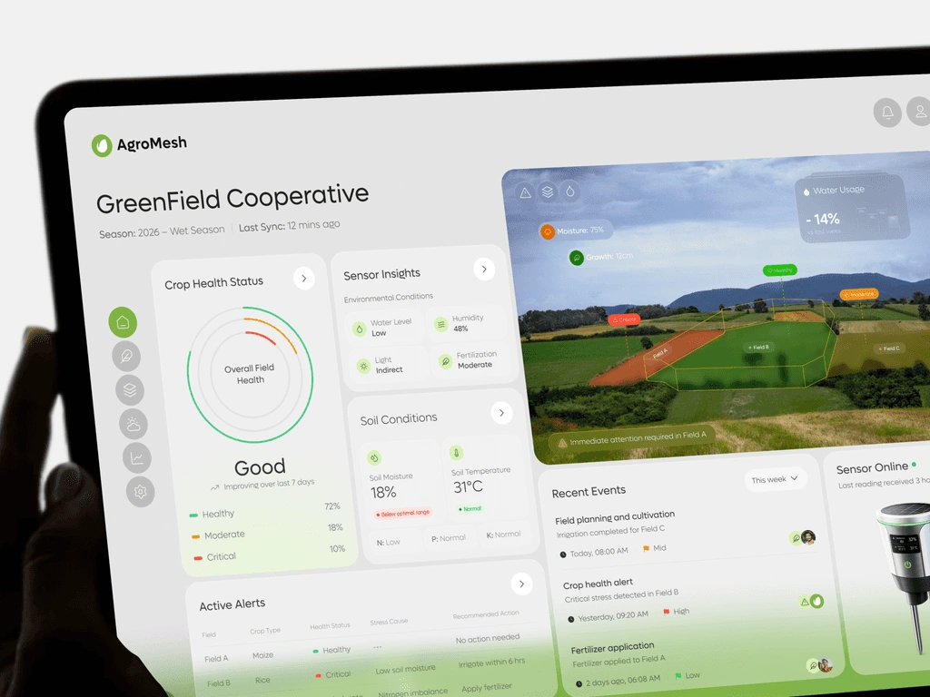
Client's Feedback“AgroMesh has transformed our cooperative's workflow. The ability to see a crop health alert and the recommended fix in one screen has significantly reduced our crop loss. It's like having a digital scout in every field 24/7.”
Like this project
Posted Sep 16, 2026
AgriTech monitoring ecosystem integrating IoT sensor data into geospatial maps to surface crop health alerts and recommended actions for cooperatives.
Likes
0
Views
0
Tags