Community Issues Map with Volunteer Review — Demo

Billy Bowlin


Project context
This is a demo for a residents' panel, using fictional data. It explores how residents can report local issues while volunteers review submissions before publication.
What I built
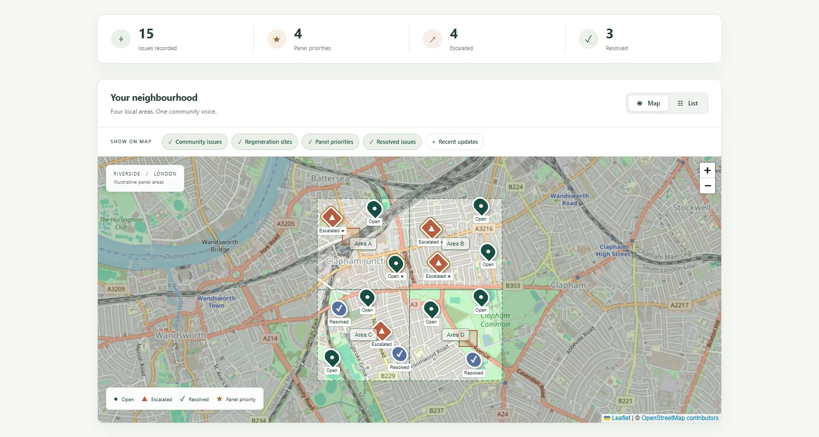
I designed an interactive map using Leaflet and OpenStreetMap. Residents can explore reports across four areas, switch map layers, filter by category, follow progress updates, and use a searchable list view.
Community reporting map with fictional demo data
My contribution
I handled design, development, and testing, including the mobile layout and submission flow.
Reports can be placed using a map, location, or street. Pins outside the supported areas are rejected. Passwordless sign-in supports resident participation, and the review flow includes duplicate warnings and a photo privacy checklist.
Delivered result
The demo shows a complete reporting path from resident submission to volunteer review and public display. The map and list views offer two ways to explore approved reports.
Demo disclosure
All displayed issue data is fictional. This case study does not claim a live municipal deployment or measured community outcomes.
Like this project
Posted Oct 25, 2026
A mobile-first community reporting demo built with Leaflet and OpenStreetMap. Includes location checks, searchable reports, and volunteer moderation. All data is fictional.