
Ahmad Mustafa
GIS & Python Developer | Geospatial AI Specialist
New to Contra
Ahmad is building their profile!
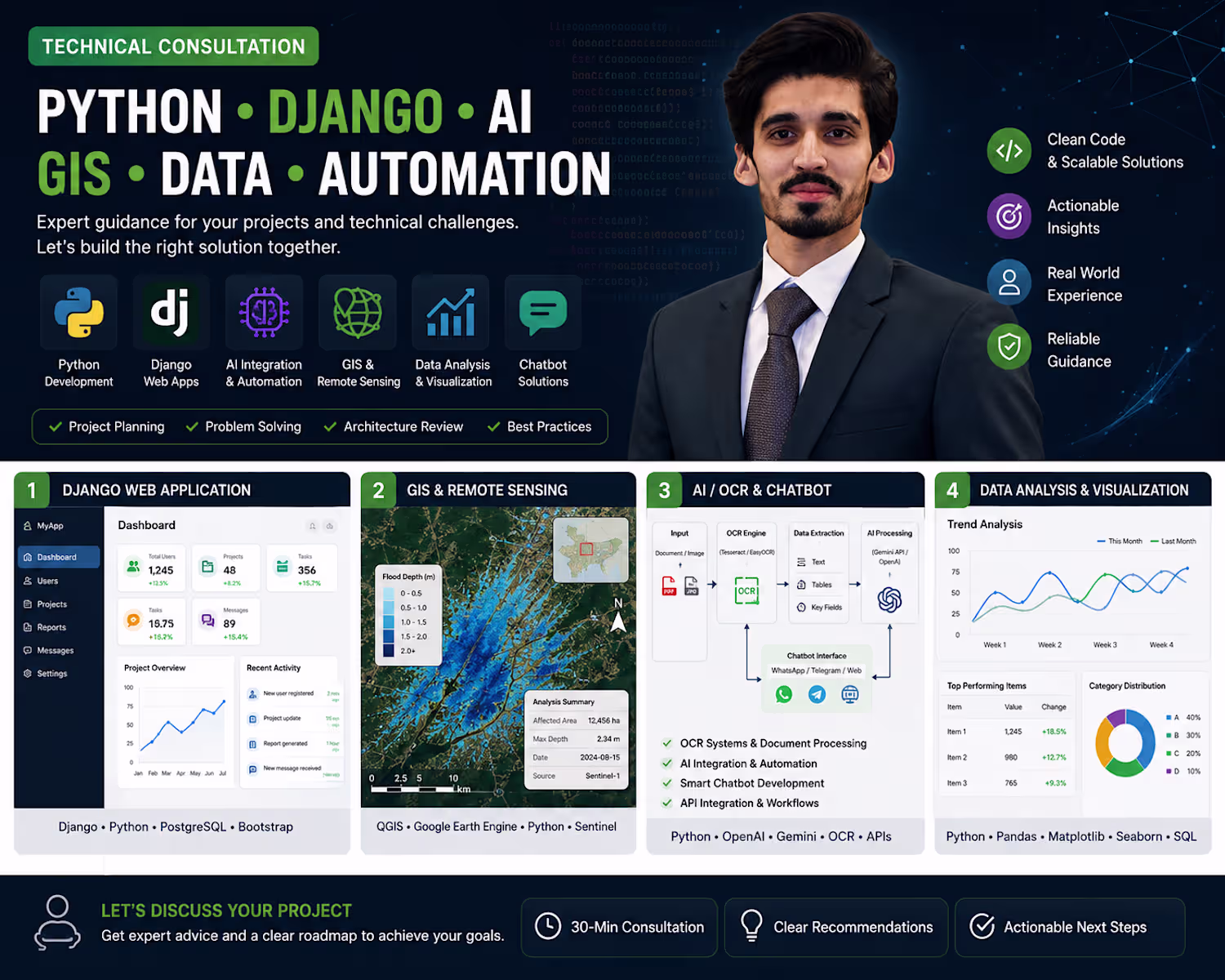
Developed a document processing and annotation platform that automatically downloads PDF files from URLs, converts PDF pages into images, and detects objects or regions of interest using AI-assisted annotation. Users can review, edit, resize, delete, or manually create annotation bounding boxes through an interactive web interface. The platform streamlines dataset preparation, document analysis, and machine learning workflows by combining automated detection with human-in-the-loop validation.
0
7
Developed a Python-based web scraping and automation platform that collects product data from multiple websites, processes and cleans the data, detects duplicates, and manages automated uploads through APIs. The system includes a dashboard for monitoring products, tracking upload status, managing deals, and streamlining large-scale data workflows.
0
11
Built a modern Web GIS application for interactive spatial analysis, map visualization, and geospatial data comparison. The platform integrates mapping technologies, satellite imagery, and location-based analytics to help users explore geographic data and make informed decisions. Developed using GIS workflows, Python, and web mapping technologies for a responsive and user-friendly experience.
0
13
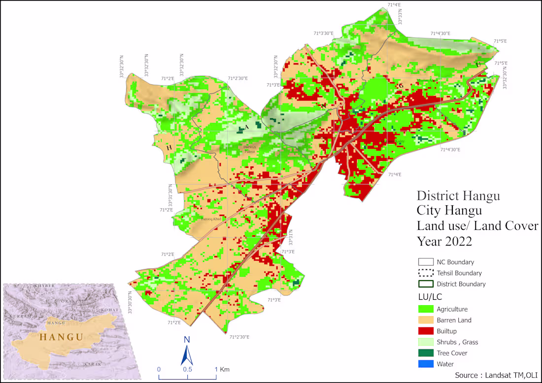
GIS-based spatial analysis and mapping project using ArcGIS, QGIS, and Remote Sensing data. Developed accessibility, land use, and spatial distribution maps to support urban planning and decision-making.
0
17