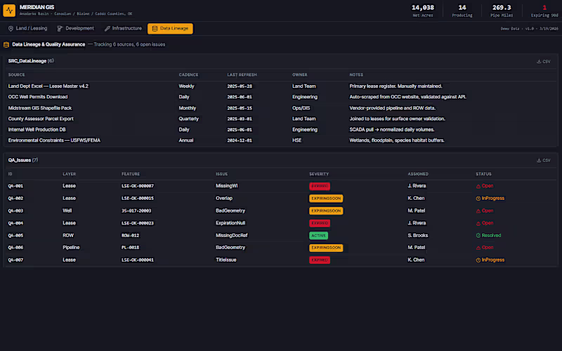
Full Stack Development Projects in North CarolinaFull Stack Development Projects in North CarolinaLead the planning and development of a full-stack geospatial dashboard for upstream oil & gas operations in the Anadarko Basin (Oklahoma). It consolidates lease management, well development planning, pipeline/ROW infrastructure, and data quality tracking into a single decision-support tool, replacing scattered Excel sheets, PDFs, and disconnected GIS layers.
Who It Solves Problems For:
Land Teams — track lease expirations, HBP status, curative issues, and WI/NRI across hundreds of tracts
Development Engineers — plan pad sites, visualize SHL/BHL well paths, and assess DSU coverage
Operations / Midstream — monitor pipeline inventory, easement status, and ROW constraints
Management / A&D — executive KPIs, acreage-at-risk summaries, and portfolio-level confidence scoring