The network for creativity
Join 1.25M professional creatives like you
Connect with clients, get discovered, and run your business 100% commission-free
Creatives on Contra have earned over $150M and we are just getting started
Back to feedPost
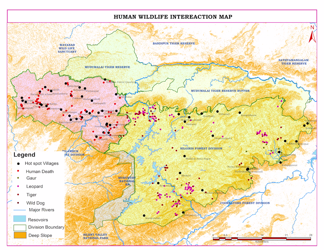
Human–Wildlife Conflict Map
Human–wildlife conflict is a major challenge in forest fringe areas. In this project, I analyzed conflict incidents across the Nilgiris landscape to identify high-risk zones and support better decision-making.
Using ArcGIS and QGIS, I mapped human death incidents, wildlife presence (leopard, tiger, gaur, wild dog), and hotspot villages. I integrated terrain (slope), forest boundaries, rivers, and reservoirs to understand patterns of wildlife movement and interaction with human settlements.
The analysis revealed that most conflict incidents occur near forest edges and buffer zones, especially in villages close to protected areas. Leopard activity was widely distributed, indicating higher interaction risk with human populations.This project demonstrates my ability to transform complex geospatial data into clear, actionable insights for forest management and conservation planning.
👉 Available for similar GIS mapping and spatial analysis projects. Feel free to message me.
The network for creativity
Join 1.25M professional creatives like you
Connect with clients, get discovered, and run your business 100% commission-free
Creatives on Contra have earned over $150M and we are just getting started
Related posts
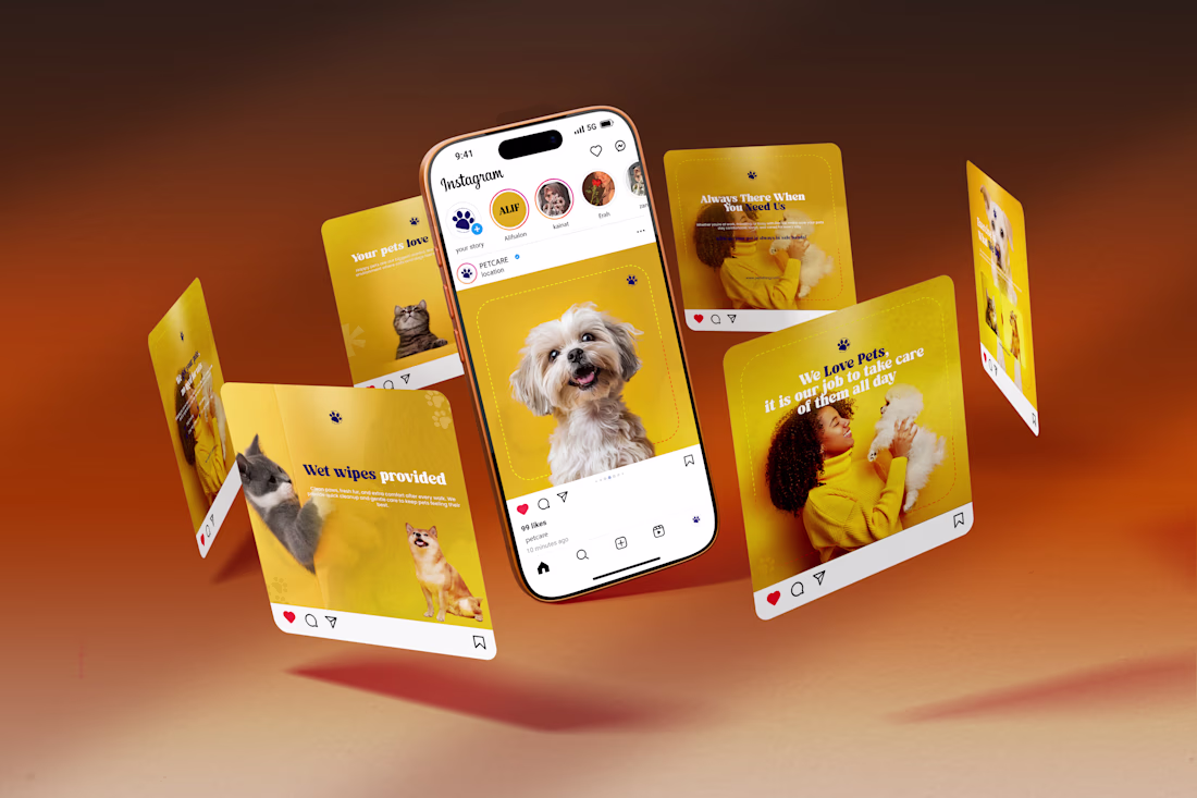
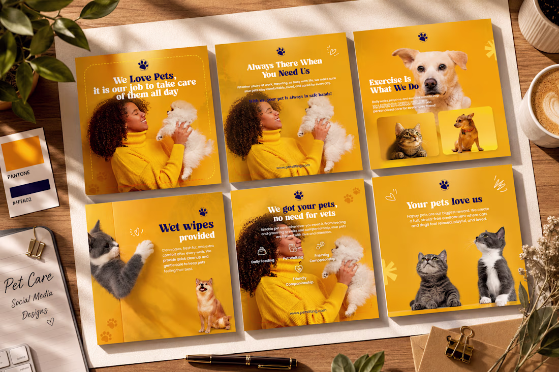
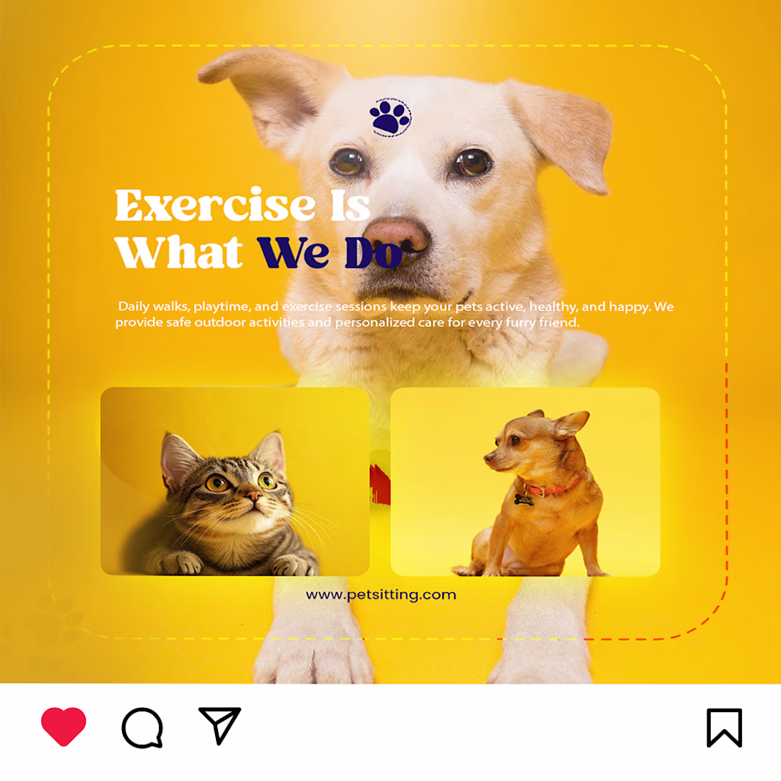
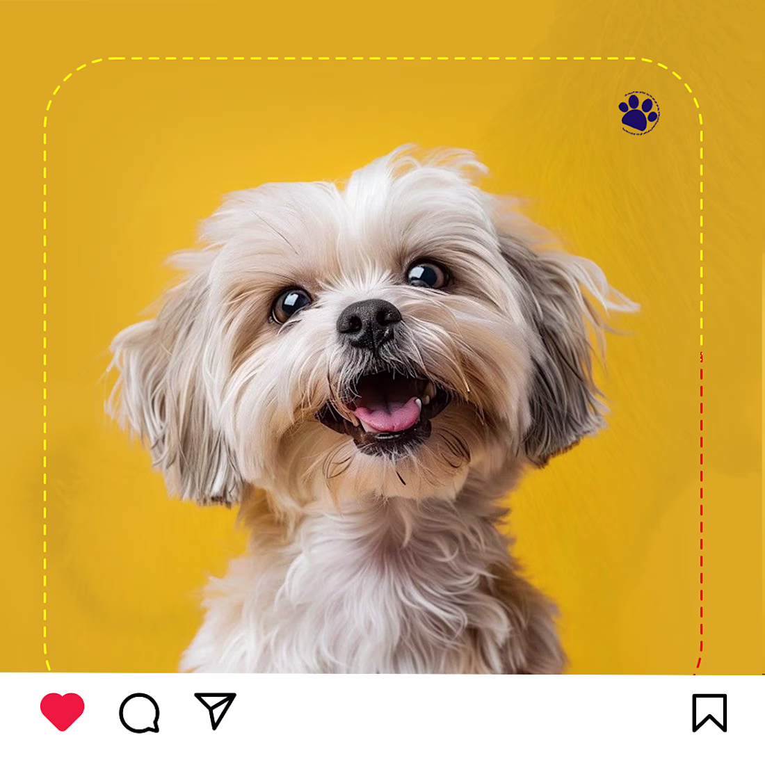
Pet Care Social Media Design
Here's a branding-focused social media carousel I designed for a pet care business. The concept combines a bright yellow color palette, clean typography, premium layouts, and engaging visuals to create a warm, trustworthy, and modern brand identity.
The goal was to design posts that are visually appealing while clearly communicating the brand's services and values.
Tools Used: Adobe Photoshop
Focus: Social Media Design | Branding | Visual Hierarchy | Typography | Color Theory
Feedback and suggestions are always appreciated! 💛
#GraphicDesign #SocialMediaDesign #Branding #AdobePhotoshop #PetCare #VisualDesign #CreativeDesign #ContentDesign #Portfolio #Behance #Designer #LinkedInDesign #UIDesign #BrandIdentity
Amazing work
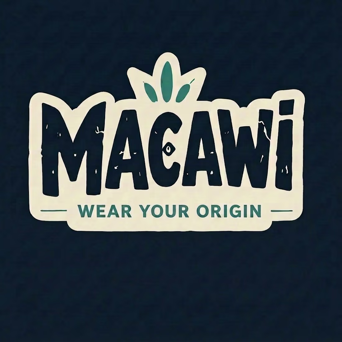
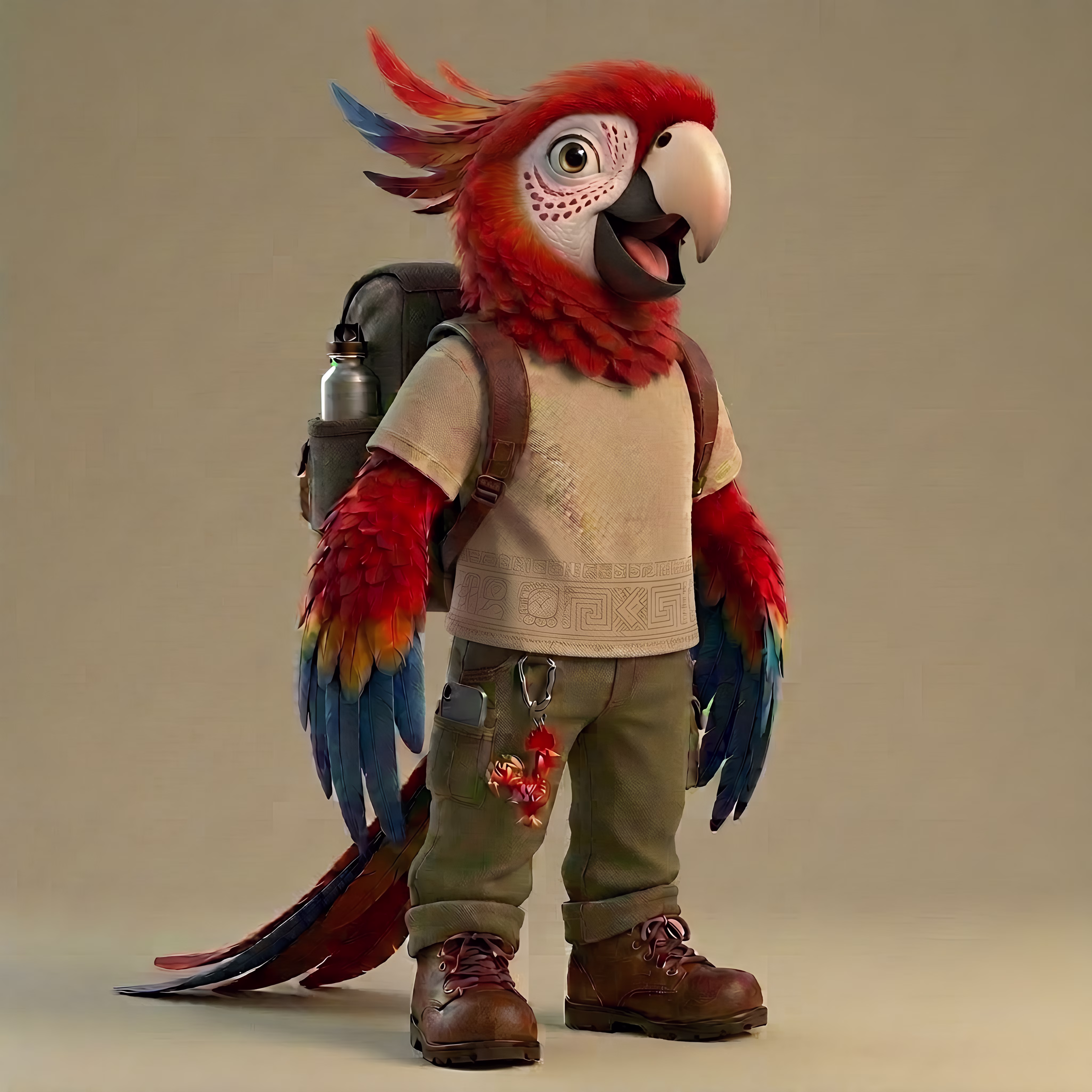
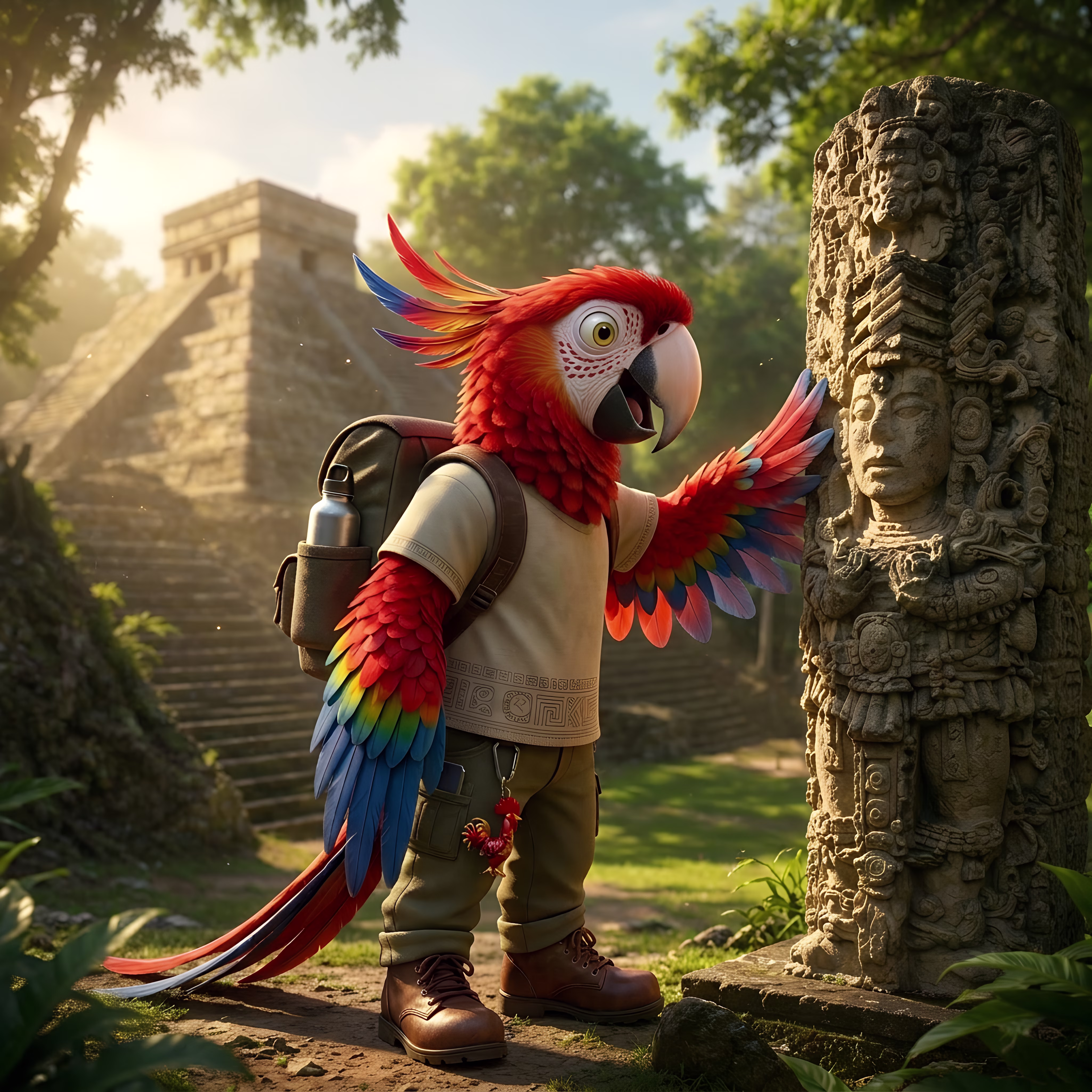
Introducing Macawi! 🦜🇭🇳
I'm so excited to share a little piece of my culture through my very first challenge.
Meet Macawi, a curious scarlet macaw born in the heart of the ancient Mayan city of Copan Ruinas, Honduras. He's an adventurous traveler on a mission to showcase the incredible beauty of his homeland, from the majestic ruins of Copán to the crystal-clear waters of Roatan, through lush tropical forests, and along the rich cultural landscapes of the Lenca Route.
Inspired by every destination he visits, Macawi brings the spirit of Honduras to life through a collection of apparel and designs that celebrate our heritage, nature, and traditions.
This is only the beginning of his journey.
I hope you love Macawi as much as I loved creating him. Thank you so much for your support! ❤️🇭🇳
#RecraftChallenge #Macawi #WearYourOrigin #BrandIdentity #CharacterDesign #Honduras #CreativeAI #BrandDesign #GraphicDesign #TravelBrand #AIArt
Project link: https://www.recraft.ai/project/8c8d14eb-7622-441b-938d-c9c7e4ed3366
Nice 💯
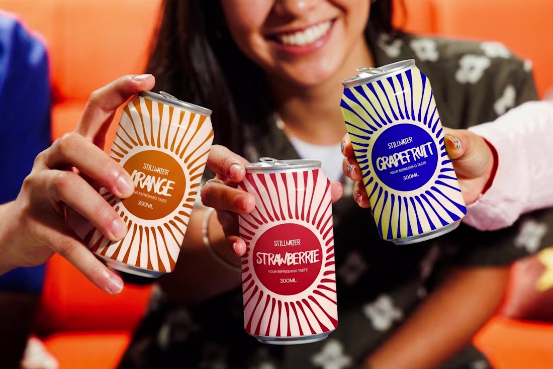
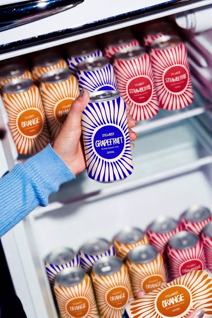
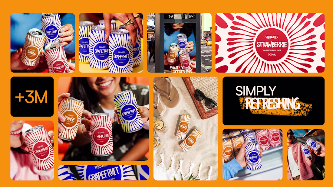
not a brief. not a client. just me, a sunburst motif and three very specific shades of bold.
STILLWATER — case study on Behance.
(and yes, i'm looking for a job. just thought you should know.)
fabulous work! this all has so much personality to it.
Trending
Claude
Claude has entered the design space. How are you using Claude Design?
Contra University
Learn from expert creatives how to earn more using next-gen AI tools.
fifaworldcup2026
The World Cup is here and the whole world's watching. How are you designing for the world stage?
creativeaiflow
Creative AI workflows are evolving. What tools do you use, and what are their strengths and weaknesses?
freelancerlife
Freelancer life is wins, pivots, and everything in between. What’s yours right now?