The network for creativity
Join 1.25M professional creatives like you
Connect with clients, get discovered, and run your business 100% commission-free
Creatives on Contra have earned over $150M and we are just getting started
Back to feedPost

GIS-Based Global Population Pattern Visualization
This project is a GIS-based global population visualization created to show how human population is distributed across the world. Using spatial population data, the map presents global settlement and density patterns in a clear grayscale thematic style, where darker areas represent higher population concentration and lighter areas represent lower or uninhabited regions.
The work focuses on geospatial data processing, raster-based population visualization, map styling, and global-scale cartographic presentation. The final output helps viewers quickly understand major population clusters across regions such as East Asia, South Asia, Europe, Africa, and the Americas, while also showing sparsely populated areas such as deserts, mountain regions, forests, and polar zones.
My role in this project involved preparing the GIS data, styling the population layer, adjusting the global map projection and layout, refining the visual contrast, and creating a clean presentation suitable for spatial analysis, education, and geographic storytelling.
Skills & Tools:
ArcGIS Pro, GIS Mapping, Spatial Analysis, Raster Data Visualization, Population Density Mapping, Thematic Mapping, Geospatial Data Processing, Cartography, Global Data Visualization, Map Layout Design, Coordinate Systems, Spatial Pattern Analysis.

The network for creativity
Join 1.25M professional creatives like you
Connect with clients, get discovered, and run your business 100% commission-free
Creatives on Contra have earned over $150M and we are just getting started
Related posts

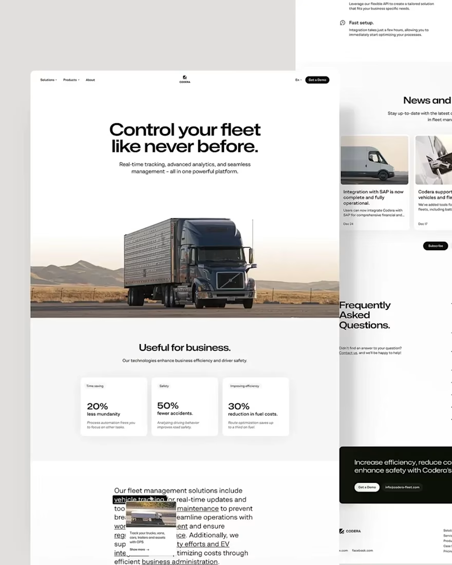
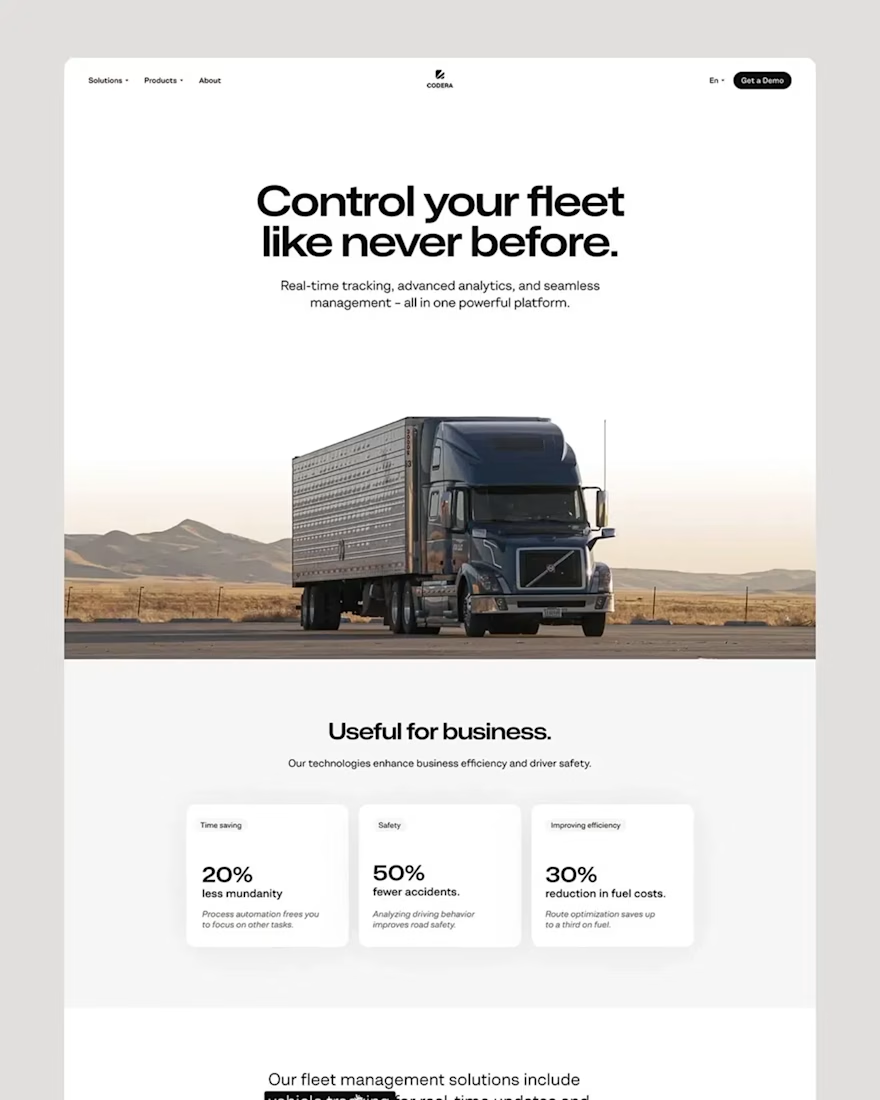
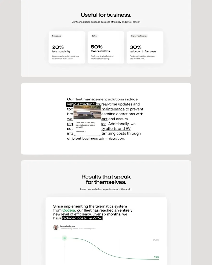
Interactive Framer SaaS Landing Page for CODERA Fleet Management
This project highlights an interactive Framer SaaS landing page developed for CODERA, a cutting-edge fleet management solution. As a Framer SaaS Expert, my goal was to create a dynamic and engaging B2B tech Framer developer experience that effectively communicates the value of real-time tracking and advanced analytics.
The solution involved leveraging Framer CMS for seamless content updates and Framer Motion for captivating animations, bringing the SaaS analytics visualization to life. I focused on high-fidelity SaaS prototypes to ensure a polished product marketing website, showcasing CODERA's vehicle tracking interface and route optimization UI. The design emphasizes a modern aesthetic with a clean layout, making complex logistics tech showcase simple and intuitive for potential clients.
This project demonstrates my expertise in creating conversion-focused Framer designs for B2B software sales pages, ensuring a powerful and efficient digital presence for tech startups in the logistics sector.
Tags/Keywords:
Framer, SaaS Landing Page, B2B Tech, Interactive UI, Framer CMS, Framer Motion, Product Marketing, Logistics Tech, Fleet Management, SaaS Analytics, UI/UX Design, No-Code Development, Responsive Design.


Good job


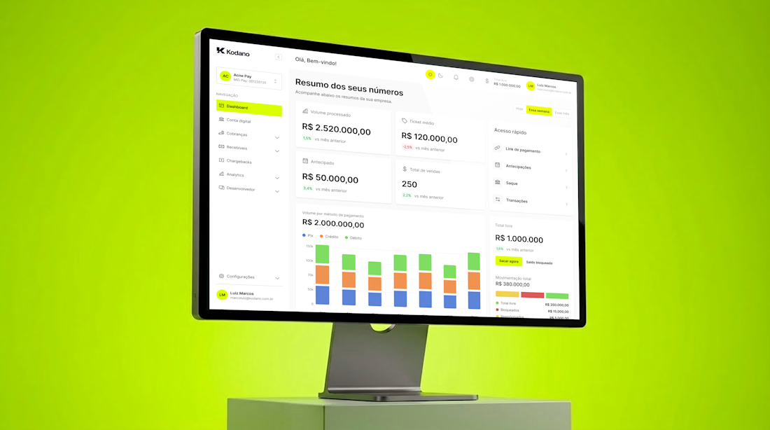

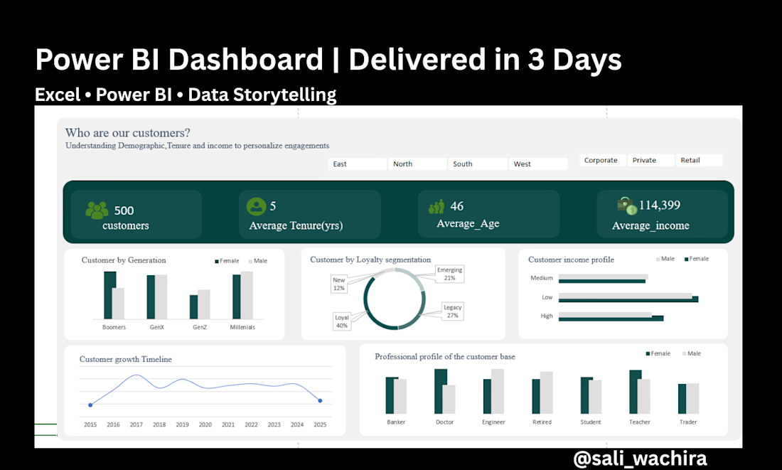
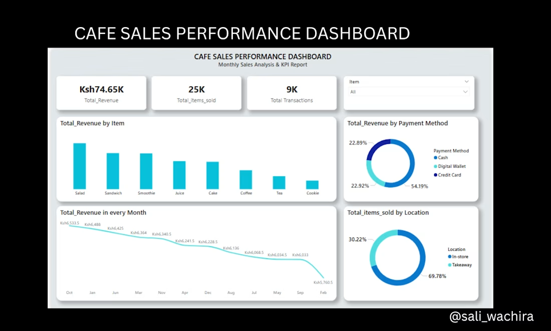
Turning Raw Data into Actionable Business Insights
A peek into some of my recent data visualization work! I designed these interactive dashboards to help businesses move away from messy spreadsheets and look at their data with absolute clarity.









Trending

Claude
Claude has entered the design space. How are you using Claude Design?

Contra University
Learn from expert creatives how to earn more using next-gen AI tools.
creativeaiflow
Creative AI workflows are evolving. What tools do you use, and what are their strengths and weaknesses?
portfolioreview
The best portfolios tell a story, not just show a grid. Share yours for feedback.
freelancerlife
Freelancer life is wins, pivots, and everything in between. What’s yours right now?