The network for creativity
Join 1.25M professional creatives like you
Connect with clients, get discovered, and run your business 100% commission-free
Creatives on Contra have earned over $150M and we are just getting started
Back to feedPost
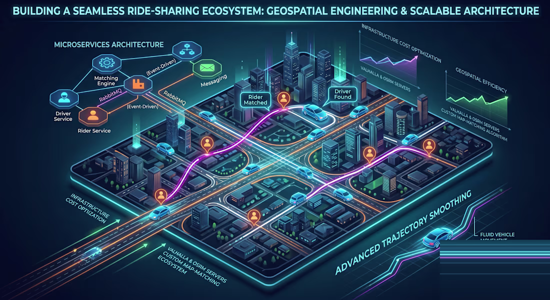
Building a Real-Time Ride-Sharing & Geospatial Ecosystem from the Ground Up
🚀 Transforming Mobility with Scalable, Real-Time Architecture
I recently engineered a highly scalable, real-time ride-sharing ecosystem, solving critical industry challenges while reducing infrastructure costs and improving user experience. Here's how I did it:
🔹 Scalable Microservices & Event-Driven Messaging:
Designed and deployed a highly available platform using NestJS microservices. Utilized RabbitMQ for reliable, event-driven communication, ensuring loose coupling and resilience across all system components.
🔹 Low-Latency, High-Speed Driver Matching:
Architected a discovery engine capable of matching the nearest available drivers in milliseconds. Leveraged WebSockets to enable real-time bidirectional communication between riders and drivers for seamless booking and tracking.
🔹 Advanced Trajectory Smoothing (Solving "Car Jumping"):
Solved the visual "car jumping" problem caused by raw GPS pings. I implemented custom logic to animate vehicle markers precisely along polylines, ensuring a fluid and realistic movement experience on the client side.
🔹 Geospatial Infrastructure & Massive Cost Reduction:
Eliminated reliance on expensive third-party mapping providers by deploying and managing custom Valhalla and OSRM servers for production and staging.
🔹 Custom Map-Matching Algorithm:
Developed a proprietary algorithm to process raw, noisy GPS data and accurately snap it to the road network. By replacing the Google Roads API with this custom solution, I achieved a massive reduction in operational costs while maintaining high accuracy.
Client Impact:
Significant Cost Savings: Drastically reduced dependence on paid geospatial APIs.
Enhanced UX: Fluid, accurate, and real-time tracking that users trust.
Scalable & Resilient: Ready to handle growing user bases with high availability.
Let's discuss how I can bring these scalable geospatial solutions to your next project! Message me to chat.
#RideSharing #Geospatial #Microservices #NestJS #RabbitMQ #WebSockets #Valhalla #OSRM #MapMatching #RealTimeData #SoftwareEngineering
The network for creativity
Join 1.25M professional creatives like you
Connect with clients, get discovered, and run your business 100% commission-free
Creatives on Contra have earned over $150M and we are just getting started
Related posts
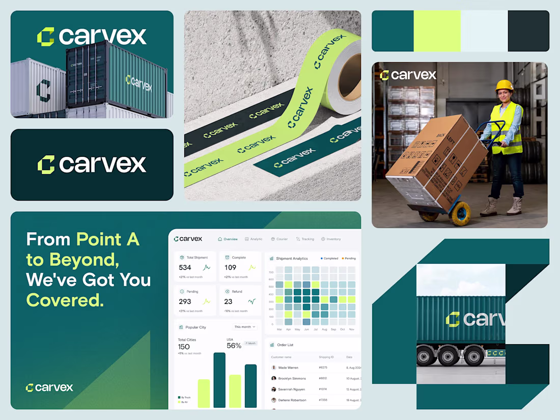
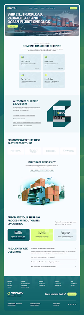
Concept Work: Carvex Logistics Website
Carvex: The Future of Logistics
Overview
Carvex emerges as the vanguard of the shipping industry, transforming how goods traverse the globe. Gone are the days of sluggish deliveries and opaque tracking; Carvex is setting a new standard in logistics with cutting-edge technology and an unwavering commitment to customer satisfaction.
Carvex isn't just a shipping platform; it's a revolution in logistics that seamlessly integrates advanced algorithms with real-time data analytics to deliver unparalleled accuracy and efficiency. Every shipment is carefully monitored from origin to destination, ensuring timely arrivals and complete visibility at every stage of the journey.
Design Philosophy
The vision behind Carvex was to simplify the complexity of global logistics through a clean, sophisticated, and user-centric experience. Logistics platforms often overwhelm users with excessive data and operational complexity. Our goal was to transform that complexity into clarity.
The design embraces a minimal and modern visual language, allowing users to focus on the information that matters most. Clear hierarchy, intuitive navigation, and thoughtful spacing help create an experience that feels effortless, whether managing a single shipment or overseeing an entire logistics operation.
Every interaction was designed with efficiency in mind. Real-time tracking, shipment management, and operational insights are presented in a way that feels accessible and easy to understand, reducing friction and enabling faster decision-making.
By balancing simplicity with powerful functionality, Carvex delivers a premium digital experience that inspires trust, enhances productivity, and reflects the innovation driving the future of logistics.

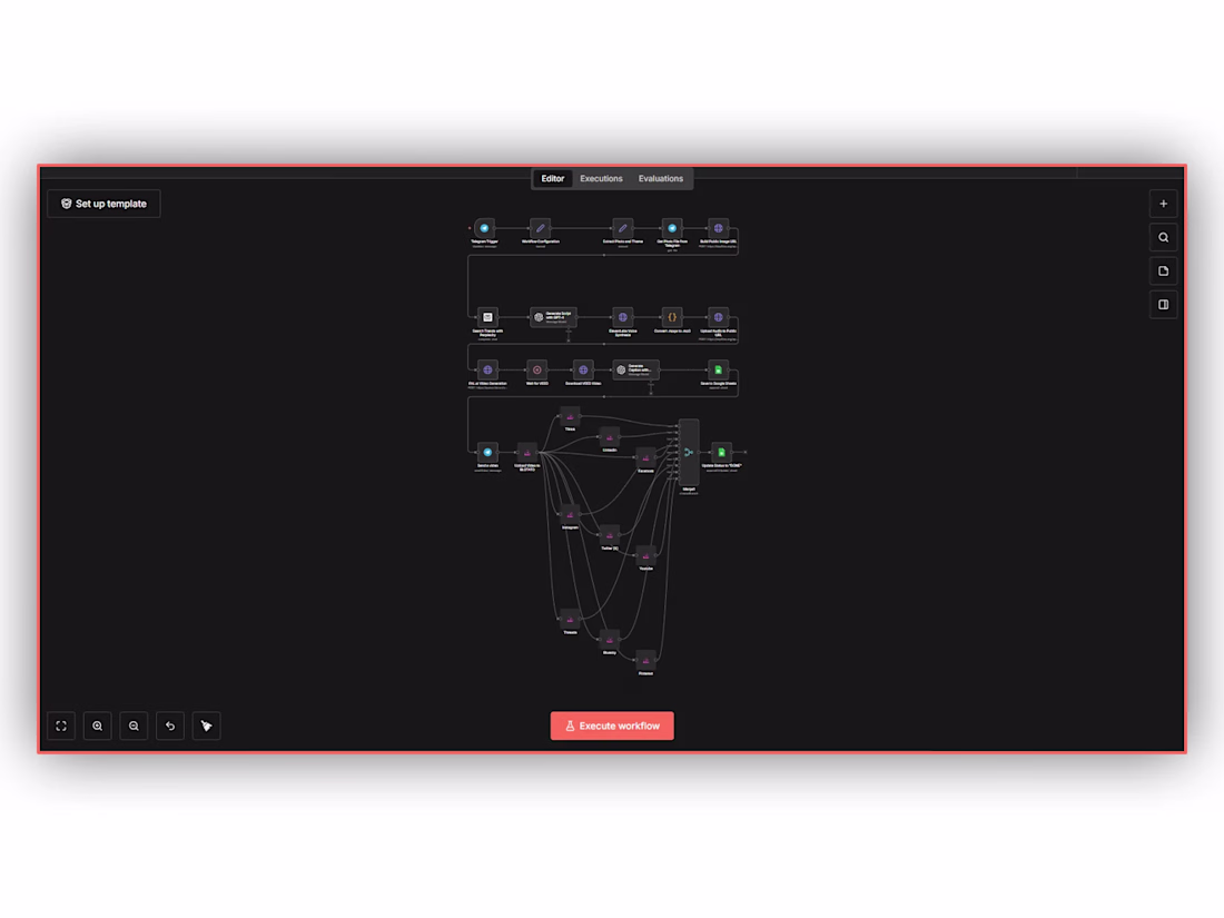
AI Video Creation & Multi-Platform Posting
My client, operating a Wix Website Development firm, needed n8n workflow development to modernise their marketing. Content production consumed massive daily resources.
I solved an operational inefficiency where manual video editing and posting limited brand growth. Process automation became essential to accelerate audience reach globally.
I deployed scalable automation systems leveraging GPT-4, ElevenLabs, and D-ID. App integration alongside advanced data routing and logic flawlessly distributes generated media to TikTok, LinkedIn, and seven networks seamlessly.
Trending
Claude
Claude has entered the design space. How are you using Claude Design?
Contra University
Learn from expert creatives how to earn more using next-gen AI tools.
MagicPath
The canvas is infinite, and exploration is becoming the workflow. How are you using MagicPath?
creativeaiflow
Creative AI workflows are evolving. What tools do you use, and what are their strengths and weaknesses?
freelancerlife
Freelancer life is wins, pivots, and everything in between. What’s yours right now?