The network for creativity
Join 1.25M professional creatives like you
Connect with clients, get discovered, and run your business 100% commission-free
Creatives on Contra have earned over $150M and we are just getting started
Back to feedPost

Complete UAV photogrammetry and geospatial processing project for a hillside property in Thailand.
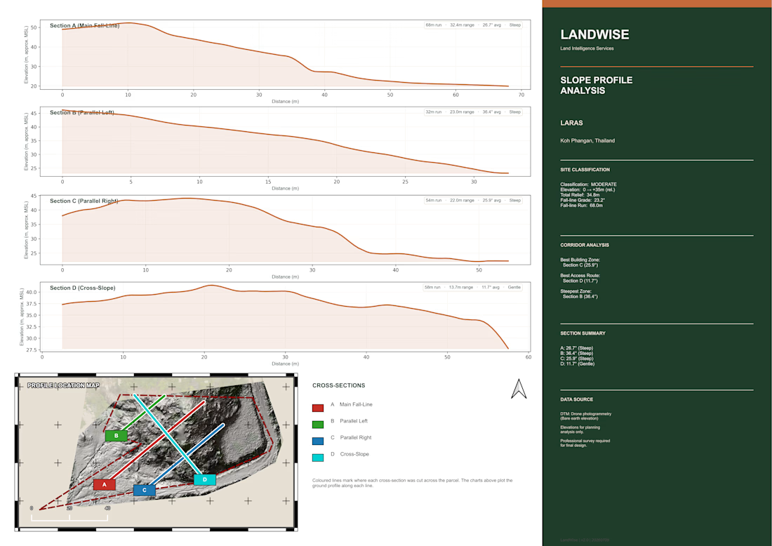
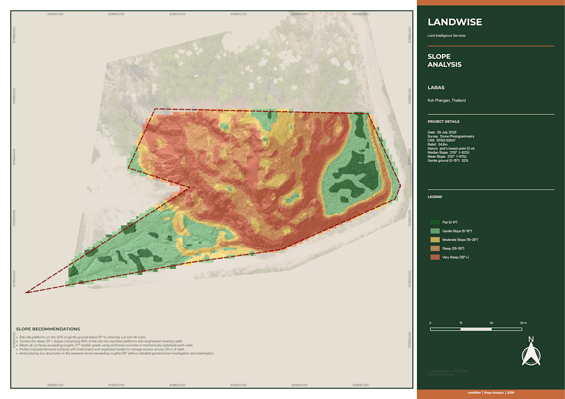
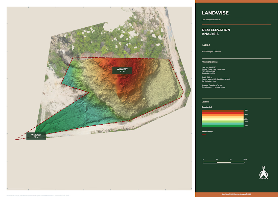
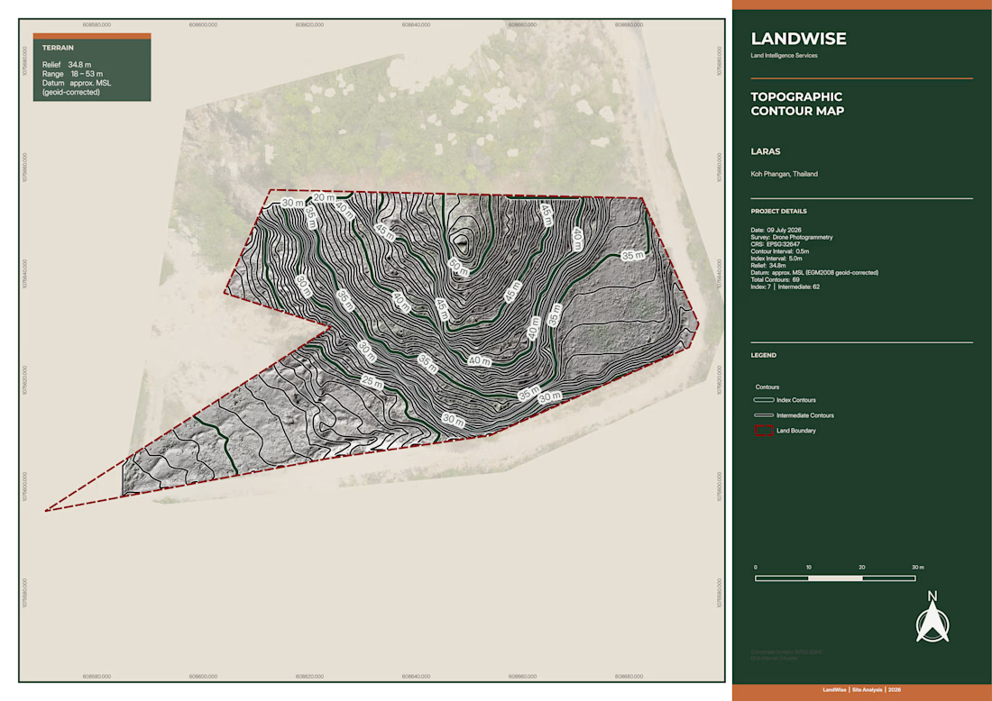
I processed 1,272 aerial images in Agisoft Metashape Professional and QGIS, producing a high-resolution orthomosaic, dense point cloud, ground-classified terrain data, DTM/DEM, 0.5 m contours, elevation analysis and a detailed 3D reconstruction.
The dataset generated more than 376 million dense points, including over 121 million ground-classified points, with mapping outputs at approximately 1 cm resolution.
The final deliverables were prepared for practical land and property analysis, with clear visual outputs showing terrain, elevation, slope and site conditions.


The network for creativity
Join 1.25M professional creatives like you
Connect with clients, get discovered, and run your business 100% commission-free
Creatives on Contra have earned over $150M and we are just getting started





Related posts

Our new favorite workflow: Blender blockout to AI render. Check it out 👇
View the full case study here: https://jzcreates.com/coastal-residence/
For our latest portfolio project, Coastal Residence, we developed a workflow that combines 3D previs in Blender with AI image generation to give us much more control over the final result.
We first built the entire property as a rough 3D block-out in Blender.
The models themselves don’t need to be beautiful.
They’re there to establish the important things: architecture, scale, room layouts, furniture placement, camera position, lens, composition, and perspective.
Once the shots are locked, those rough Blender frames become the foundation for the final AI-generated images.
Blender controls the structure. AI creates the finish.
This gives our team the ability to art direct each shot before generating the final visual, while keeping the property much more consistent from image to image.
And because everything begins with the same 3D environment, that one model can become much more than a set of still images.
For Coastal Residence, we used the workflow to create photoreal renders, floor plans, cinematic video, property walkthroughs, and AI agent-led tours.
We’re attaching a before-and-after video showing the transformation from the original Blender block-outs to the finished visuals.
Stay creative 🎨


Great work

Furniture for your eyes. ☺💯
Software- Blender3d, Substance Painter, Adobe Premiere Pro;
Direction - 3D Modeller - Animation - Colourist: Gbolahan Akinwole - @afoo3d
Sound - @pixabay
#productdesign #productanimation #furniture #3dart #3dproducts #3dmodeling #3danimation #cgi #product #animation #blender #blender3d #furnituredesign #furnituremakeover

