
Prakhar Saxena
AI Developer | Computer Vision | LLM | RAG | Healthcare AI
New to Contra
Prakhar is building their profile!

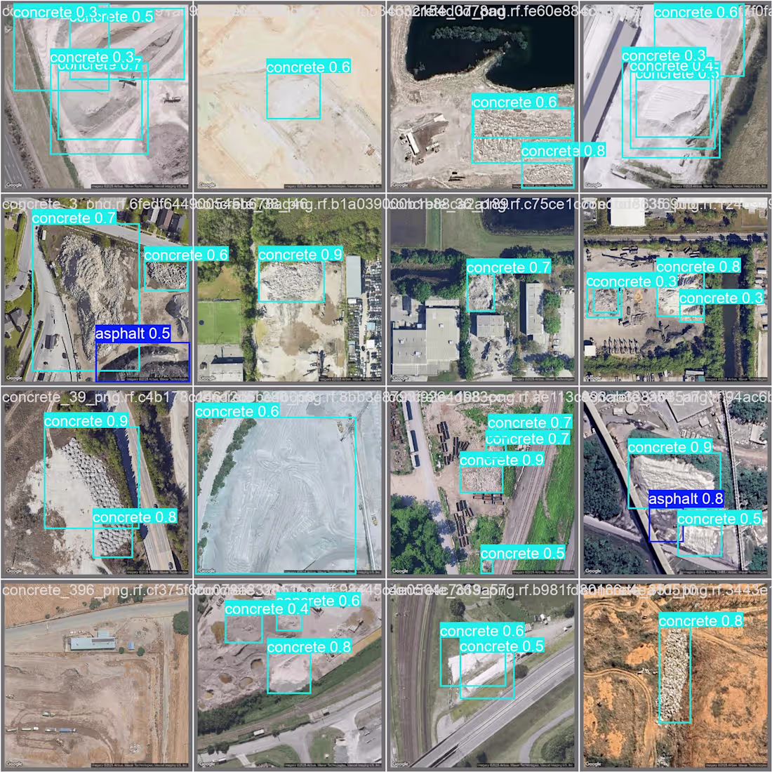
Please check my similar work object detection project using Yolov8,google apis and GCP.I am Detecting Rubble Piles from Aerial Imagery (Geospatial AI,Mapping etc.) Project Description
Steps taken-
- Configured and extracted the coordinates (longitude and latitude) from the provided Google Maps link using the requests library.
- Downloaded the satellite imagery tile using the Google Maps Static API.
- Set up Roboflow, annotated the images with the classes asphalt and concrete, and exported them into a dataset. (Please see the attached screenshot.)
- Split the dataset into 11 training, 3 validation, and 2 test images; then augmented it to 44 training, 12 validation, and 8 test images.
- Trained the dataset on the YOLOv8s model (50 epochs).
- Metrics: mAP@50: 0.603 (asphalt: 0.311, concrete: 0.895).
- Model Analysis: The model performs well on concrete, but moderately on asphalt due to limited data and its visual similarity with the background.
0
2
I have developed Image processing model for a Automotive company where I have used U-2 Net model and hosted on Hugging face,
1
11
I have developed an employee attendance AI system that records the exit time along with tracking where I stored the entry and exit times in a CSV file.
1
23