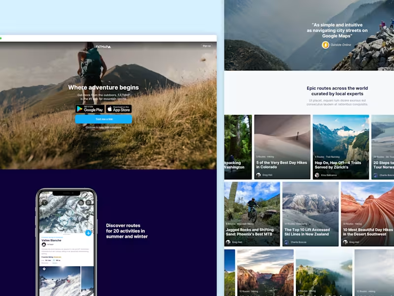
Custom interactive digital map design – (PRO) – MapboxCeri Lewis
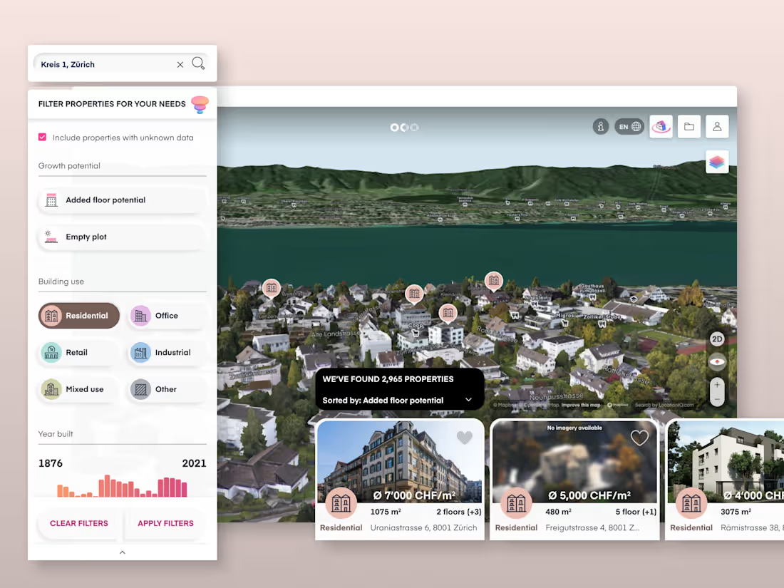
I craft stunning maps using Mapbox Studio (although I’m happy to discuss other platform). I offer a deep-dive consultation to understand your goals and your data. I can even support in creation of your data if needed. With complete customization of the map's style and visual language and clear data hierarchy – from 2D/3D elements to custom icons. The final delivery includes editable map files, assets and options for both basic website embedding and full developer access.
Take your map visualization to the next level with the PRO package. It includes everything in the BASIC package, plus interactive features like popups and data layer toggles, custom UI/UX design.
FAQs
Yes and yes... Mapbox has a considerable free tier offering a certain amount of free MAUs, map loads, and monthly requests. You can review the full details here Mapbox pricing
I work with Mapbox as they allow for deep customisation and control over every aspect of map design. Offering full design control from styling (placemarks, icon sets, fonts, textures, patterns, lines & colours) to information density. They offer their own curated location data and easy integration of your own. This ensures your map seamlessly integrates with your brand and works effectively with your usecase and data. If customisation of style and data is a key goal within your project then I would recommend Mapbox, however if you are comfortable with basic styling customisations then I am also very happy to work with google maps or design for other platforms, including your own if that is the case.
I'll work with your data in Mapbox studio. This can either be supplied as a dataset or tileset within mapbox. Or as a GeoJSON, JSON or CSV file that we’ll import into the dataset editor. Mapbox offer a comprehensive amount of curated location data that we can use as the base map alongisde your own data or work with solely if it offers what you need. If your custom data hasn’t made to a digital spatial database yet then we can discuss a data creation package to support you in that process. If there is only a small amount of data and / or we can access it from an open source supplier this could also be a very quick process and included within the main package.
Yes, if you require a fully customised large range of icons we can discuss a separate icon package. I love icon creation.
An iframe is an HTML element that allows you to embed another webpage within yours, commonly used for embedding vmaps, videos and social media across websites. What it can do: - Display a Mapbox-hosted style on an HTML page - Pan, zoom, and tilt - A default map location - Search What it can't do: - Support feature interactions such as popups and click events. See developer resources FAQ.
We will transfer the style to your own mapbox account. This will give you full options for futher development. Including style URL and access tokens for your developers to start building a fully interactive map on web, ios, android, unity or other third party. It’s also possible to download your stylesheet to embed directly in your app’s source code.
Contact for pricing
Tags
Figma
Data Visualizer
Iconography Designer
Product Designer
Service provided by

Ceri Lewis Squamish, Canada
- 3
- Followers

Custom interactive digital map design – (PRO) – MapboxCeri Lewis
I craft stunning maps using Mapbox Studio (although I’m happy to discuss other platform). I offer a deep-dive consultation to understand your goals and your data. I can even support in creation of your data if needed. With complete customization of the map's style and visual language and clear data hierarchy – from 2D/3D elements to custom icons. The final delivery includes editable map files, assets and options for both basic website embedding and full developer access.
Take your map visualization to the next level with the PRO package. It includes everything in the BASIC package, plus interactive features like popups and data layer toggles, custom UI/UX design.
FAQs
Yes and yes... Mapbox has a considerable free tier offering a certain amount of free MAUs, map loads, and monthly requests. You can review the full details here Mapbox pricing
I work with Mapbox as they allow for deep customisation and control over every aspect of map design. Offering full design control from styling (placemarks, icon sets, fonts, textures, patterns, lines & colours) to information density. They offer their own curated location data and easy integration of your own. This ensures your map seamlessly integrates with your brand and works effectively with your usecase and data. If customisation of style and data is a key goal within your project then I would recommend Mapbox, however if you are comfortable with basic styling customisations then I am also very happy to work with google maps or design for other platforms, including your own if that is the case.
I'll work with your data in Mapbox studio. This can either be supplied as a dataset or tileset within mapbox. Or as a GeoJSON, JSON or CSV file that we’ll import into the dataset editor. Mapbox offer a comprehensive amount of curated location data that we can use as the base map alongisde your own data or work with solely if it offers what you need. If your custom data hasn’t made to a digital spatial database yet then we can discuss a data creation package to support you in that process. If there is only a small amount of data and / or we can access it from an open source supplier this could also be a very quick process and included within the main package.
Yes, if you require a fully customised large range of icons we can discuss a separate icon package. I love icon creation.
An iframe is an HTML element that allows you to embed another webpage within yours, commonly used for embedding vmaps, videos and social media across websites. What it can do: - Display a Mapbox-hosted style on an HTML page - Pan, zoom, and tilt - A default map location - Search What it can't do: - Support feature interactions such as popups and click events. See developer resources FAQ.
We will transfer the style to your own mapbox account. This will give you full options for futher development. Including style URL and access tokens for your developers to start building a fully interactive map on web, ios, android, unity or other third party. It’s also possible to download your stylesheet to embed directly in your app’s source code.
Contact for pricing
