
GIS / WebGIS Application & Spatial System DevelopmentYong Zhang
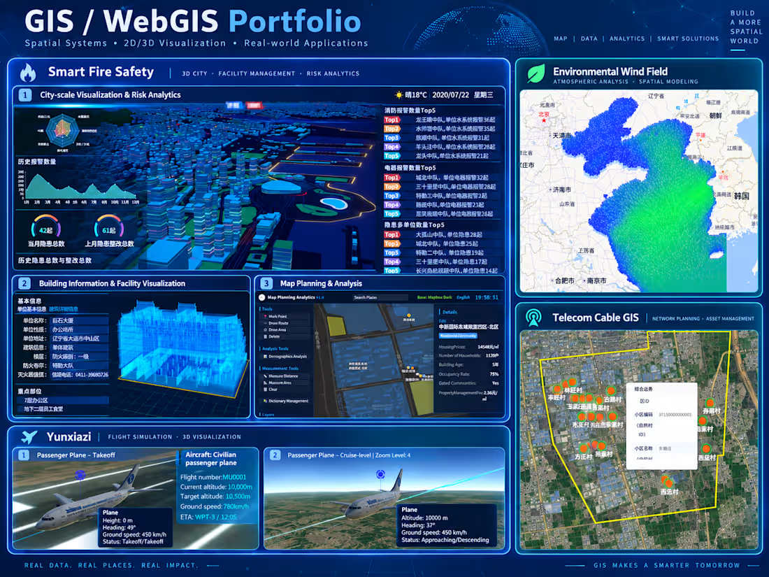
I design and build GIS / WebGIS applications and spatial data systems, from business requirements and technical architecture to implementation, integration, and deployment.
My work goes beyond displaying maps. I help clients turn geographic data and operational requirements into maintainable software solutions.
What I can help you build
Custom WebGIS applications, interactive maps, and spatial dashboards
GIS integration for inspection, asset management, tracking, and operational workflows
Spatial databases and map services using PostgreSQL/PostGIS, GeoServer, and WMS
Large-scale spatial data management and GIS architecture improvements
Geographic queries, drawing tools, routing, and spatial analysis
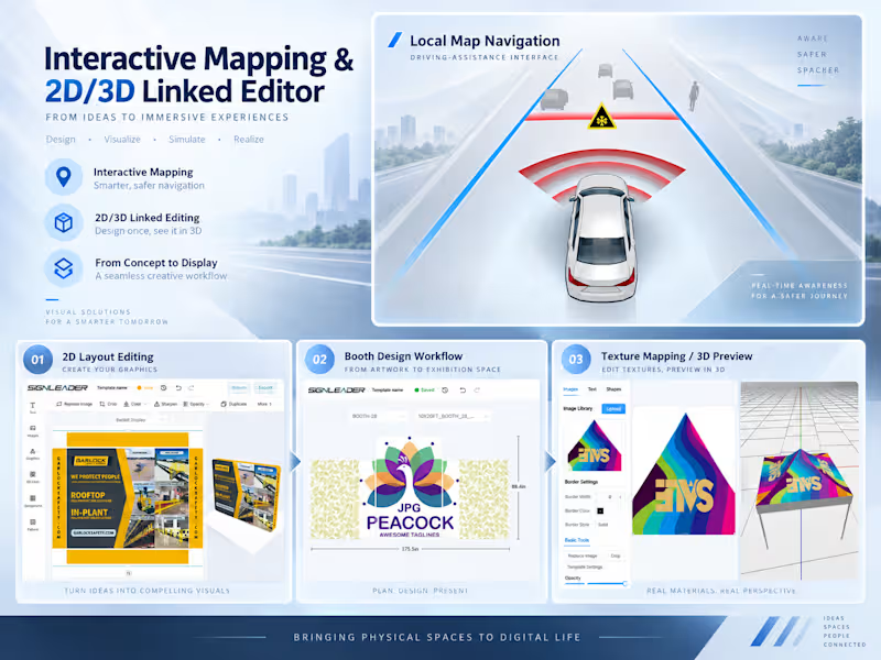
2D/3D geographic visualization using OpenLayers and Cesium
Offline GIS environments and reusable GIS SDK components
Troubleshooting and extending existing GIS applications
What you can expect
Depending on the agreed scope, deliverables can include GIS architecture and data models, working map interfaces, spatial services, frontend/backend integration, reusable components, testing, deployment support, and technical documentation.
How we work
We start by reviewing your business goals, geographic data sources, existing systems, and technical constraints.
I'll help identify the appropriate system architecture, spatial data strategy, map service approach, and integration requirements.
We then define the implementation scope, milestones, and delivery expectations before development begins.
Project timelines depend on data complexity, existing infrastructure, and the agreed scope. They are confirmed before development begins.
Relevant experience
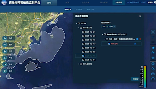
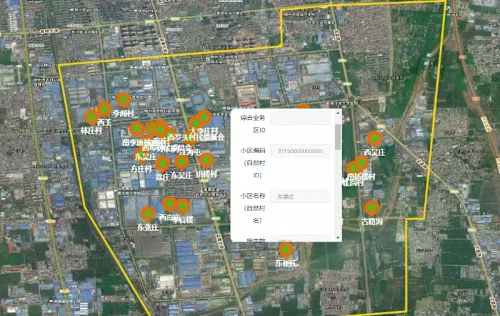
My previous work includes redesigning a GIS data and service architecture for more than 20 million spatial features, developing telecom infrastructure GIS capabilities, building reusable GIS SDKs, and delivering marine environmental data visualization applications.
I have also worked on offline GIS environments, large-scale 3D geographic data, spatial analysis, and multi-developer system integration.
Whether you're building a new geographic application or improving an existing GIS platform, feel free to share your requirements for a technical assessment and project estimate.
FAQs
Example work
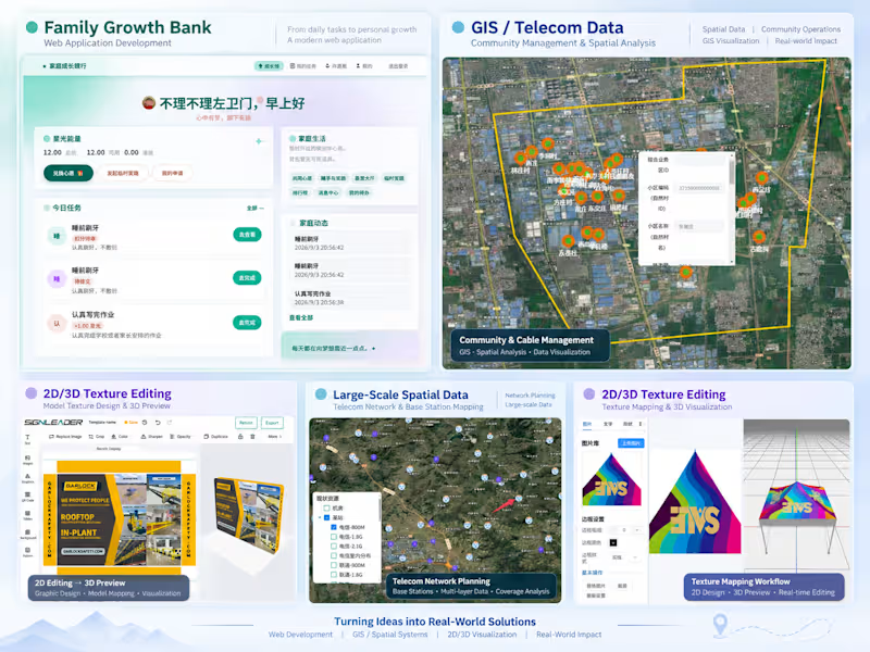
Contact for pricing
Duration1 week
Tags
GeoServer

Openlayers

PostgreSQL

QGIS

Data Engineer
Software Architect
Software Consultant
Software Engineer
Web Developer
Service provided by
Yong Zhang Jinan, China
GIS / WebGIS Application & Spatial System DevelopmentYong Zhang
Contact for pricing
Duration1 week
Tags
GeoServer
Openlayers
PostgreSQL
QGIS
Data Engineer
Software Architect
Software Consultant
Software Engineer
Web Developer
I design and build GIS / WebGIS applications and spatial data systems, from business requirements and technical architecture to implementation, integration, and deployment.
My work goes beyond displaying maps. I help clients turn geographic data and operational requirements into maintainable software solutions.
What I can help you build
Custom WebGIS applications, interactive maps, and spatial dashboards
GIS integration for inspection, asset management, tracking, and operational workflows
Spatial databases and map services using PostgreSQL/PostGIS, GeoServer, and WMS
Large-scale spatial data management and GIS architecture improvements
Geographic queries, drawing tools, routing, and spatial analysis
2D/3D geographic visualization using OpenLayers and Cesium
Offline GIS environments and reusable GIS SDK components
Troubleshooting and extending existing GIS applications
What you can expect
Depending on the agreed scope, deliverables can include GIS architecture and data models, working map interfaces, spatial services, frontend/backend integration, reusable components, testing, deployment support, and technical documentation.
How we work
We start by reviewing your business goals, geographic data sources, existing systems, and technical constraints.
I'll help identify the appropriate system architecture, spatial data strategy, map service approach, and integration requirements.
We then define the implementation scope, milestones, and delivery expectations before development begins.
Project timelines depend on data complexity, existing infrastructure, and the agreed scope. They are confirmed before development begins.
Relevant experience
My previous work includes redesigning a GIS data and service architecture for more than 20 million spatial features, developing telecom infrastructure GIS capabilities, building reusable GIS SDKs, and delivering marine environmental data visualization applications.
I have also worked on offline GIS environments, large-scale 3D geographic data, spatial analysis, and multi-developer system integration.
Whether you're building a new geographic application or improving an existing GIS platform, feel free to share your requirements for a technical assessment and project estimate.
FAQs
Example work
Contact for pricing