
Shaded relief elevation mapSimonas Valatka
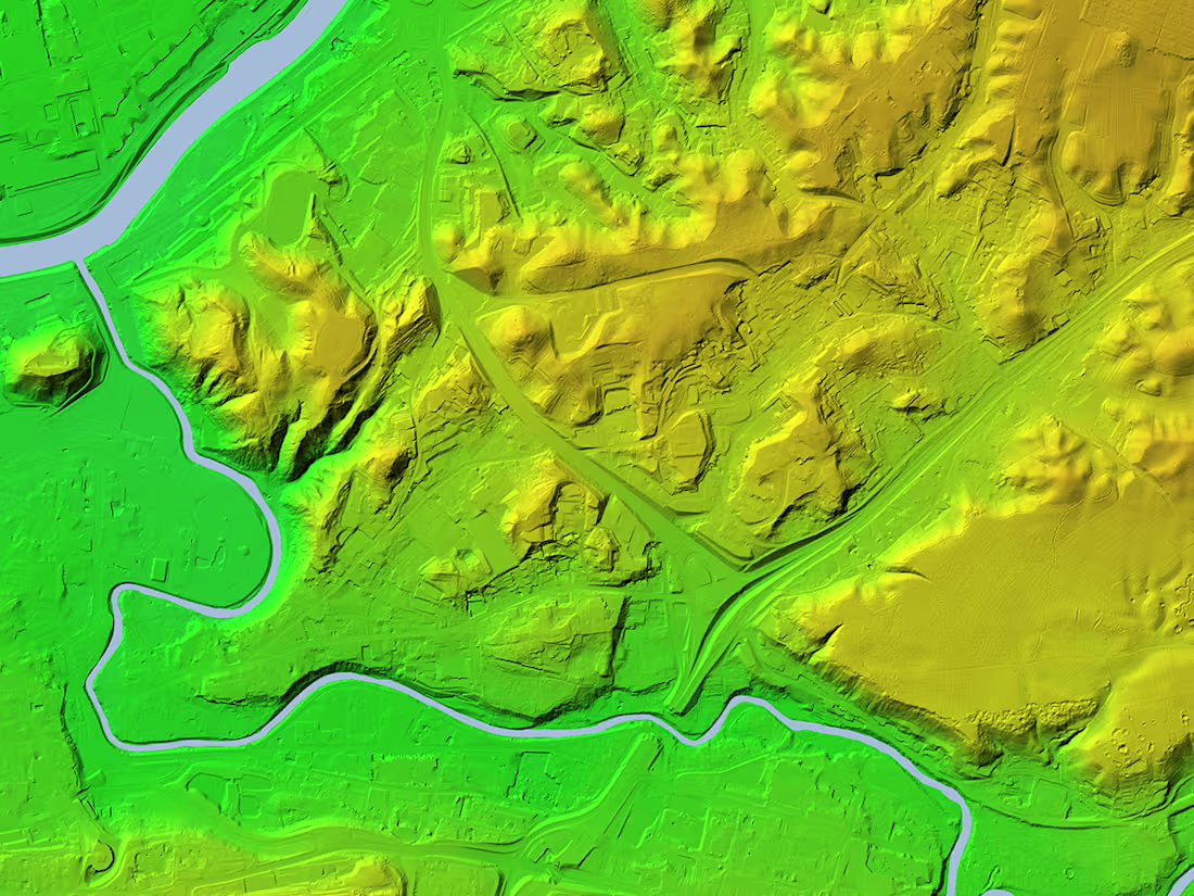
Shaded relief maps are great for visualizing elevation features. Very useful for flood risk assessment, real estate feasibility assessment and similar tasks.
What's included
Shaded relief elevation map
You will get a shaded relief map for you area of interest. I can deliver the elevation map in *.png or *.tiff (geotiff) format.
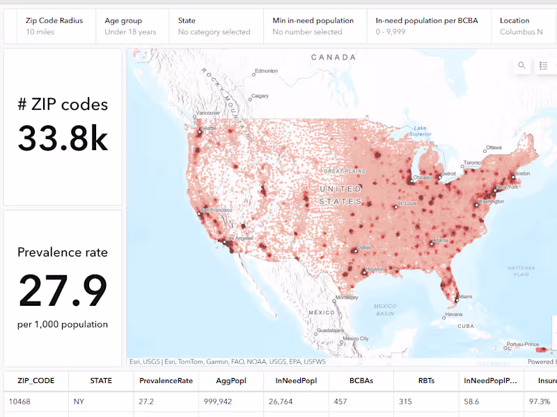
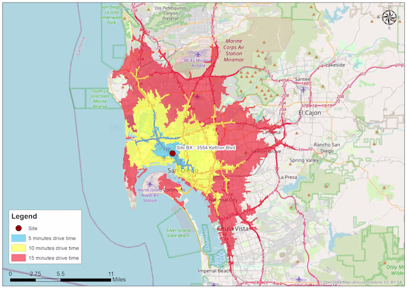
Simonas Valatka's other services
Starting at$30
Duration1 day
Tags
QGIS
Data Analyst
Data Scientist
Data Visualizer
Service provided by
Simonas Valatka Vilnius, Lithuania
Shaded relief elevation mapSimonas Valatka
Starting at$30
Duration1 day
Tags
QGIS
Data Analyst
Data Scientist
Data Visualizer
Shaded relief maps are great for visualizing elevation features. Very useful for flood risk assessment, real estate feasibility assessment and similar tasks.
What's included
Shaded relief elevation map
You will get a shaded relief map for you area of interest. I can deliver the elevation map in *.png or *.tiff (geotiff) format.
Simonas Valatka's other services
$30