
Accessibility analysis using drive time polygonsSimonas Valatka
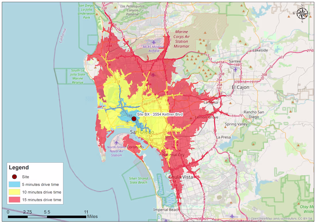
Drive time area maps are useful for the analysis of customer distribution, store location, site accessibility, etc. The drive time polygons may be enriched with demographic/ income data to provide useful business insights
What's included
Accessibility map - drive time polygons
I will develop a map showing areas accessible by car (or by walking) within a specified time period (drive time polygons or isochrones). Several locations/ time periods can be combined on the same map.
Simonas Valatka's other services
Starting at$30
Duration1 day
Tags
Microsoft Excel
QGIS
Data Analyst
Data Scientist
Data Visualizer
Service provided by
Simonas Valatka Vilnius, Lithuania
Accessibility analysis using drive time polygonsSimonas Valatka
Starting at$30
Duration1 day
Tags
Microsoft Excel
QGIS
Data Analyst
Data Scientist
Data Visualizer
Drive time area maps are useful for the analysis of customer distribution, store location, site accessibility, etc. The drive time polygons may be enriched with demographic/ income data to provide useful business insights
What's included
Accessibility map - drive time polygons
I will develop a map showing areas accessible by car (or by walking) within a specified time period (drive time polygons or isochrones). Several locations/ time periods can be combined on the same map.
Simonas Valatka's other services
$30