Satellite image breakdown for ML
Kristian Juel
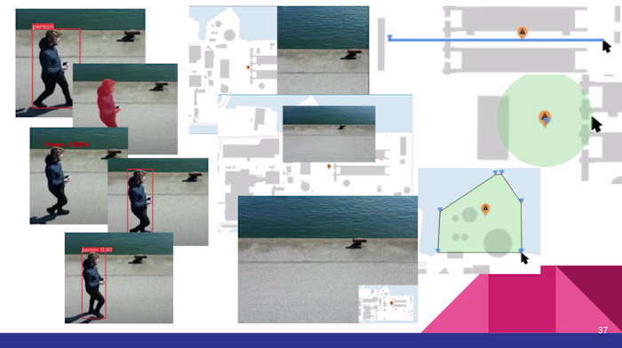
A python script which takes a png file or folder of pngs and breaks down the images into a set size. For example a 10000x10000px satellite image with the target size set to 250x250px, you will get 1600 small pictures as a result.
But the image breakdown is only part 1. The script also analyses each new image and calculates a percentage of a color in the images. The default is targeting forest and waterbodies.
If the folder contains .pgw files with the same name as a .png file, it can be read along with the .png. The script assumes the .pgw is the coordinates for the top left corner. The calculated coordinates of each photo will be stored with the color percentage data.
The info is stored as a python dictionary, so data outputs are easy to create. pre-made options is the images with the info in the name, as .json and as .txt
Like this project
Posted Jul 20, 2024
Tool for breaking satellite images down into small pieces and adding meta-data such as percentage of forest and water to use in training ML models.
Likes
0
Views
16