LOCATION MAP - QGIS
Gio Silveira
Location maps created using QGIS software. The maps are a case study of an archaeological site location, indicating the location, topography, altitude, hydrography, and delineation of the Direct Influence Area (AID) and Directly Affected Area (ADA).
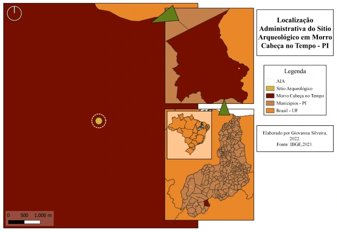
Map showing the administrative region where the archaeological site found in the municipality of "Morro Cabeça no Tempo" is located. The site is near the border between Piauí and Bahia
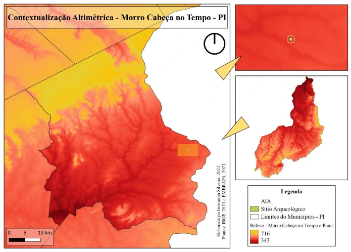
Map showing the relief of Piauí, the municipality of "Morro Cabeça no Tempo", and the region where the archaeological site was found. The site is located in a region with lower elevation.
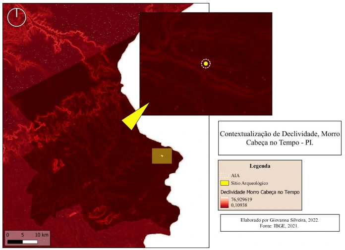
Map showing the slope of the municipality of "Morro Cabeça no Tempo" and the region closest to the archaeological site found. The slope in the area where the site was found is quite low, as it is located near a river.
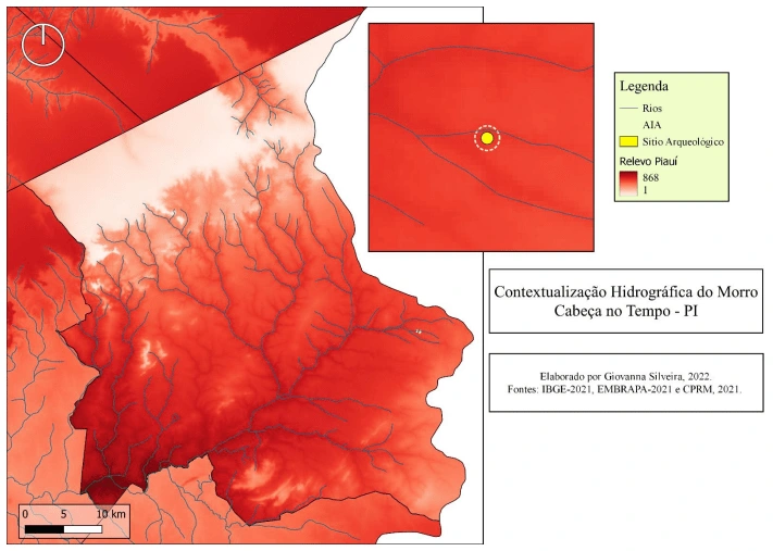
Map showing the hydrography of "Morro Cabeça no Tempo" municipality and the region near the archaeological site found. The location where the archaeological site was found is very close to two current riverbeds.
Map showing satellite images of "Morro Cabeça no Tempo" municipality and the area closest to the site found. The region where the site was found appears to be a deforested area and somewhat far from the urban zone of the municipality.
Location map of the state of Alagoas.
Location map of the development project with Direct Influence Area (AID) and Directly Affected Area (ADA) indicated.
Location map of the archaeological site.
Like this project
Posted Jun 9, 2023
Location maps created using QGIS software. The maps are a case study of an archaeological site location and environmental characterization.
Likes
0
Views
38
Tags