Land Cover Classification
Odilbek Tokhirov
Deep learning models for semantic and instance segmentation of satellite images for land cover classification. The semantic model was trained on the OpenEarthMap dataset while the instance model was trained on SpaceNet-v2 dataset. The predicted instance masks were overlaid on top of the predicted semantic masks to simulate panoptic segmentation. This was done due to the lack of public panoptic segmentation datasets for satellite images.
You can find the source code in this GitHub repository.
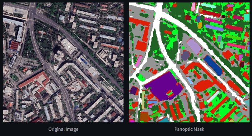
A sample image and its final prediction mask.
Like this project
Posted Jul 28, 2024
Deep learning models for semantic and instance segmentation of satellite images for land cover classification.
Likes
0
Views
12