Guest Post: DePIN Research Article
Jason Glynn
Verified
GEODNET's Satellite Navigation Solution Further Enhances Crypto Utility
Discover a unique DePIN project with powerful Superhex multipliers

I’ve been on a mission to uncover true utility in the crypto space for a while and you’d be surprised how difficult that is to find within the tens of thousands of projects listed on CoinMarketCap and CoinGecko. Sure you get some crypto projects looking to solve niche issues, but more often than not they serve up more promises than deliveries.
GEODNET is different on 2 specific counts. It’s fixing a universal issue and it’s ready to use right now.
Let’s dive in!
The problem with satellite navigation today
SatNav is good, but it’s not perfect. How many times has your GPS placed you in the wrong spot? You’re halfway down the road but it says you’ve already arrived?
I’ve even come across product reviews for GPS smart watches where parents got freaked out because their kids have apparently left the school premises.
Smart devices and tracking applications are meant to simplify our lives, but if they can’t be pinpointed correctly then they offer more stress than anything else.
And guess who’s to blame. Not the government (this time), nor Elon, nor Daylight Savings or Millenium bugs. It’s the big ol’ Sun up in the sky. Elements such as solar winds, space weather and air pollution create mismatches between what gets sent “up there” with what gets received “down here”.
This requires correction data to put things back into place. In simple terms, you have 2 ways to receive your satellite positioning data: straight from the source or through terrestrial connections. While you might be inclined to choose the more direct route, it is precisely this dependence that is more likely to be influenced by space weather. Opting for the terrestrial route allows for the signal to be corrected by numerous relay nodes and provide much more precise location data.
Getting this right turns meters into centimeters.
The only problem is that the infrastructure required to roll out large scale correction data is expensive. Yet so many people and increasingly more smart devices rely upon it. Industries both heavy and light are becoming increasingly autonomous and demand extremely high precision.
Take one of our oldest professions (no, not that one), farming. Unmanned tractors and drones can greatly aid in seeding, irrigating and harvesting, but incorrect positioning quickly leads to dry spots and damaged crops.
Therefore it would seem that a more universal correction data method would greatly solve this issue and GEODNET is on track to deliver just that.
GEODNET’s blockchain-based solution improves navigation utility
As with many things in life, coordination is key. GEODNET leverages a technique called Real-Time Kinematic (RTK) positioning to coordinate between satellites and ground receivers to improve correction data. Spreading out a large network of correctional stations improves the positioning data for the devices that need high-precision coordinates. RTK promises centimeter accuracy that’s around 200x more precise than what a typical GPS receiver would provide.
Consider this analogy with Google Maps. It costs a lot of money to maintain those high-tech cars and pay full-time salaries to the drivers who navigate the roads on a daily basis. What’s the result? Old street views; sometimes years old. But there are hundreds, if not thousands, of cars driving past your house each day. If a fraction of the world’s cars would contribute data, we’d have an efficient, up-to-date decentralized mapping solution.
GEODNET is taking this all-hands-on-deck approach to navigational data. But instead of equipping people’s cars, they’re hooking up antennas to people’s roofs. With every new antenna, the network of correction data improves and increases the precision.
So who are these guys placing antennas on your house?
The GEODNET Foundation
GEODNET (short for Global Earth Observation Decentralized Network) is the brainchild of Mike Horton. With an impressive career in navigation technology spanning multiple decades, Mike is perfectly positioned to lead this innovative project.

Source: Mike Horton
The list of Mike’s achievements is impressive:
Graduated from UC Berkeley and then co-founded Crossbow Technology, a pioneer in MEMS-based IMUs and GPS/INS systems, where he served as CEO from its inception to the successful sale to Moog for $32M.
Co-founded ANELLO Photonics, the creator of the Silicon Photonic Optical Gyroscope and raised $30M in venture capital and serves as the CTO.
Has over 15 patents in the field of navigation, is fluent in Mandarin Chinese and has been a member of Band of Angels for over 5 years.
Alongside his colleagues Yudan Yi and David Chen, Mike works for the non-profit GEODNET Foundation, based in Singapore.
The GEODNET white paper was published by the Institute of Navigation (ION) after a successful presentation in late 2021. The idea was well received as it took an entirely different and creative approach to solve the expensive problem of correction data – using blockchain technology to incentivize the deployment and maintenance of a people-powered network.
As with other DePIN projects, GEODNET’s approach is a perfect example of how blockchain ledgers and cryptoeconomics can be coupled with physical hardware to get people around the world aligned on tackling real-world issues.
The concept is straightforward. Users install blockchain-tethered RTK devices and get rewarded in GEOD tokens for contributing data to the GEODNET network. The data itself is then sold on to people and enterprises who require such high-precision information. But that’s not all. Given the inbuilt cryptography of this solution, GEODNET brings a level of validity to the data that is sometimes doubtable with GPS signals, as GPS spoofing is a serious issue in this sector.
The goals laid out in the GEODNET white paper convey it best:
Distributed network with no single point of trust or failure
Robustness against (non-malicious) low-quality data
Robustness against malicious manipulation (gaming or spoofing)
Rapid network development without centralized investment (incentivization)
Let’s take a closer look at what utility such a network can provide.
GEODNET’s RTK utility
Source: geodnet.com/use.html
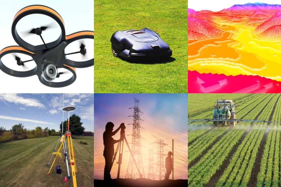
Unlocking high-precision navigation opens up a whole new level of efficiency in multiple industries. This is data that high-paying enterprise clients are willing to pay a premium for. We touched upon agriculture; this is, in fact, something that’s been highlighted recently with GEODNET’s partnership with Deep Sand Technology. Retrofitting old tractors with high-precision auto steering is a win-win for the agriculture industry.
But the use cases get much more advanced. From e-commerce deliveries to 3D model scans, drones look certain to play increasingly important roles in our lives and this is a use case that demands centimeter accuracy. Enterprise level models such as those from DJI are easy to enhance thanks to their RTK connectivity. This short video gives an idea of what’s required to connect via RTK, while also giving a glimpse into the centimeter accuracy that RTK correction provides:
Self-driving cars are yet another interesting application, although considering the amount of regulation and legislation involved here, it’s probably a little early to think about a 100% GEODNET powered solution. However, there are established companies providing these types of RTK services to manufacturers already, so targeted partnerships by GEODNET are a way of leveraging the network’s data and increasing rewards for community miners. One such partner is Quectel with their lightweight RTK GNSS modules.
Even more advanced applications like climate monitoring can benefit from such a precise data stream. This levels the entry point for scientists around the world to study serious issues like rising sea levels, desertification, and forest fire threats.
And beyond professional services, RTK technology can give access to more consumer facing use cases like smart lawnmowers and endless mobile phone applications. It’s clear to see there’s immense value to be claimed at various price points and applications in the RTK sector.
Now, let’s get into the nitty gritty.
How does GEODNET work?
We’ve all heard of GPS before. The Global Positioning System is a US owned satellite constellation that’s been orbiting our planet for over 40 years. But it’s not the only player in the space race. Europe has its own Galileo system, Russia oversees the GLONASS system and China operates the BeiDou system. These are the four core satellite navigation systems offering global coverage, so called global navigation satellite systems (GNSS).
In proper decentralized fashion, GEODNET leverages connectivity from all 4 GNSS constellations. To achieve this, GEODNET approved miners must meet strict technical requirements. To simplify the growth of the network, the GEODNET Foundation has partnered up with manufacturer HYFIX to produce Triple-Band GNSS Base Station Receivers. Not only are the devices compatible with all 4 GNSS constellations, but they also serve a double function as crypto miners for the GEOD token.

Source: hyfix.ai/products/mobilecm-triple-band-gnss-base-station
Users willing to participate in the GEODNET reference network can install a receiver on their roof. The device can work in both urban and rural areas, so long as the antenna has a clear line of sight towards the sky and the installation has a stable internet connection.
Once installed and hooked up to the network, users will begin to earn GEOD tokens as a reward for their contribution. Bit by bit, the decentralized installation builds out, creating a “public GNSS reference sensing network”.

Source: console.geodnet.com/map
The network architecture is supported by 3 distinct proof algorithms:
Proof of Location (PoL)
Proof of Accuracy (PoA)
Proof of Stake (PoS)
I won’t bore you with the technical details of each, see the white paper if you want to dive deeper. Suffice it to say that PoL maintains the quality of the data, PoA governs the miner rewards and PoS secures the blockchain’s integrity. Note however that the PoS aspect is not yet live as the network has yet to introduce validators.
All of this is made possible thanks to GEODNET’s cryptoeconomic architecture.
Read the full article on DePIN Hub:
Like this project
What the client had to say
Jason is super reliable, attentive, fast, and easy to work with. On top of that, the quality of his writing is superb. Highly recommend him
Michael Sothan, Hotspotty Inc
Jan 26, 2024, Client
Posted May 18, 2025
This is an excerpt of a research article about GEODNET, a blockchain-based RTK network. The full article is published as a guest post on DePIN Hub.
Likes
2
Views
29
Timeline
Dec 27, 2023 - Jan 23, 2024
Clients
Hotspotty Inc