
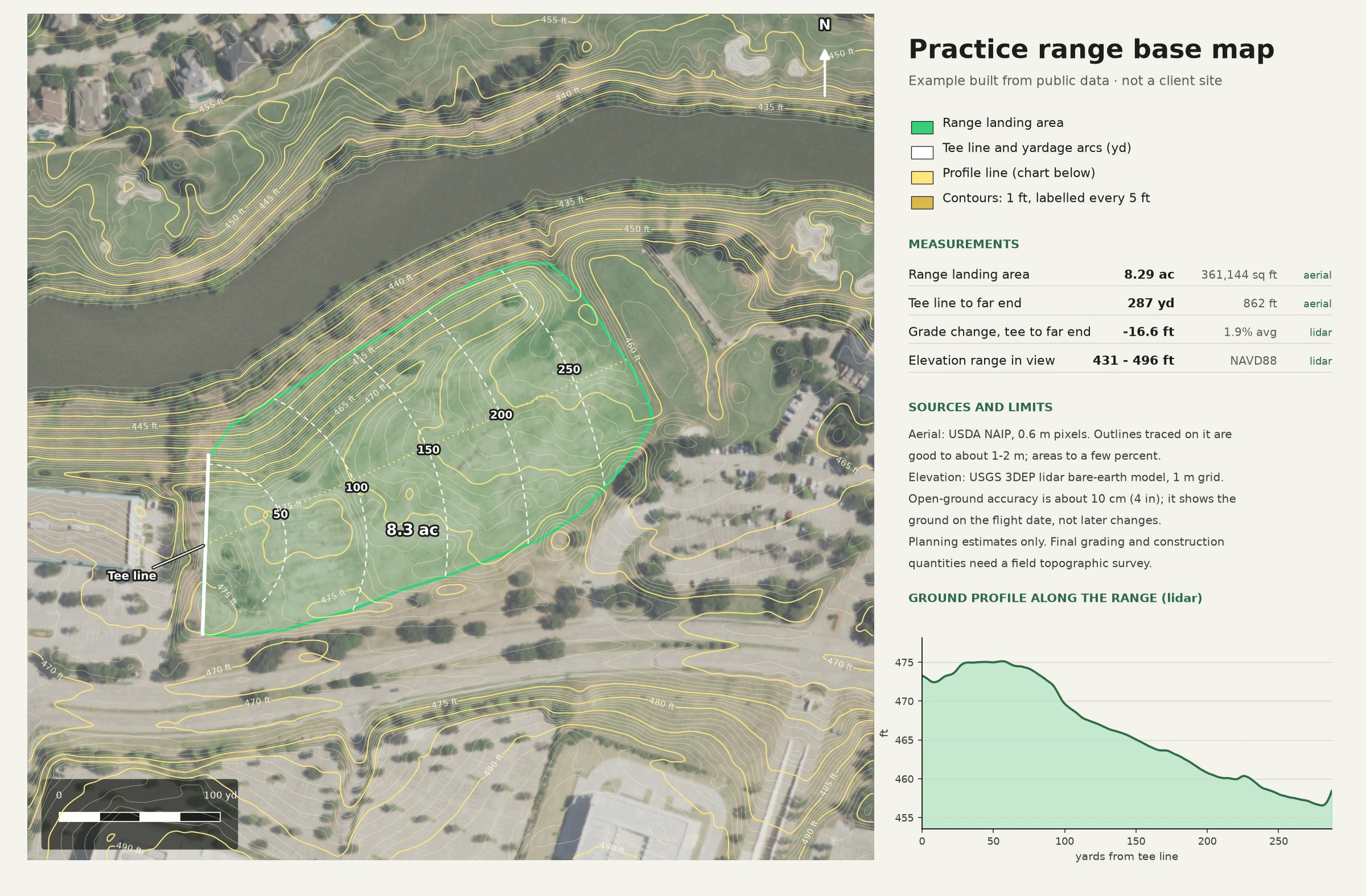
A measured base map of a golf practice range, built from public aerial imagery and lidar elevation data instead of guesswork. Every tee line, target green, bunker and boundary sits where it really is on the ground, at true scale, so the map can be used for planning, signage, a simulator layout or a 3D model.
The same data drives the 3D side. Lidar elevation becomes the terrain, the aerial imagery and mapped features become the surfaces, and the result can be rendered as stills or a flyover like the clip above, made from real course data.
Built with Python (lidar, aerial imagery and map data), Blender for the 3D terrain and renders, and DaVinci Resolve for the finish.
0 likes · 0 views · Nov 15, 2026
A true-scale golf range base map built from aerial imagery and lidar, plus a 3D flyover made from the same real data.
