Solar and Wind Powered Cell Tower Placement
Lisa Enns
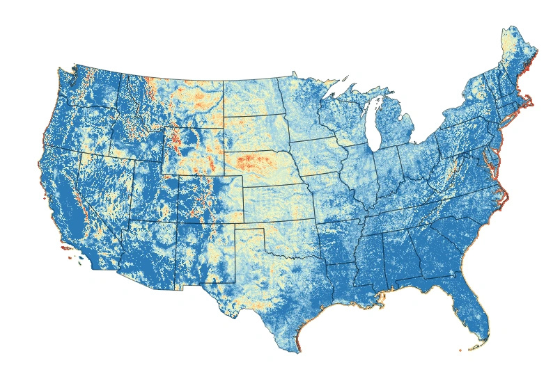
Lisa was hired to create a heatmap of locations within the United States that would be the most ideal locations for off-grid cell phone tower placement. Inputs to this heat map included detailed population data, wind speeds, solar radiation, points of interest, highways, electrical grid location, and more. Using Python and QGIS, she created an automated process where the client could change inputs as needed and see the resulting characteristics of any potential location.
Like this project
Posted Jul 9, 2024
Using a variety of inputs defined by the client, QGIS, Python, and Open Street Maps, Enns Analytics created a heatmap for communications infrastructure.
Likes
0
Views
15
Featured on