
Juan Esteban Perez
GIS Specialist & Geoscience | Geodata & Mapping
New to Contra
Juan Esteban is ready for their next project!
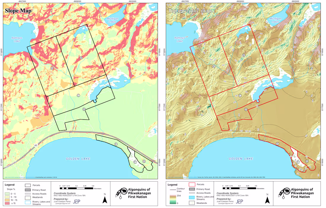
GIS Analyst for a 200-acre lakefront feasibility study in Ontario. Conducted terrain, slope, and land use analysis using ArcGIS Pro to identify development constraints and opportunities, delivering high-quality maps for planning and decision-making.
1
96
In this video, I take an old map from National Geographic Society (which I really admire), update it, and create my own version. I walk through the step-by-step process of transforming an outdated map into a modern, accurate, and visually polished one.
1
116
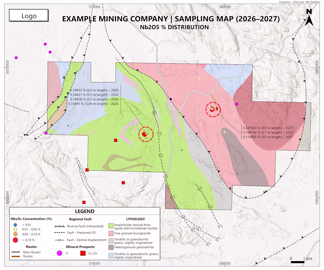
This project represents the type of geological and geochemical maps I have developed for mineral exploration reporting. It simulates a professional technical map including Nb₂O₅ channel sampling results, lithological units, structural features (regional, interpreted, and dextral faults), mineral prospects, infrastructure, coordinate grid, and scale.
1
70
Developed an interactive GIS dashboard analyzing population and socioeconomic patterns in Manhattan (2024), integrating open data to deliver clear insights for urban and demographic analysis.
1
106