The network for creativity
Join 1.25M professional creatives like you
Connect with clients, get discovered, and run your business 100% commission-free
Creatives on Contra have earned over $150M and we are just getting started
Back to feedPost
Mandum Rimba Project.
Mandum Rimba is an open-source geospatial platform, I designed and developed to make environmental and conservation data more accessible, interactive, and easier to understand.
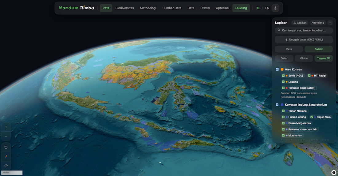
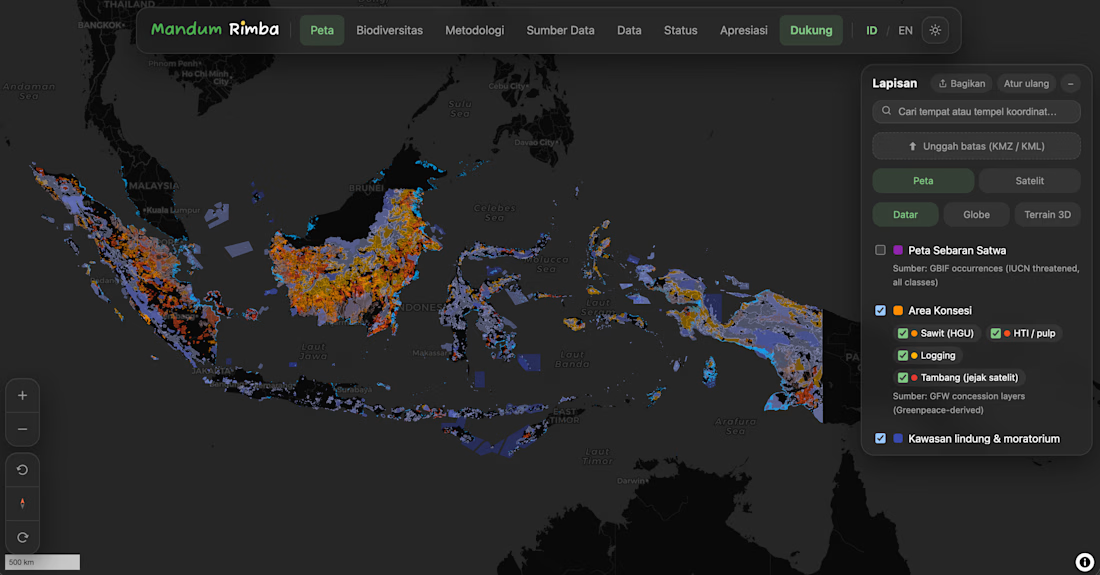
The platform brings together dozens of spatial datasets, including protected areas, endangered wildlife, deforestation, peatlands, mangroves, concessions, wildfire hotspots, and biodiversity records, into a single WebGIS experience.
Beyond visualization, I built features that help users explore complex environmental issues through interactive maps, story-driven content, spatial analysis, and automatically generated reports.
The project was built from the ground up using a modern full-stack architecture, with a strong focus on performance, usability, and scalability.
What I worked on
- Full-stack architecture and development
- Interactive WebGIS and map visualization
- Spatial data processing and optimization
- Backend API and database design
- UI/UX design
- Data integration from multiple environmental sources
- Performance optimization for large geospatial datasets
Tech Stack:
Laravel, Next.js, TypeScript, MongoDB, MapLibre GL JS, PMTiles, Cloudflare R2, Tailwind CSS.
github repository:
https://github.com/ammar-rasyidi/mandum-rimba



Mandum Rimba Url:
https://www.mandumrimba.org
The network for creativity
Join 1.25M professional creatives like you
Connect with clients, get discovered, and run your business 100% commission-free
Creatives on Contra have earned over $150M and we are just getting started
Trending
retrofuturism
Share your favorite designs from the past exploring the distant future. Or your own take on the aesthetic 🚀
halftone
Dots. Texture. Grain. Let's see your designs using the halftone technique.

Midjourney
Creatives are showing off what they're making with Midjourney.
colorgrade
Video editors sound off: How do you enhance the mood of your video in color grading?


Related posts

We designed a sleek and intuitive dashboard for Axiom.
A modern AI meeting assistant dashboard designed to turn conversations into actionable insights. We focused on creating a clean layout, clear data visualization, and a frictionless experience for modern teams.
Check out the full case study on our page and let us know your thoughts! 🚀 📩 Collaborate with Us? Contra Odama Studio


Clean work! The dashboard feels easy to navigate without sacrificing the amount of information shown.

𝗕𝘂𝗶𝗹𝘁 𝘁𝗵𝗲 𝗦𝗶𝗺𝗮𝗯𝗲𝗹 𝗟𝗶𝗺𝗶𝘁𝗲𝗱 𝘄𝗲𝗯𝘀𝗶𝘁𝗲, 𝗮𝗻𝗱 𝗶𝘁'𝘀 𝗻𝗼𝘄 𝗹𝗶𝘃𝗲. 🚀
Started by defining the design direction, pulling moodboards, understanding the client brief, and getting clear on the goal: a website that instantly communicates what the platform does, backed by deliberate CTAs guiding users to get started.
Built end-to-end with Claude Code.
If you're looking to get a website built for your brand or business, reach out. We'd love to help bring it to life.
🔗Website link: https://simabelltd.com
#VibeCoding #ClaudeCode #WebDevelopment #WebDesign #Logistics


Something I've been working on recently. This is a version of the hero section for an AI FinOps agent. Kept the type minimal and monospace, added a subtle wavy background, and let the gradient orbs carry the motion- it's fun to experiment with these gradients. Built in Framer.
Would love to know your take on this- does the motion feel too much, or just right?


Looks really clean. The simple style and small movements work really well together.