The network for creativity
Join 1.25M professional creatives like you
Connect with clients, get discovered, and run your business 100% commission-free
Creatives on Contra have earned over $150M and we are just getting started
Back to feedPost
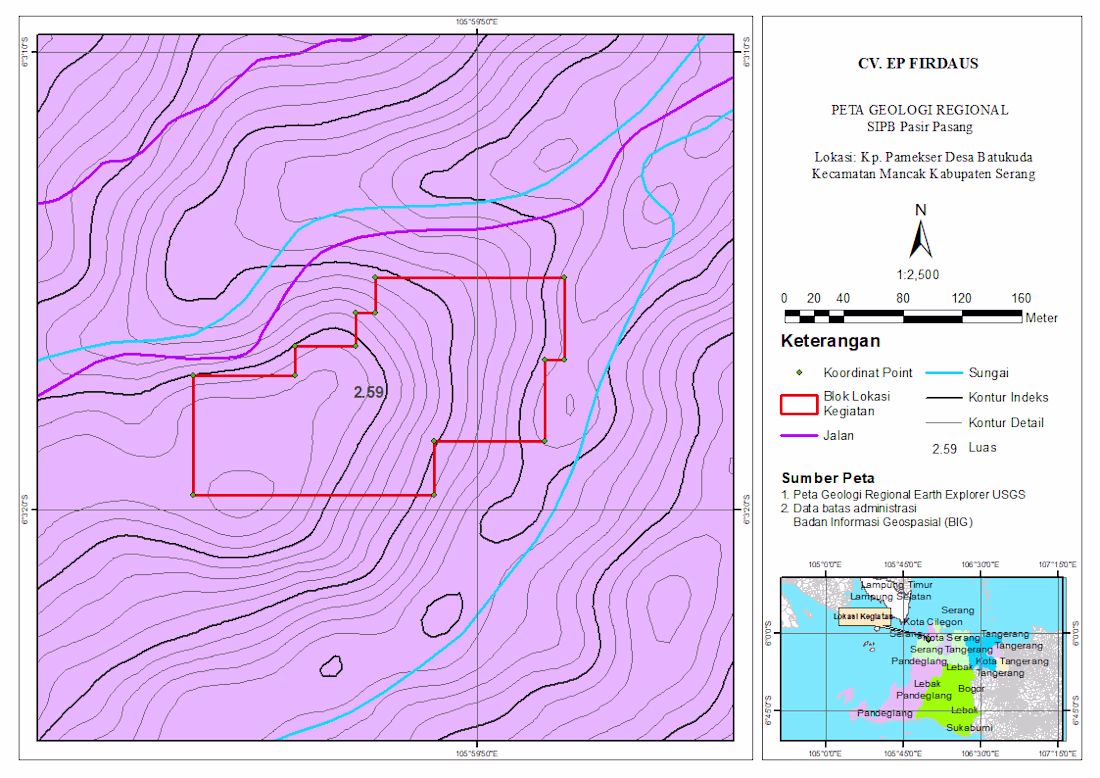
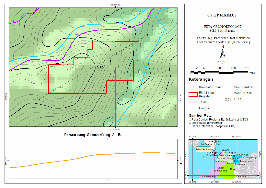
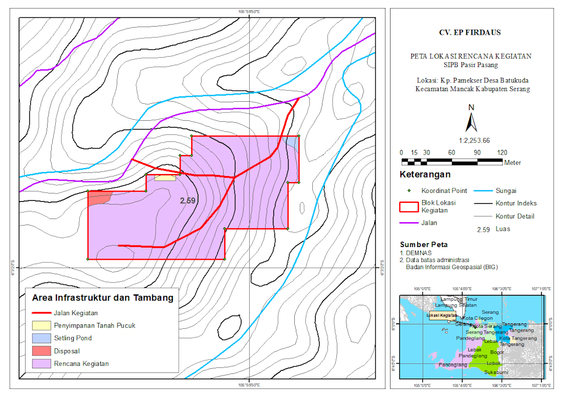
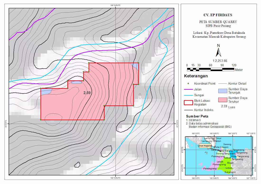
Professional Geomorphology Map & Terrain Profile (ArcGIS/QGIS)
I create precise and visually clear geomorphological maps like this, including:
- Contour mapping (index & detailed)
- Landform interpretation
- River and infrastructure overlay
- Project boundary mapping
- Elevation cross-section analysis (A–B profile)
Perfect for research, environmental analysis, mining, or land development projects.
Oh, hello! Would you mind if I followed you? 😊
It seems like we’re in a similar field, and I feel I could learn a lot from you. I’m still not quite an expert yet, but I’m always trying to improve and expand my skills.
I’d love to stay connected and hopefully have some interesting...
Amazing work
Thanks
The network for creativity
Join 1.25M professional creatives like you
Connect with clients, get discovered, and run your business 100% commission-free
Creatives on Contra have earned over $150M and we are just getting started
Related posts
Hey everyone!
I made OVERTIME 🌙 a living map of how the world really sleeps.
The problem / the idea
We celebrate the 5am club. We rarely see the others; the night-shift nurse, the new parent awake at 3am, the insomniac watching the ceiling, and the guard who clocks out at sunrise. I built this for the lyrics inspiration "8 billion people are 8 billion lamps in the night."
What it is
A quiet, generative map of a single day. Each glowing light is one real person's rhythm, when they sleep, move, eat, and how stressed they are. Data visualization is drawn from ~1,200 lives across 9 regions of the world, gathered into one symbolic city. Add your own rhythm and watch your light fly into the crowd. Toggle Weekday vs Weekend and the whole sky shifts. You find your people, you find night owls, early risers, and the sleepless. No scores, no "good" or "bad" sleep. Just where you land, among a thousand others. Whether you sleep late or barely sleep at all, the message is one: you're not alone in the dark, so please take care of yourself. 💛
How I built it (workflow + tools)
Designed in Figma and built entirely in Figma Make. The community isn't random noise; it's a research-calibrated dataset modeled as a mixture of real human archetypes (night owls, night-shift workers, the sleepless, early birds, long sleepers), so the field is genuinely human: people asleep at 6am, people with 3 hours of sleep, people who barely move. A generative particle engine renders every life as its own light, so no two nights look alike.
#ConfigMakeathon · Built with Figma + Figma Make
What if you could discover the world through a local's eyes? 🌍
Work in progress. 🤫
What do you think of the visuals?
This looks fun
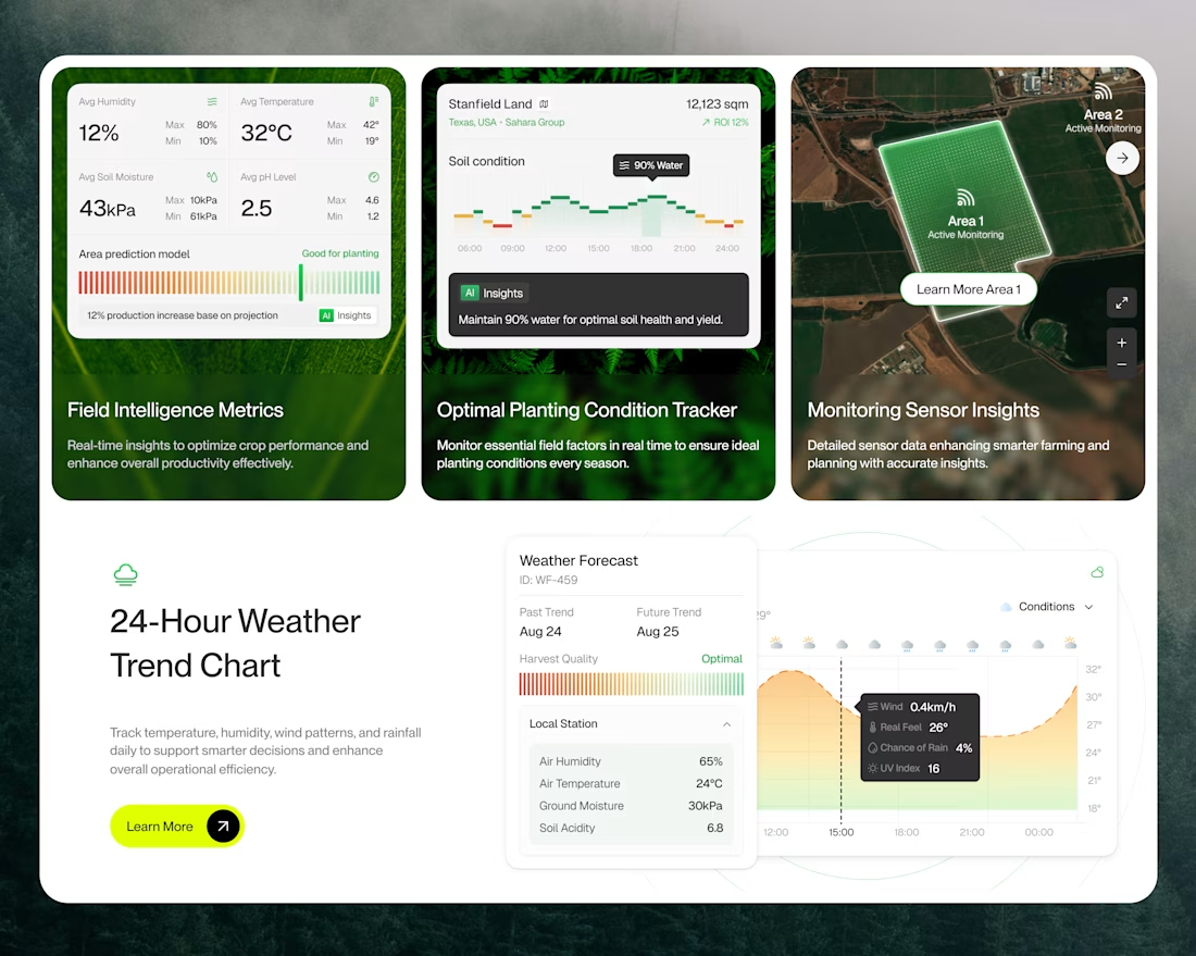
🌱 Smart Farming Dashboard, designed to grow results.
-> Real-time field intelligence metrics
-> Optimal planting condition tracker
-> Live sensor monitoring across zones
-> 24-hour weather trend insights
-> AI-powered yield predictions
Clean. Smart. Built for farmers who think ahead. 🚜
Smart use of data + agriculture.
Trending
Claude
Claude has entered the design space. How are you using Claude Design?
Contra University
Learn from expert creatives how to earn more using next-gen AI tools.
MagicPath
The canvas is infinite, and exploration is becoming the workflow. How are you using MagicPath?
creativeaiflow
Creative AI workflows are evolving. What tools do you use, and what are their strengths and weaknesses?
freelancerlife
Freelancer life is wins, pivots, and everything in between. What’s yours right now?